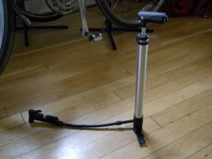
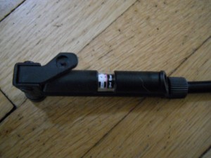
Back in Orwell again

Made it to Mosquito Lake last night. Got a tenant site with electric for $24. There is a small convenient store right across the road from the park entrance and they carry Great Lakes beer. Nice!
Anyway, we got set up ASAP because we were worried about getting rained on. Took a shower, they were ok. Tried to make dinner but our old Coleman stove finally gave out and was leaking badly, so we each had a can of tuna fish in the dark.
In the morning we could hear thunder rolling in. It was a big storm, but it just missed us. We packed or gear quickly and hit the road. It started raining on us on rt. 305. We stopped in a new trail shelter and waited for it to stop, then hit the trail again. It started raining again in a few miles, so we put on our ponchos. They worked great!
We are now eating lunch at the A&W again!

Posted in Blog | Tagged , , | 1 Comment

Short tour of Ashtabula and Trumbull counties

Ok. We decided to take a little three night tour along the trial in Ashtabula, camping along the way. We started in Austinburg and made it to Orwell when we were overtaken by a thunderstorm. We are hiding out in an A&W eating ice cream, waiting the storm out.

20120808-154848.jpg
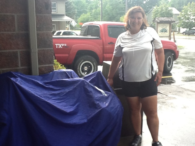
That’s our bikes under the blue tarp.
The trail is really flat and smooth. It’s been pretty hot, so hopefully the rain will have cooled things down. Lots of lightning. Smells like fresh rain and cow manure outside.

Posted in Blog | Tagged , , | Comments Off on Short tour of Ashtabula and Trumbull counties

Cool Bicycle Parking Garage in Japan

Check this video out of a cool new bicycle parking garage in Japan. It’s like a bicycle missile silo! Apparently, they commute by bike a lot more than we do, but it’s still a really cool concept.

Posted in Blog | Tagged , | Comments Off on Cool Bicycle Parking Garage in Japan

Bike and Hike Trail and Towpath Trail Loop Bicycle Route and Map, 25 miles

Carol and I went on a really fun ride today that uses both the Summit County Bike and Hike Trail and the Cuyahoga Valley Towpath Trail to create a nice 25 mile loop, suitable for the intermediate bicyclist. The route is mostly trail, with just a little bit of road riding to connect the two trails. It is best to ride this route in a clockwise fashion; south on the Bike and Hike, north on the Towpath, due to the rather steep 5% grade on Heinz Hill Road.
Here’s the map Carol designed of the loop. Click map to enlarge.
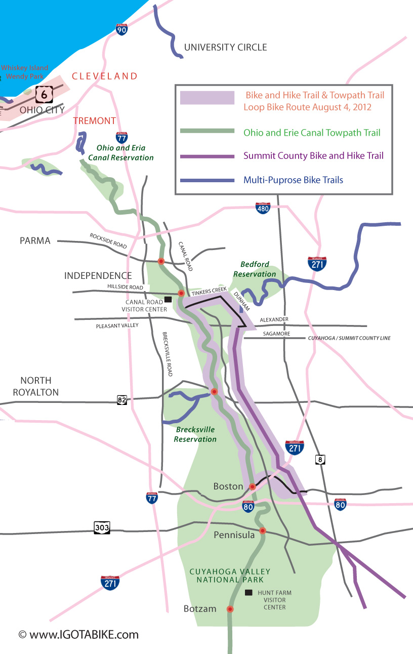
Igotabike.com loop map using The Summit County Bike and Hike Trail and Ohio and Erie Canal Towpath Trail

Igotabike.com loop map of Bicycle route using The Summit County Bike and Hike Trail and Ohio and Erie Canal Towpath Trail

Being a loop, you can start from any trail access point that is convenient to you. We started at the Canal Visitor Center 7104 Canal Road, at the intersection of Canal and Hillside roads, Valley View. From there we headed south on the Towpath approximately a half mile to Tinkers Creek Road, east. Tinkers Creek is a great road for cycling; flat, straight, not a lot of traffic. Follow it for about a mile and a half until you get to Dunham Road. Just before you get to Dunham, you will pass Tinkers Creek Tavern on your right. It’s an excellent stop for a lunch break.
At Dunham Road, turn right. The Astorhurst Golf Course and snack bar will be on your right and you will need to gear down to get up Dunham hill, now right ahead of you. The worst part of the hill is what you can see from the corner of Dunham and Tinkers Creek. The hill is short, but kind of steep and fairly narrow. Being passed by cars while climbing can be a little scary sometimes, but most drivers are used to cyclists on the road in that area. At the top of the hill is a gravel drive where you can pull off the road to catch your breath.
Continue up Dunham Road. It is still slightly uphill. Soon you will pass Egbert Road coming in on your left. If you choose, you can jump on the bike trail at this point, across Dunham Road to follow Dunham the rest of the way downhill to Alexander Road. We always just stay on the road.
At Alexander, turn right. Maybe about a thousand feet down the road, on your left, is the Bike and Hike Trail Head. Get on the trail and head south.
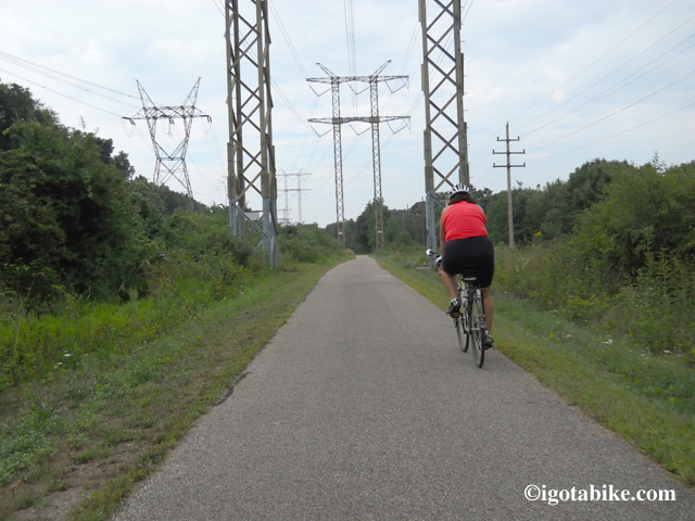
The Summit County Bike and Hike Trail is sweet! It is straight and flat.

The Summit County Bike and Hike Trail is sweet! It is straight and flat.

The Bike and Hike Trail is sweet! It is straight and flat and doesn’t have a lot of road crossings. There is usually nowhere the amount of trail users as down on the Towpath, so it’s a great trail to stretch out and get a good quick pace on. Fun!
The worst road crossing is at Route 82. It’s four lanes wide at 45 mph and is usually pretty busy. PLEASE be extra careful at this crossing. We would love to see some flashing lights and a marked cross walk here! (hint, hint, hint!)
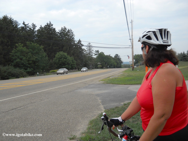
Looking west at the intersection of Route 82 and the Summit County Bike and Hike Trail. Caution required.

Looking west at the intersection of Route 82 and the Summit County Bike and Hike Trail. Caution required.

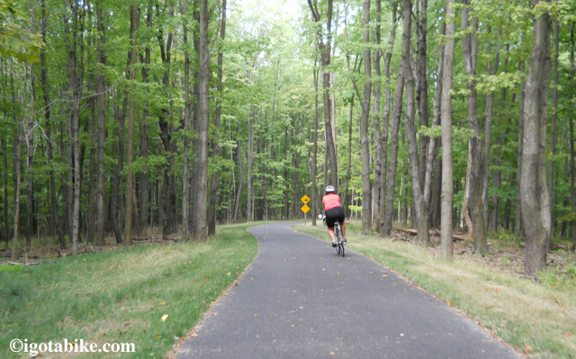
At Brandywine Road, the trail turns right and crosses four new wooden bridges on the way to Brandywine Falls. This section used to be on the road. Just before the falls, the trail dives into the woods and swoops downhill to enter the park (toilets, no water) from the back.
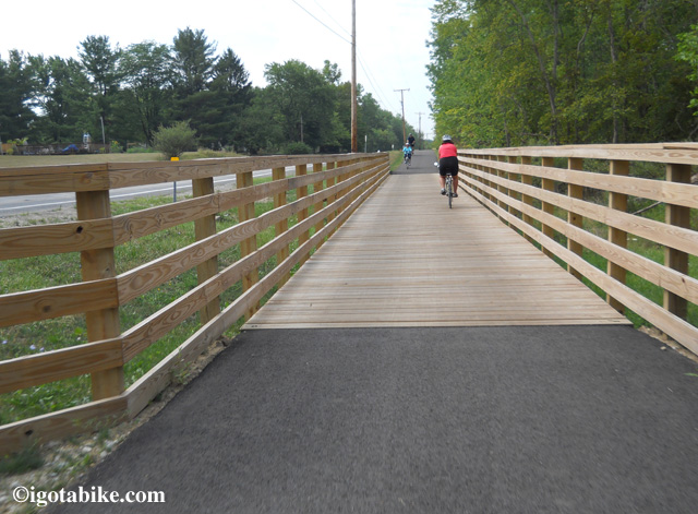
One of the new bridges along Brandywine road closes the gap in the Bike and Hike Trail
One of the new bridges along Brandywine road closes the gap in the Bike and Hike Trail


The new trail with switch backs replaces the dangerous and steep road route into Brandywine Falls. And its fun!

The new trail with switch backs replaces the dangerous and steep road route into Brandywine Falls. And its fun!

On your left is the Inn at Brandywine Falls B&B (the place with the chickens).
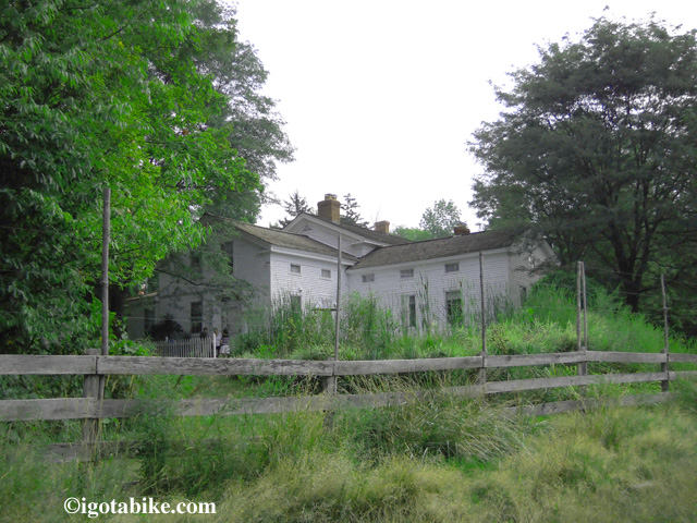
The Inn at Brandywine Falls Bed & Breakfast

The Inn at Brandywine Falls Bed & Breakfast

The falls are actually pretty cool, and definitely worth a look if you’ve never been here before. They have installed several “Bike Lock” posts so you can secure your bike and walk down the trails for views of the falls. Nice.
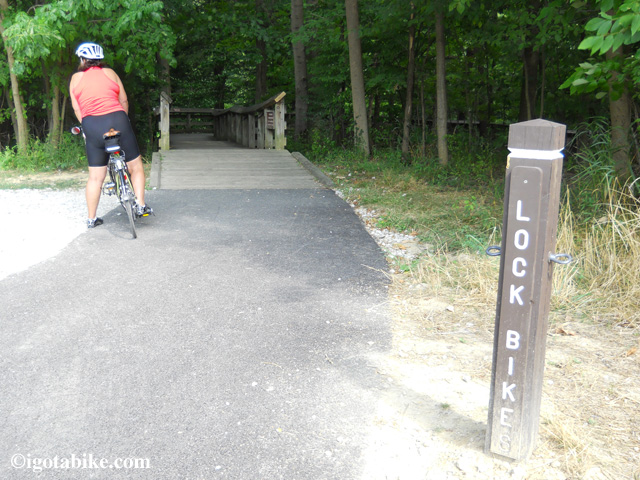
 “Bike Lock” posts at Brandywine Falls

“Bike Lock” posts at Brandywine Falls

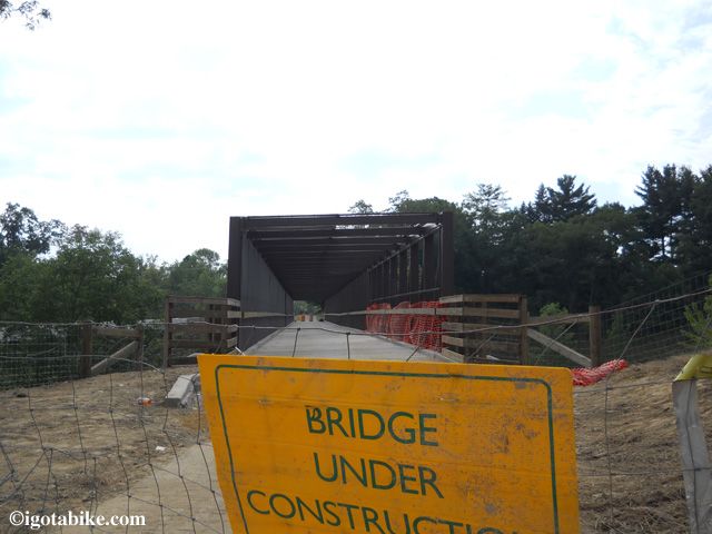
This is also where a new trail bridge has been installed to cross I-271…. but it’s STILL not open yet! Oh well, it’s back onto the road again, just to cross the bridge over the highway, then you’re right back on trail again.
EDIT: The bridge is now open as of 8/10/12
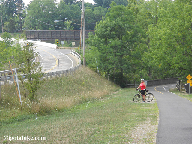
New bicycle bridge over I 271 is not open yet so you need to ride on the road for a few hundred feet
New bicycle bridge over I 271 is not open yet so you need to ride on the road for a few hundred feet

Bike and Hike Trail Bridge over I 271 near Brandywine Falls is not open yet.
Bike and Hike Trail Bridge over I 271 near Brandywine Falls is not open yet.

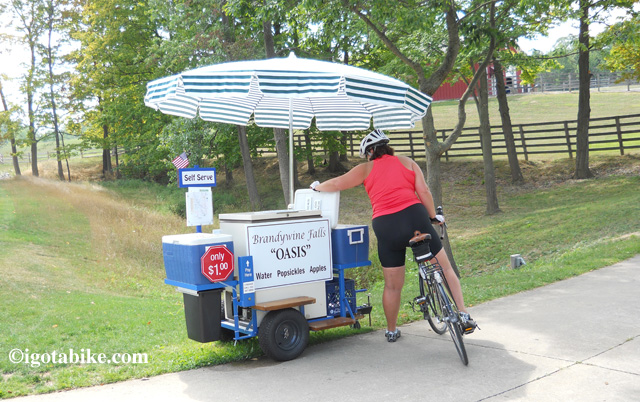
Just past I 271 we found this self serve snack stand full of snack and goodies.

Just past I 271 we found this self serve stand full of snacks, water, and goodies.

Very soon, you will come to Heinz Hill Road,. Turn right (west) on Heinz Hill.
(Every road crossing on the Bike and Hike is marked with a sign on the left hand side (?) of the trail, just a few feet before the crossing.)
Heinz Hill is just that; a hill. Actually, about three of them. Going down Heinz Hill Road, you will appreciate why we said to ride this loop in a clock wise direction. There are several sections where the road twists and turns down a 5% grade. It’s a riot!
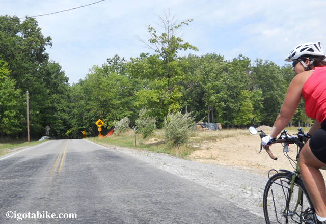
Heinz Hill Road is great going down, (west). Probably not so good going up.

Heinz Hill Road is great going down, (west). Probably not so good going up.

The bottom of the last hill (hill #3?), ends at a stop sign on Boston Mills Road, so be ready for it. Follow Boston Mills Road (to the right) just a few feet and you will be at the Towpath Trail at the Boston Towpath Museum. There is also a little store there, Trail Mix, where you can buy snacks and ice cream. Also, the Stanford House is nearby. It is a hostel and primitive campground. There is an access trail north of Boston on the east side of the trail.
At Boston, you will turn right (north) on the Towpath Trail and follow it all of the way back to the visitor center in Valley View.
Carol and I were hungry, however, so we instead turned left on the Towpath and rode into Peninsula, 2 1/2 miles away to get something to eat at Fishers. Peninsula is a great little town with a couple of places to eat, a Century Cycles Bike shop (rentals) and a Cuyahoga Valley Scenic Railroad train station.  Adding the 2 1/2 miles back and forth, made our little loop 30 miles, with lunch. Give it a try and let us know what you think!
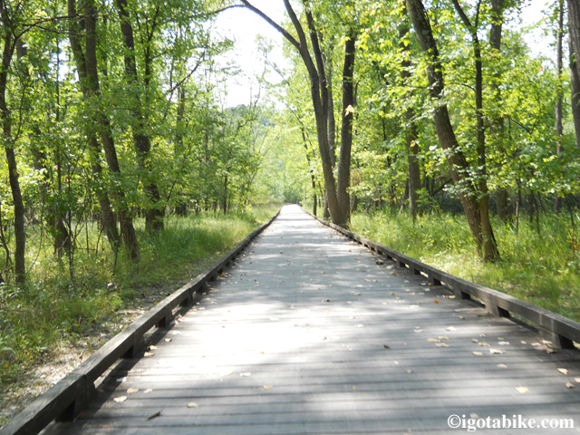
One of the many bicycle boardwalks along the Ohio and Erie Canal Towpath Trail. This one is between Boston and Pennisula.
One of the many bicycle boardwalks along the Ohio and Erie Canal Towpath Trail. This one is between Boston and Pennisula.

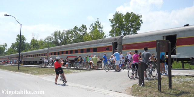
While in Penninsula we sawWhile in Penninsula we saw the Cuyahoga Valley Scenic Railroad loading up another round bikes heading south. Cyclist and their bikes can ride the train for $2! the Cuyahoga Valley Scenic Railroad loading up another round bike heading south. Cyclist and their bikes can ride the train for $2!

While in Penninsula we saw the Cuyahoga Valley Scenic Railroad loading up another round of bikes heading south. Cyclist and their bikes can ride the train for $2!

By the way, we looked into the possibility of using old Stanford Road, now closed to cars, as a connector trail in lieu of Heinz Hill Road. It’s not a good plan. It’s starts off as gravel and turns into old broken asphalt down a really steep hill. If you are young and adventurous, and have a mountain bike, go for it!
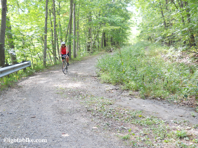
Stanford Road is closed to cars and not so good for road bikes.
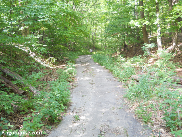
Stanford Road is closed to cars and not so good for road bikes.

Guy halfway down Stanford Road, on foot, deciding its too rough to reccomend. We turned back.

Guy halfway down Stanford Road, on foot, deciding its too rough to recommend. We turned back.

Also, keep in mind that a short section of Canal Road, from the Canal Visitor Center to Tinkers Creek is closed until sometime in the Fall. Not a problem when you are on the trail, but it may gum up the works if your are trying to get to the visitor center by car.
Posted in Trail Maps | Tagged , , | Comments Off on Bike and Hike Trail and Towpath Trail Loop Bicycle Route and Map, 25 miles

Cincinnati considering a bikeshare program

Bikesharing is a program that allows individuals to rent a bicycle from a kiosk, usually in an urban area for short distance transportation.
According to wikipedia, as of last year, there were 136 bikesharing programs in 165 cities around the world, with estimated fleet of 237,000 bicycles.
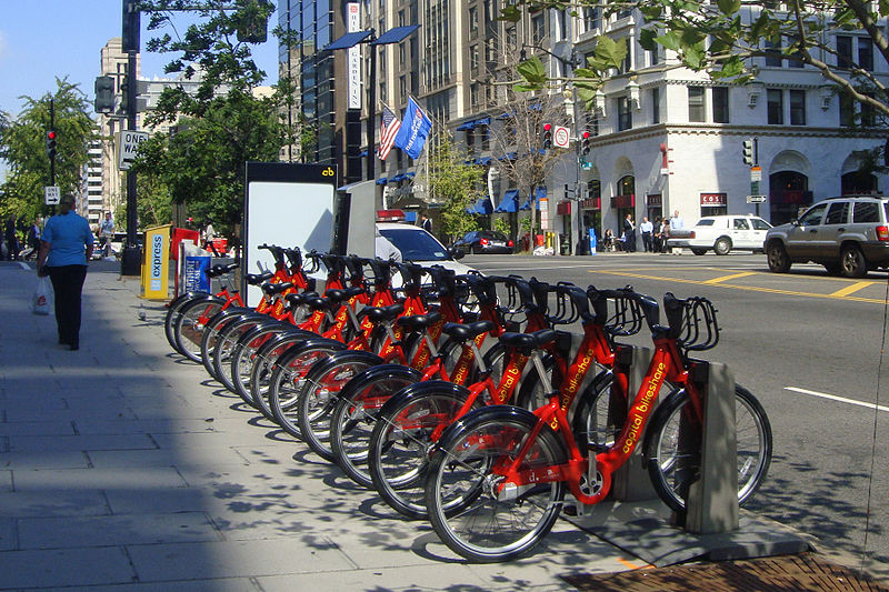
Capital Bikeshare in Washington, D.C. has 1,670 bicycles operating from 175 stations and is known as the largest bike sharing service in the United States.
The city of Cincinnati is considering a bikeshare and is asking for input on where it should place bike share stations. There is a map where you insert a pointer to make your suggestion. The deadline to give input is August 10. The site allows you see to see the suggestions that others have made so it is pretty interesting reading. Cincinnati has “an uphill battle” to be a bicycle friendly city! I hope the bikes they get have a really, really BIG first gear!
I wonder if the bikeshare bicycles will have racks and panniers? What about helmets?
At Capital Bikeshare its BYOH but they do provide a list of where you can purchase a helmet with a discount for Capital Bikeshare members.

Capital Bikeshare rental station near McPherson Square Metro (WMATA) station, downtown Washington, D.C. PHOTO: Mario Roberto Duran Ortiz

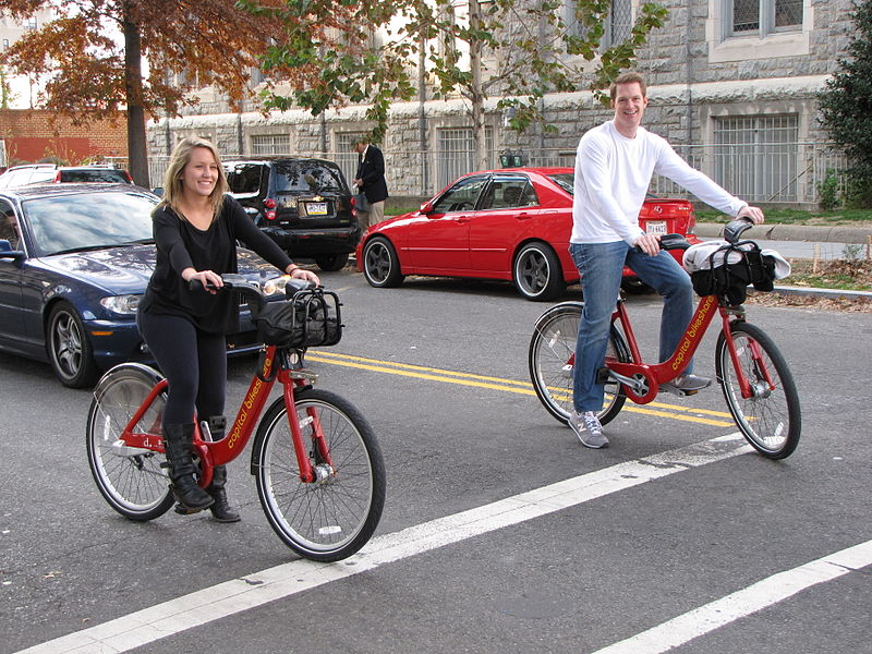
Two people ride Capital Bikeshare bicycles in the Dupont Circle neighborhood of Washington DC.
Whooops forgot the helmets again!
PHOTO: Ben Schumin


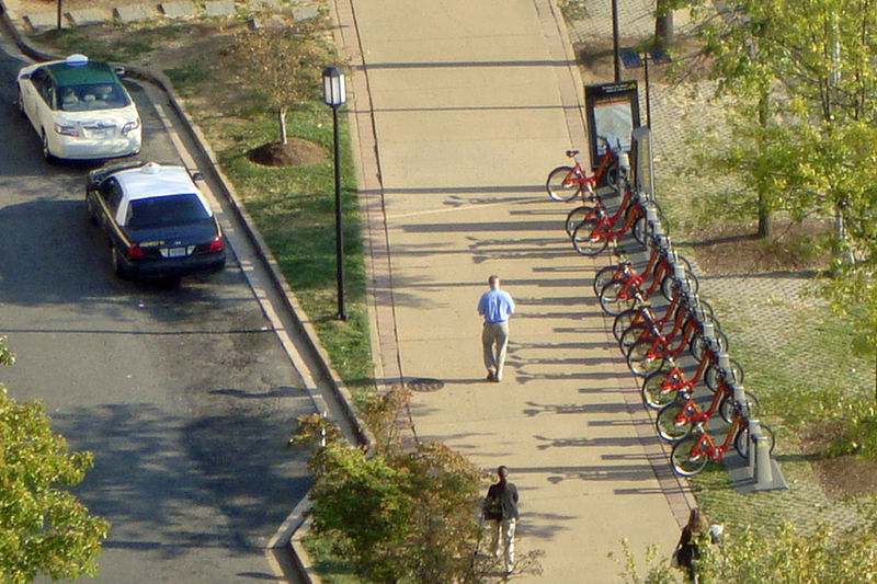
Aerial view of Capital Bikeshare automated rental station near Pentagon City Metro St, Pentagon City, Arlington, VA. PHOTO: Mario Roberto Duran Ortiz

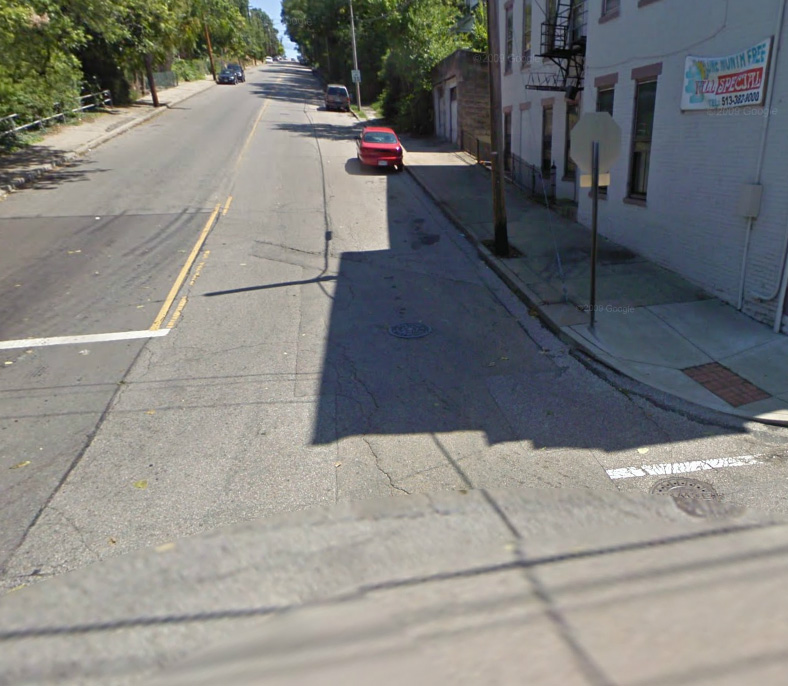
On Cincinnati's bike share map some fella named "Lance" suggests a bikeshare station on top of Straight Street.
He didn't leave his last name!
PHOTO: Google Maps Street View

Posted in Blog | Tagged | 3 Comments

The Joys of Seal Coating and other news

I just got an email from the Friends of Madison County Parks and Trails of London, Ohio (FMCPT). They are seal coating a section of Roberts Pass just east of London this week. If you’ve never ridden on a seal coated trail, it’s as smooth as a baby’s butt 😉 Carol and I have found that it’s worth another 2 mph as well!
The seal coating will be finished in time for the FMPT festivities this weekend; The rib and jazz fest, the rib tickler ride and a pie baking contest.

Posted in Blog | Tagged , | Comments Off on The Joys of Seal Coating and other news

The Lakewood Criterium is a fast and fun cycling event

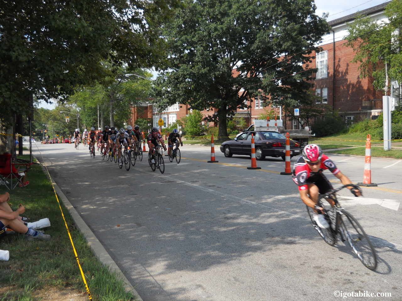
Guy and I attended the The Lakewood Criterium on Saturday July 28. Wow! what a blast! The cyclist were incredible and inspiring. The weather was perfect and the atmosphere was fun and festival like with plenty of refreshments along the route. We had a fantastic time and will make a point of attending this event again next year.
Great! Now Guy wants a racing bike!

Cat 3 Men making the final turn onto Detroit before the finish line.


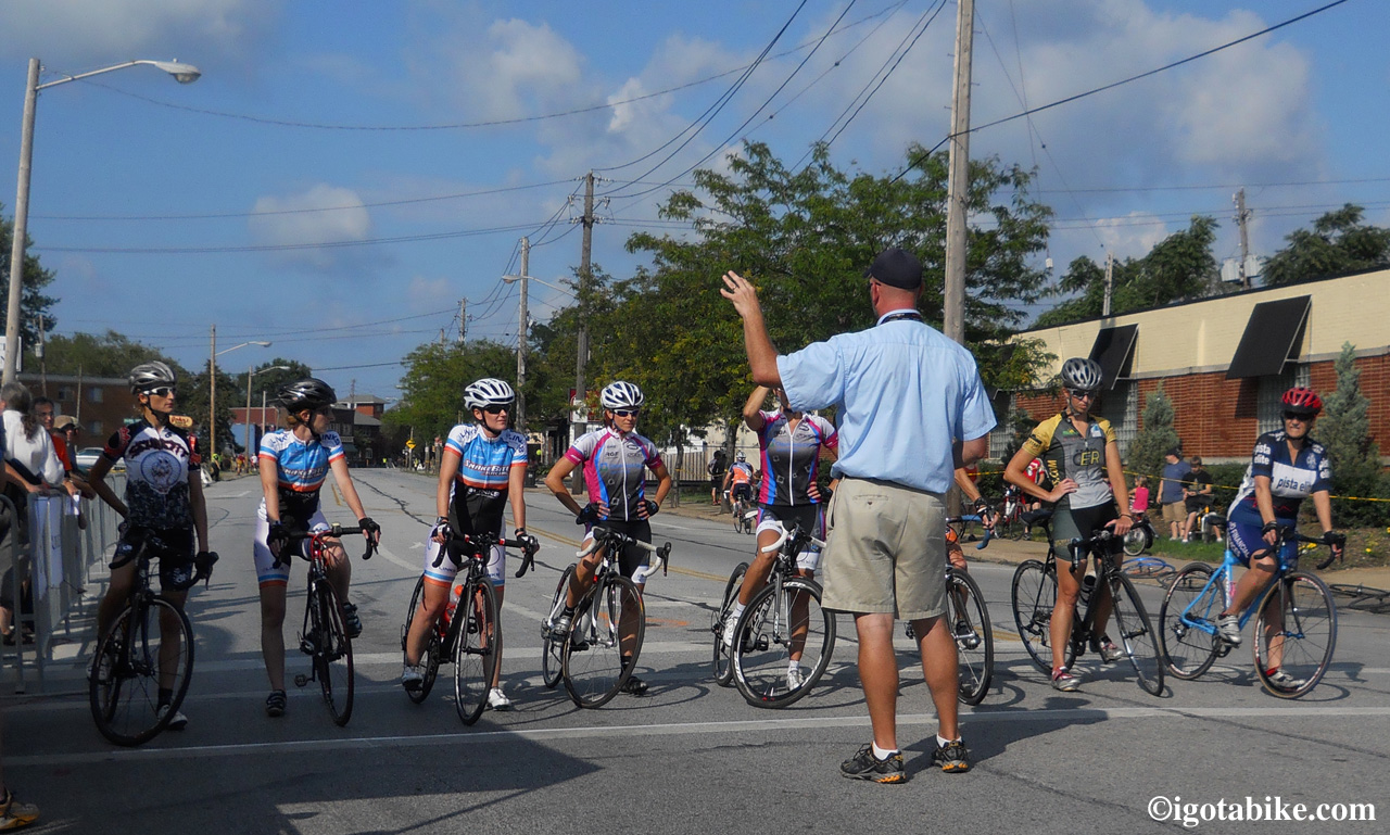
The Ladies Race was small in numbers but big on power!


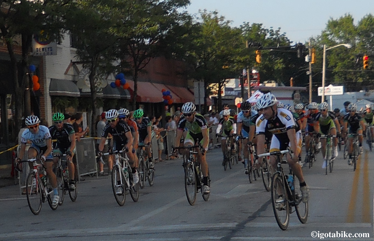
Mens Pro Cat 1, 2, 3 was the main event! Fast! Look at all those racers!


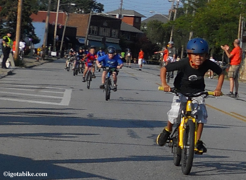
The kids races were really fun to watch. Pure detrmination! One little girl completed the course training wheels.

Click here to watch a short movie of the Lakewood Criterium. It will open in a new window.


Posted in Blog | Tagged | 1 Comment

Bicycle route with map for riding west from Cleveland into Lorain County

Riding west from Cleveland into Lorain County is a great bicycle route.
Route Level: intermediate to advanced

Guy and I live very close to some fantastic bike trails that usually take us south. It is very easy for us to get to the Ohio and Erie Canal Towpath Trail, The Bike and Hike Trail and the Cleveland MetroParks Emerald Necklace trails in the Rocky River Reservation and these are our everyday picks for riding. Last weekend we caught a break in the unusually hot weather with favorable winds so we decided to head west for a quick overnight bike tour. Guy reviewed the campground here.
Even though we were less than thrilled with the accommodations, we still had a great time and we will repeat this ride. There are other great destinations in the vicinity that make this an excellent route. Findley State Park, The North Coast Inland Bike Trail, and The Beaches and Back Roads bicycle route are all nearby. You could also access the Adventure Cycle Northern Tier route that travels east to west along Lake Erie.
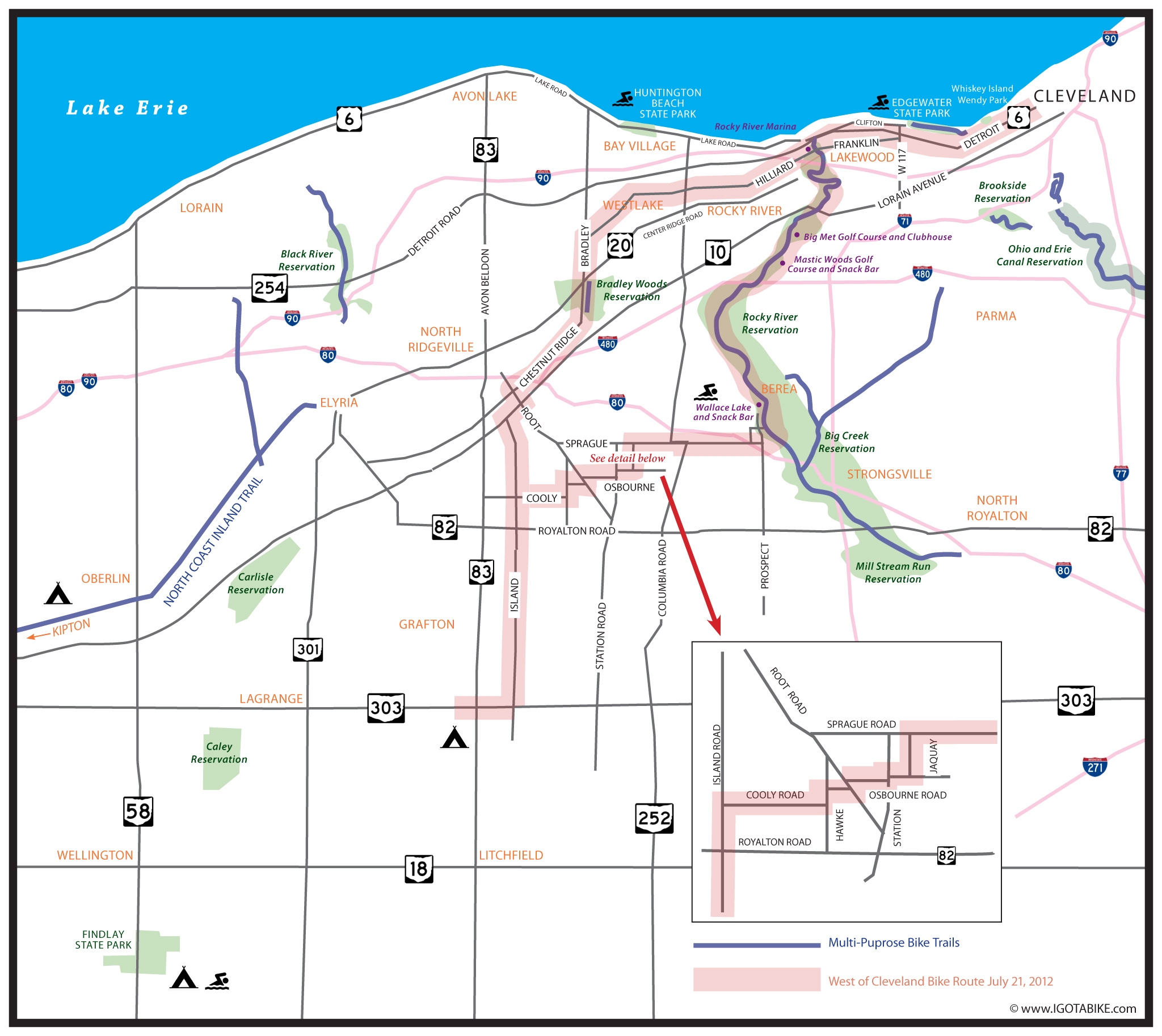
In short we used Franklin and Hilliard to head west and get through Lakewood and continued on Hilliard through Rocky River, Westlake and North Ridgeville. We used Bradley Road and Island Road to go south to get to RT 303 in Grafton. On the return we used Island Road and Osbourne Road to get to Sprague Road which took us into Olmsted Falls and to Prospect Road which took us into the Cleveland MetroParks Mill Stream Reservation where we headed north through the Rocky River Reservation to get back home. We used the NOACA maps to find our way. Here is quick overview map I designed to show you how we did it. Click the map to make it larger.

From downtown Cleveland use the Veterans Memorial Bridge to cross the Cuyahoga River from Superior Avenue on the east side to Detroit Avenue on the west side. There is a bikeway on the north side of the bridge with a fantastic view and benches with shade at the peak. As you approach Detroit there are usually a lot of pedestrians and one spot where a sidewalk blindly meets the bikeway. Use caution.
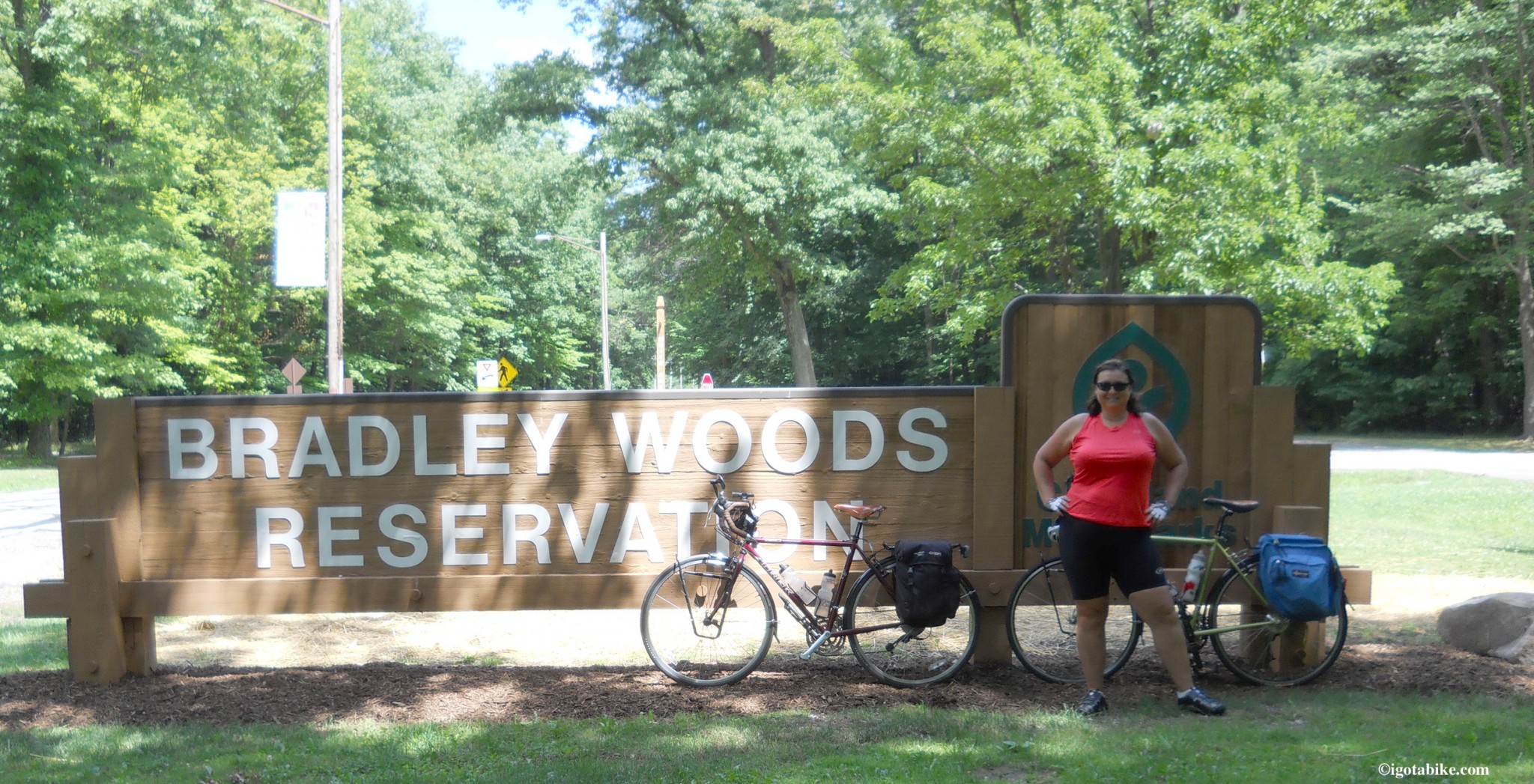
Continue on Detroit Avenue and enjoy the beautiful views of Lake Erie. The large patch of green you will see across the Shoreway is Whiskey Island and Wendy Park. When you get into Lakewood and beyond West 110 you will need to head south 3 blocks to pick up Franklin Avenue. West 116 is good choice. (West 117th is usually heavy with traffic) Head west on Franklin Avenue which is nice and wide and perfect. Franklin Avenue dead ends into Hilliard Avenue at the intersection with Madison Avenue. Make your way on across the bridge on Hilliard Avenue as it takes you over the Cleveland MetroParks Rocky River Reservation. For the next few miles the traffic is a bit heavy as you are right next to I90 and just south of a giant retail complex on Center Ridge Road. If you are ready for some refreshments the Rocky River Brewing Company is near the intersection of West 210 / Wager Road and Center Ridge Road. Soon Hilliard Avenue settles down as it passes beautiful homes and gardens. There is a bike lane between but is really not needed because the road is so wide (four lanes, divided) and the traffic is light. Just past Clague Road is the entrance to Clague Park on the right where there are bathrooms, water, picnic shelters and a swimming pool. A few more miles is Crocker Road and access to Crocker Park, a retail and restaurant megaplex to the north. Continue west on Hilliard Avenue until it dead ends at Bradley Road and turn left to go south. You will pass the Cleveland MetroParks Bradley Reservation.

Not sure of the facilities in this park but they are not near the entrance. We will check it out next time!

There is a bike trail for a couple of miles on Bradley for the length of the park that will allow you some leisurely time off road and out of traffic.
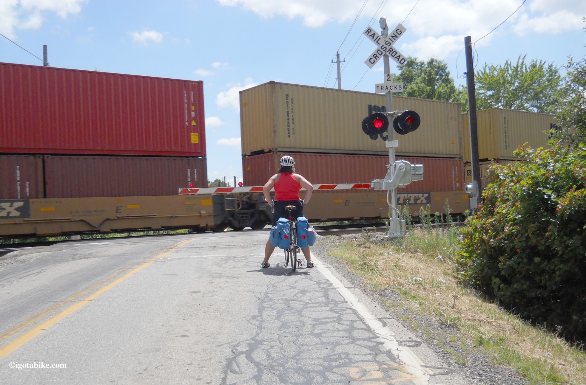
You will soon cross out of Cuyahoga County and into Lorain County and Bradley Road becomes Chestnut Ridge Road. Turn left on Root Road and then a right on Lorain Avenue RT 10 for a short distance to turn left to go south on Island Road. At the intersection of Island Road and RT 82, in the town of Midview, there is a Dairy Queen, a convenient store and an IGA. Just south of 82 you cross the railroad tracks. Use caution these are the main tracks and the trains are going fast! I was probably too close in this photo.

When bicycling in Lorain County you will encounter the main line tracks and the trains are going very fast!
The train should be blurry in this photo as it was ripping past us at 50 mph.

On the other side of the tracks there is new pavement! Very smooth and nice!
Continue on Island Road to RT 303 and turn right. There is a tiny hill on 303 only worth noting because it is the ONLY hill on this entire route and you are in flat farm country now! At RT 83 turn left to reach the campground–its just ahead about 200 feet on the left. It is about 12 miles further to the south and west to reach Findley State Park where there is camping and a beach. We have camped there (by car) many times and we love it. Bring the poison ivy soap! There is another campground west of Oberlin which is a quaint college town and the North Coast Inland Bike Trail passes through with Elyria to the north Kipton to the south. The Beaches and Back Roads bicycle route also passes through Oberlin.  
On our return trip we retraced our route by going north on 83, east on 303, north on Island and just past RT 82 turned right on Cooley Road which dead ends at Hawke, turn left. Within sight is Osbourne Road where you turn right. Follow Osbourne Road as it dog legs– turn left, turn right, across Roote Road and Station Road where there is a convenient store. When you get to the railroad tracks turn turn left on Jaquay to get to Sprague Road and turn right. At the intersection of Sprague Road and RT 252 Columbia Road there is a gas station. Follow Sprague Road and immediately after crossing the bridge over I80 turn left on Fair into the neighborhood. The second street down is Meadow, turn right. Cross Prospect and pick up the bike trail at the entrance to the Mill Stream Run Reservation. At the bottom of the hill is Valley Parkway and a latrine. Turn left and head north on the bike trail. Less than a mile down you will come to Wallace Lake which is a swimming beach and there is a refreshment stand. There is a water fountain right on the bike trail opposite Wallace Lake. For more refreshment options turn right at the stone bridge to go into Berea where there is a grocery store and the Cornerstone Brewery. To continue, follow the bike path north as it crosses Bagley and runs along the road and under a bridge and turns right to go past Berea Falls. Continue north on the bike trail and you will pass several picnic areas with latrines and just north of Cedar Point Road there is a latrine with a water fountain. Just across the river is the Rocky River Nature Center that is air conditioned and has real bathrooms and an ice cold drinking fountain. The Mastic Woods Golf Course is just to the right of the bike trail at Puritis Road and there is snack bar. Just beyond that is the Big Met Golf Course where there is a club house with ready to carry out or made to order food and beer and air conditioning. About four more miles on the bike trail and you will come to the northern end. At the bottom of the hill on the left is the Rocky River Marina where you can get food and beer and sit on the patio and watch the boats. At the top of the hill you are at the west end of Lakewood. Turn right onto Detroit and follow it around the bend and turn right onto Riverside Drive. Turn left on Madison Avenue to get to the intersection with Hilliard which becomes Franklin when you bear left at the light. Follow Franklin through Lakewood and turn left to go north on West 116 to get to Detroit and turn right to get to downtown Cleveland. 
This was a fantastic route! Give it a try and let us know how you like it!

Posted in Trail Maps | Tagged , | Comments Off on Bicycle route with map for riding west from Cleveland into Lorain County

Topeak Road Morph G Mini Pump with Gauge Review

Topeak Road Morph G Mini Pump with Gauge
Link: http://www.topeak.com/products/Pumps/RoadMorphG

Price Paid: Don’t remember.
 Currently $29.99 at Nashbar
Grade: A

We’ve had this pump for years, and right off I got to say, it’s been a stout performer. We’ve taken it with us on several tours and it lives daily on the bottom side of the downtube of my Trek 520. (click on any picture for a full size view)

Topeak Road Morph G mounted to the downtube of my Trek 520

It came with a really nice and simple bracket that mounts to any standard water bottle cage braze-ons.
The pump sort of snaps into place and is then secured with a velcro strap that threads over the pump, through an eyelet, then back onto itself, creating a tight lock on the pump. In 1000 miles so far this season it has never came loose- not even a little bit. A+ on the bracket.

Topeak Road Morph G

Topeak Road Morph G ready for action!

The pump itself is super cool. The handle folds down and twist-locks into the pump body for storage. There is also a little foot tab that folds out on the bottom so you can hold it steady while pumping, like a conventional floor pump.  The best things about this pump are first, the hose. In years past I had a Zefal frame pump, the kind without a hose. It was always so ridiculously difficult to pump up a tire while at the same time trying not to rip the stem off the tube. It really was awful. The answer was so simple; just add a short hose! The hose on the Topeak extends a bit, making it relatively easy to fill a tire on the road. The other really cool thing that they added is a pressure gauge!
Topeak Morph Road G pump pressure gauge

Topeak Morph Road G pump pressure gauge.

Those two things really help to put this piece of gear over the top.
 In use the pump is fast and efficient. Take it out of it’s bracket, extend the hose, lock it to the stem, fold down the foot tab, twist the handle to unlock it and start pumping.
The only things that are slight drawbacks, are
1. it is sometimes difficult to remove the nozzle from the stem, it’s such a tight fit. It seems that it is getting a little easier with time, and it’s not the only pump that I’ve ever had that experience with.

2. The gauge is a little small, making it hard for me to read (impossible without my reading glasses). It used to be OK, but the older I get, the harder it gets. It would be cool if they came out with a large font style gauge for us older guys! 😉
All in all, it’s a good piece. Easily one of our best purchases.

Posted in Gear Reviews | Tagged | Comments Off on Topeak Road Morph G Mini Pump with Gauge Review

Getting Started Bicycle Touring: Bike Camping Checklist

Here’s a great checklist we’ve compiled, based on the gear we usually take with us. It’s in a convenient PDF format. Send us and email at CarolandGuy@IGotABike.com to let us know if you think we’ve missed anything.
Bicycle Camping Checklist

Posted in Getting Started | Tagged | Comments Off on Getting Started Bicycle Touring: Bike Camping Checklist