The North Coast Inland Trail: Lorain County from Elyria, to Oberlin to Kipton, 13 mile Bicycle Ride.

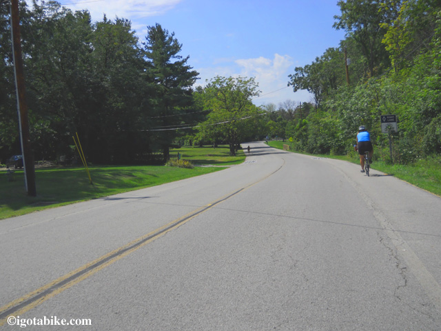
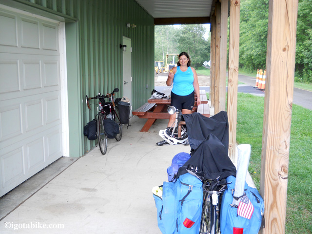
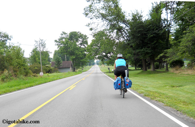
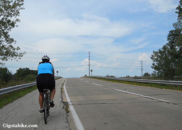
A few days ago we rode the Lorain County section of North Coast Inland Trail from Elyria, through Oberlin and on to Kipton. It’s approximately 13 miles long. It is very smooth and very flat. It is seal coated in many places. The trail runs east / west and has mile markers indicating your direction. Nice.

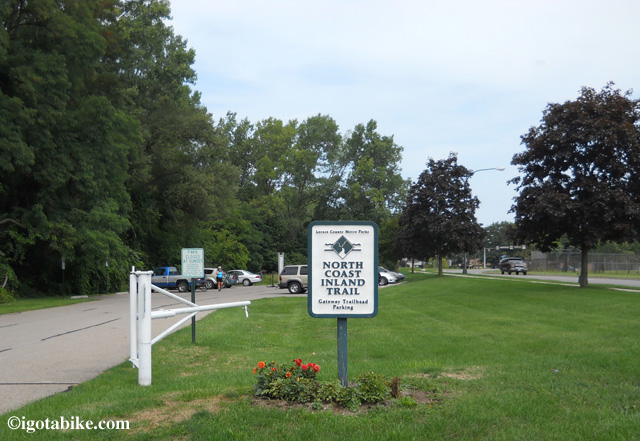
The North Coast Inland Trail head in Elyria is at the north west corner of Gateway Boulevard and Woodford Avenue.

The North Coast Inland Trail head in Elyria is at the north west corner of Gateway Boulevard and Woodford Avenue.

The trail head in Elyria was a little difficult for us to locate for some reason. It is at the north west corner of Gateway Boulevard and Woodford Avenue. To access the trail from the parking lot, you must ride north up the sidewalk a few hundred feet. At W 3rd Street turn left (west) and cross the bridge. It’s kind of strange, because W 3rd is a one-way heading east, but there is a marked bike lane on the south side shoulder. It is plenty wide enough, but riding facing traffic is just weird. Anyway, you are only on that section for maybe a quarter mile until the real trail departs from the road on the left. You can’t miss it.

To access the North Coast Inland Trail in Elyria ride north up the sidewalk a few hundred feet and W 3rd Street turn left (west) and cross the bridge. The bike lane over the brige on West 3rd goes against traffic.

To access the North Coast Inland Trail in Elyria ride north up the sidewalk a few hundred feet and W 3rd Street turn left (west) and cross the bridge. The bike lane over the brige on West 3rd goes against traffic.

The trail follows the right of way of an old railroad and there are still large old carved stone markers along the path. The trail runs pretty uneventfully to Oberlin. There are multiple road crossings, many of which have limited sight lines. Use caution and your ears. Stop, look, listen.

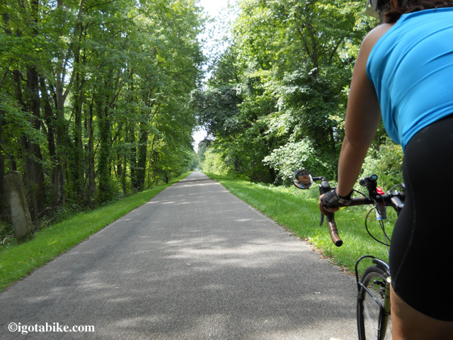
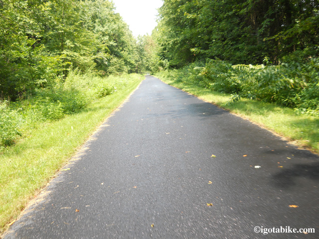
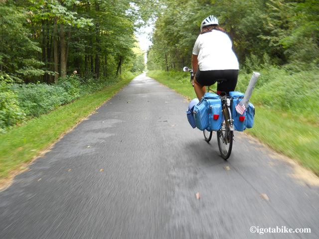
The North Coast Inland Trail is scenic and wooded. It is smooth and paved for 13 miles.

The North Coast Inland Trail is scenic and wooded. It is smooth and paved for 13 miles.

All of the roads are marked, their names stenciled onto the trail at the crossings.
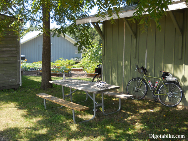
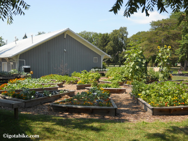
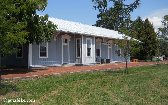
Oberlin is a college town, so the trail gets used a lot. The trail skirts the southern edge of town. There is a good opportunity for stopping where it crosses Main Street. There is a McDonalds, a drug store and a small restaurant. We got carry out from the restaurant and took it across Main to the old Oberlin train station. There is a picnic table around the back, under a nice shady tree with a nice community garden to look at.

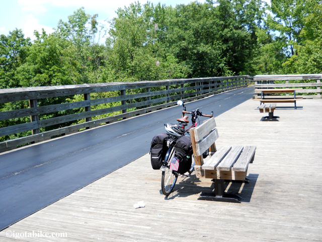
The historic Oberlin train station is located where the trail crosses Main Street. There is a drinking fountain.

The historic Oberlin train station is located where the trail crosses Main Street. There is a drinking fountain.

Behind the Oberlin train station there is a picnic table under a nice shady tree.

Behind the Oberlin train station there is a picnic table under a nice shady tree.

Nice community garden behind the historic Oberlin train station along The North Coast Inland Trail.

Nice community garden behind the historic Oberlin train station along The North Coast Inland Trail.

West of Oberlin, the trail takes a slight road detour. Heading west, the Oberlin Country Club will be on your right (watch out for stay golf balls!). The route turns south onto Pyle-Amherst Road for less than 500 feet, then west on W. Hamilton St. (Township Hwy. 122) for maybe 1/4 mile. The trail picks up again on the south side of Hamilton. There are bike route signs clearly marking the way.

West of Oberlin, The North Coast Inland Trail takes a slight road detour past the Oberlin Country Club.

West of Oberlin, The North Coast Inland Trail takes a slight road detour past the Oberlin Country Club.

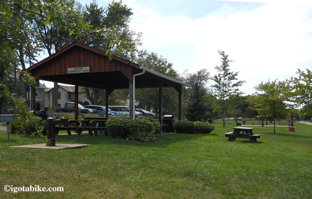
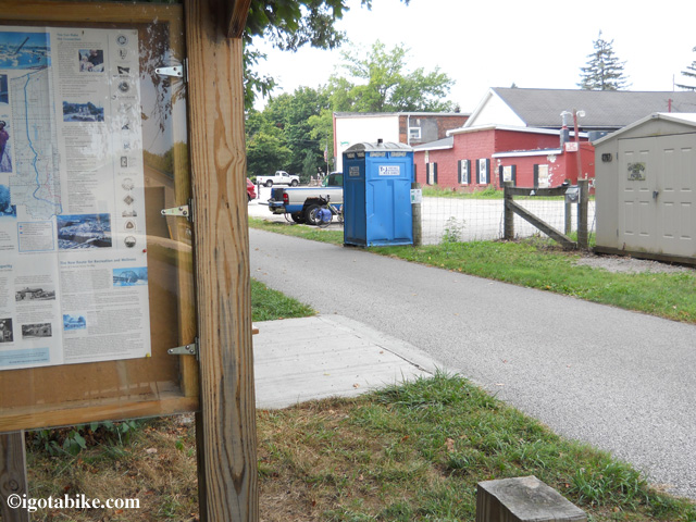
When you get to Kipton, there is a nice park with a gazebo, shelter and picnic tables. There is also a drinking fountain and a port-o-potty. There is no place to get food.

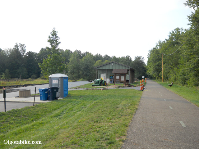
The Community Park in Kipton has a gazebo, picnic shelter with grills and picnic tables. There is also a water fountain and a port-o-potty.

The Community Park in Kipton has a gazebo, picnic shelter with grills and picnic tables. There is also a water fountain and a port-o-potty.

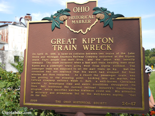
Great Kipton Train Wreck

The trail continues past the park and dead ends at Baird Road (Township Hwy. 47). At that point we went road riding.
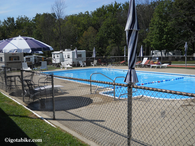
The roads in the area are great for riding and many of them are included in the Backroads and Beaches Bicycle Route. There are many opportunities to create loops with the trail. There is also the possibility of using the trail for an over-nighter, as there is a campground very near. A short over nighter like this might be useful for trying out touring for your first time or for testing new equipment. The campground is called Schaun Acres and is just a few short and pleasant miles of road riding away from the trail. To get there from the end of the trail, turn left (south) onto Baird Road, which is part of the Backroads and Beaches Route. Follow Baird south. Cross Oberlin-Norwalk Road (RT 20). Continue south on Baird. At Lagrange-Richfield Road (RT 303), turn left (east). Schaun Acres Campground will be 1/4 mile down on the left (north) side of the road. We rode into the campground and looked around a bit, but we didn’t stay there. It does look nice, and the pool looks great.
Note: In several places we saw signs that indicated the trail closes at 11 pm on weekdays and midnight on the weekends, so overnight parking maybe an issue.

Riding south on Baird approaching Lagrange-Richfield Road (RT 303). There are no road signs. Turn left (east) to reach Schaun Acres Campground.

Riding south on Baird approaching Lagrange-Richfield Road (RT 303). There are no road signs. Turn left (east) to reach Schaun Acres Campground.

The swimming pool at Schaun Acres Campground looks mighty nice!

The swimming pool at Schaun Acres Campground looks mighty nice!

Overall, the Lorain County section of North Coast Inland Trail is smooth, flat, well maintained and has good signage.

Note: The west end of the North Coast Inland Bike Trail in Kipton is about 15 miles north of Findlay State Park where there is camping and a beach. There are 3 or 4 other campgounds in the area.

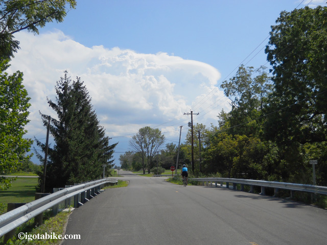
Pedal faster! I hear thunder!

Pedal faster! I hear thunder!

Posted in Trail Maps | Tagged , | Comments Off on The North Coast Inland Trail: Lorain County from Elyria, to Oberlin to Kipton, 13 mile Bicycle Ride.

How long does it take to ride the Ohio to Erie Trail?

How long does it take to ride the Ohio to Erie Trail?
Good question.
The answer is; it depends.
We’ve talked to people that did it in three days! That’s better than 100 miles a day!
The way we rode was not to accomplish a feat, but to actually experience the trail, the people and all of the cities, towns and country side along the way. We carried gear for camping and staying in hotels. It took us eight days. That’s an average of 45 miles per day. Not too bad. Your mileage may vary.
There are reasons we took as long as we did; 50 miles per day is about as far as we can pedal in one day and the places to stay are spaced in such a way as to pre-determine our particular pace. In other words, pedaling past a particular point just to get more miles in would land us in a place with no or reduced accommodations – food, camping or hotel, etc. (all of this goes out the window if you are stealth camping)
So for those that want to know the schedule we kept without reading our entire trip blog, here is a synopsis of how and why we we did what we did, north to south.
Day 1: Cleveland To Stow
Approximately 35 miles from our front door near downtown, to the hotel in Stow. Some city riding, but mostly trail. (note that we deviated from the official Ohio to Erie Trail route utilizing the paved Summit County Bike and Hike Trail. It is 6 miles from our front door to the Harvard Road Trailhead.)
Day 2: Stow to Massillon
We stayed in Massillon the second night 46.5 miles from Stow. Akron was too close to Stow, but was too far from Cleveland for the first night. See?
Day 3: Massillon to Millersburg
40 hard miles. Some road riding through the hills of Amish country.
Day 4: Millersburg to Mt. Vernon
42 more hard miles. More road riding through the hills of Amish country and some rough going on the Mohican Valley Trail
Day 5: Mt. Vernon to Columbus
54 miles. A long day for us. Mostly trail with sections of relatively flat road roughly between Mt Vernon and Mt Liberty and Centerburg and Sunbury. (note that we deviated from the official Ohio to Erie Trail route utilizing the newly paved sections of the Heart of Ohio Trail.)
Day 6: Columbus to London
36 miles. A good easy day, except for how confusing the trail system is in Columbus. Luckily, we had a local guide, or else we’d still be there!
Day 7: London to Waynesville
50 miles. All trail. Tough day as the trail is very exposed and windy.
Day 8: Waynesville to Cincinnati
50 miles almost all trail.

353 miles total over eight days.
Even though it was May we got hammered with some extremely hot and humid weather making the hills seem higher and the miles longer.

Our return trip was a bit more drawn-out as we were no longer on a strict schedule. We stayed in Cincinnati for a few days and detoured (wandered) over to one of our favorite campgrounds outside of Dayton for a few more days. All in all we were on the trail for about three weeks.

Here are some numbers from our northbound journey.
Cincinnati to Spring Valley: 58 miles
Spring Valley to Brookville: 51 miles
Brookville to Cedarville: 53 miles
Cedarville to London: 23 miles
Bike trouble caused us to hitch a ride from London to Columbus
around town in Columbus and to Polaris: 28
Polaris to Mt Vernon: 41 miles
Mt Vernon to Millersburg: 43 miles
Millersburg to Massillon: 40 miles
Massillon to Akron to home via train: 44 miles
in Akron we loaded our bikes onto the Cuyahoga Valley Scenic Railroad
and took the train to Rockside Road then rode our bikes home

total mileage 759

Posted in Trail Maps | Tagged | Comments Off on How long does it take to ride the Ohio to Erie Trail?

Cleveland Bridge Construction Workaround and Tire Dipping Directions and Map

UPDATE SEPTEMBER 2014: The bicycle tunnel at West 65th is closed. Northbound: Stay on Detroit to Lake Ave, (Burger King) turn right at end of Burger King parking onto West 76, just past second stop sign is new bike tunnel to Edgewater Park. Southbound: the new tunnel is near the concession stand at the beach, on the other side, continue forward on West 76, turn left on Detroit Avenue.

These directions are the work-arounds due to the major I-90 bridge construction over the next couple of years. During that time, many of the regular road routes will be closing and opening or redirected. While it’s not the most scenic way, Carol and I believe this work-around route will not be disturbed by the construction (we live here in Cleveland). Please note that the area around W 25th and Clark Avenue is quite… urban. It’s mostly businesses, though.
Important note to Dippers: There is no actual access to Lake Erie in downtown Cleveland. The entire downtown waterfront is on piers, many feet above the waves. The nearest access is just a few miles to the west at Edgewater Park. Follow the directions below.

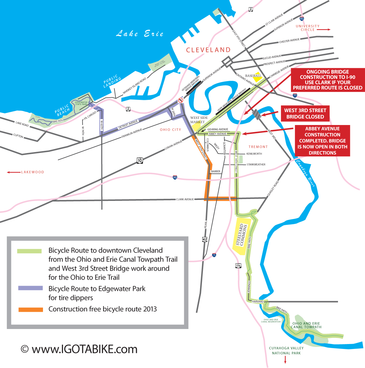
Cleveland Bridge Construction Workaround and Tire Dipping Directions and Map. NOTE: The Abbey Avenue construction completed. Abbey Bridge is now open in both directions.

(detoured in 2014 see above)

Cleveland, South to North for the Tire Dippers

Traveling north on W 14th from Steelyard Commons
Proceed north on W 14th approximately 1/4 mile
Turn left (west) onto Clark Avenue
Proceed west on Clark approximately 1/4 mile
Turn right onto W 25th  (the area around W 25th and Clark is a little rough)
Proceed north on W 25th for approximately 1.5 miles
For Lake Erie access, proceed west on Detroit in the following manner:
There is no left turn from W 25th onto Detroit heading west, instead-
Turn left (west) onto Franklin Boulevard
Proceed west on Franklin Boulevard approximately 1000 feet to W 29th
Turn right (north) onto W 29th
Follow W 29th 2 blocks north to Detroit
Turn left (west) onto Detroit
(detoured in 2014 see above) Proceed approximately 1 mile west on Detroit to W 65th Street
At W 65th turn right (north)
Proceed north on W 65th approximately 1/4
W 65th dead ends at Fr. Caruso Drive. A bike north path begins here, taking you under the railroad tracks
Proceed on the path through the tunnel and down the hill on the other side
You are entering Edgewater Park
Proceed on the path under the Cleveland Memorial Shoreway
Follow the path to the left (west) to reach the public beach
Turn right (east) onto Whiskey Island Road along side the marina to reach the public boat launch (no sand) approximately 1/4 on left (north)
For access to downtown:
At Detroit Avenue turn right (east) to go downtown. There are marked bike lanes over the bridge or you can ride on the north side of the bridge on a wide sidewalk.
(There is another opportunity to access downtown approximately 1/2 mile to the south of Detroit using the Lorain-Carnegie Bridge on Lorain Road. The West Side Market is a landmark at the corner of W 25th and Lorain)

Cleveland, North to South for the Tire Dippers

UPDATE APRIL 2013 see bridge construction update here. The Abbey Avenue bridge construction is completed. The bridge is open in both directions. However, the route below that uses Clark Avenue remains relevant in the event that I 90 bridge construction blocks the route.

Start at the public boat launch (on Whiskey Island Road next to the marina) or the public beach at Edgewater Park
(detoured in 2014 see above) Head south on the bike path under the Cleveland Memorial Shoreway
Proceed up the hill and through the tunnel under the railroad tracks
The path ends at W 65th St and Fr. Caruso Drive
Proceed south on W 65th approximately 1/4 mile
At Detroit Avenue, turn left (east)
Proceed east on Detroit approximately 1 mile
At W 25th turn right (south)
Proceed south on W 25th approximately 1.5 miles
Turn left (east) on Clark Avenue. (The area around W 25th and Clark is a little rough)
Proceed east on Clark approximately 1/4 mile
Turn right (south) on W 14th.
Continue following original route map and description

Posted in Trail Maps | Tagged , | 1 Comment

Cleveland: Bicycle route from Ohio to Erie Trail to downtown Cleveland with Map

Cleveland is a little more difficult than other towns along the Ohio to Erie Trail. There are plenty of places to stay and eat and hang out at in Cleveland. The problem stems from where the trail terminates in town.
(Please Note: There are some major construction issues in Cleveland that will be present for the next several years, presenting obstacles to the regular route. We have created a map with directions for getting around these trouble spots. Also included are directions for the “Dippers” out there that actually want to dip your tires in the waters of Lake Erie. Dippers and Construction Workaround)

UPDATE APRIL 2013 see bridge construction update here. The Abbey Avenue bridge construction is completed. The bridge is open in both directions. The new bikeway pedestrian section of the Hope Memorial Bridge is complete and open.
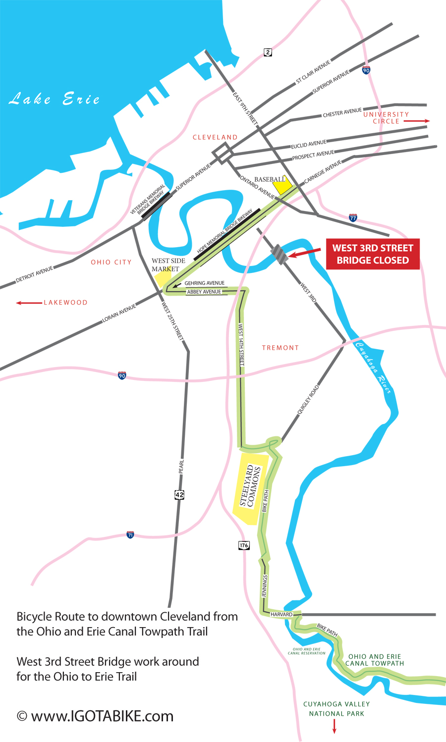
Bicycle Route to downtown Cleveland from the Ohio and Erie Canal Towpath Trail. West 3rd Street Bridge work around for the Ohio to Erie Trail

Bicycle Route to downtown Cleveland from the Ohio and Erie Canal Towpath Trail. West 3rd Street Bridge work around for the Ohio to Erie Trail.

The trail comes to a sputtering end at the Harvard Avenue Trail Head Parking lot, in the shadows of the big blue AlCoA plant on the hill and the Harvard Denison bridge just ahead in the distance.
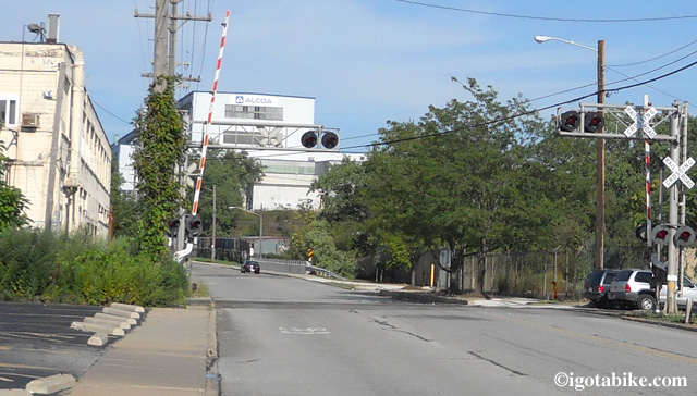
Trailhead on Harvard Road

This photo is looking east down old Harvard Road. Just beyond the rail road tracks is the trail head for the Ohio and Erie Canal Towpath and the Ohio to Erie Trail turns to a road route. The large building in the background is the Alcoa plant and it can be seen for miles. The car is on the bridge that crosses the Cuyahoga River.

At this point, you are not really downtown, yet. From this trail head parking lot, the trail becomes a road route, following surface roads.
From the trail head parking lot, turn left (west) onto Harvard Avenue. You will cross the Cuyahoga River in about 200 feet. Just past the river, in another 200 feet, you will turn right at the light, onto Jennings Road (north).
There is a sports bar/restaurant at the corner of Harvard and Jennings, called Cleats. Pretty good bar food (burgers, etc.) and decent beer (Great Lakes). There is a bike rack on the Jennings road side.
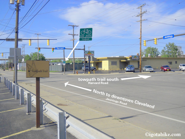
bike route to downtown Cleveland

This photo is showing the intersection of Harvard and Jennings with Cleat's in the background.

The bike route continues north on Jennings. There are green bike route signs pointing you to the Tremont neighborhood. In about a half mile, the bicycle trail picks up to take you behind a large retail complex, Steelyard Commons, in homage to the once magnificent steel mills that used to stand there. There is a gigantic Walmart, Target, Home Depot, a Subway, Chipolte, Steak and Shake, IHOP and so on. The trail runs behind the complex in a fenced-in corridor along side a train yard and an old steel mill.
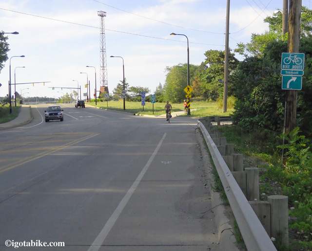
At Steelyard Commons the bicycle route leaves Jennings Road and returns to trail.
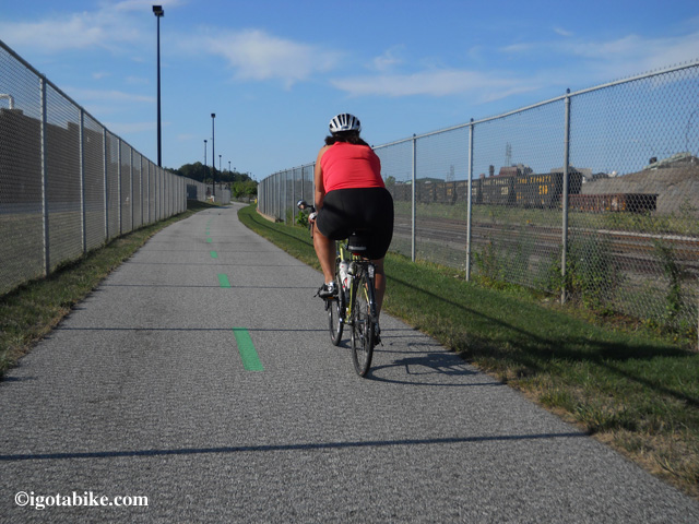
At Steelyard Commons the bicycle route leaves Jennings Road and returns to trail.

The trail runs behind the Steelyard Commons complex in a fenced-in corridor along side a train yard and an old steel mill.

The trail runs behind the Steelyard Commons complex in a fenced-in corridor along side a train yard and an old steel mill.

Just north of Steelyard Commons, the Ohio to Erie Trail route sputters again. The most direct way to downtown (as indicated on the Ohio to Erie Trail website) would have been to turn right onto Quigley, just past the shopping center, adjacent to the electric sub station. You would follow Quigley for about a half mile until you reached West 3rd Street, where you would make a left. You would follow West 3rd for about a mile, cross the river on an old lift bridge, turn right on Canal Rd., just over the bridge, go up Canal then right on Commercial, up Commercial and you would pop out right downtown, across from The Indian’s stadium.
That won’t work, however, because the lift bridge on West 3rd is closed for repairs until 2013. At least. Soooo….
Here’s the Carol and Guy approved alternate route:
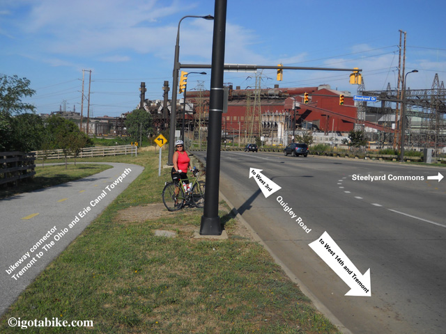
The official route of the Ohio to Erie Trail follows Quigly down hill to get to downtown Cleveland but the bridge is CLOSED. The alternate route is to go uphill and cut through the Tremont neighborhood, using West 14th Street.

The official route of the Ohio to Erie Trail follows Quigly down hill to get to downtown Cleveland but the bridge is CLOSED. The alternate route is to go uphill and cut through the Tremont neighborhood, using West 14th Street.

After Steelyard Commons, turn left to go uphill on Quigly. There is actually a bicycle path connector that will takes you from the path behind Steelyard Commons under Quigley through two short tunnels and up the hill on the other side of the road.
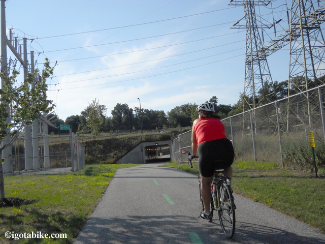
Approaching tunnel number 1 that takes you under Quigley Road north of Steelyard Commons.

Approaching tunnel number 1 that takes you under Quigley Road north of Steelyard Commons.

Once at the top of the hill (it’s not too bad), you will be at a traffic round-a-bout. Head to your right on West 14th Street. Proceed along 14th. (There is a lot of construction going on for the next few years. From this point north, you may need to take this alternate route)When you cross Clark Avenue, your are entering the Tremont neighborhood. It’s a kind of trendy place with lots of cool restaurants and pubs along the way, especially around Lincoln Park.
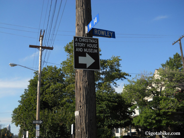
Fans of Christmas Story movie turn here.

Fans of Christmas Story movie turn here.

Proceed the length of 14th, ignoring the “End of Bike Route” sign, until you cross Fairfield.
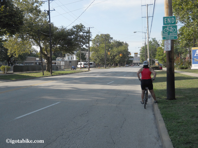
Ignore the “End of Bike Route” sign and continue on West 14th Street.

Ignore the “End of Bike Route” sign and continue on West 14th Street.

At this point it looks as if you are getting onto the highway ramp. There is a Greek Orthodox Church on the corner. Proceed up the ramp. At the last second there is a road off the ramp on the right- follow it. It’s just a short little connector road barely 500 feet long. I don’t even think it has a name. It will take you to Abbey Avenue.
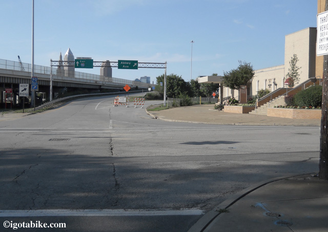
The highway Ramp is straight ahead, The church on the right, and the short connector to Abbey Avenue is in the center. During construction you may need to go around the block.

The highway Ramp is straight ahead, The church on the right, and the short connector to Abbey Avenue is in the center. During construction you may need to go around the block.

Turn left on Abbey. (At this time there is a lot of construction and the connector may be closed. The alternate is to turn right on Fairfield, left on W11th and then left onto Abbey- in essence, just going around the block) There are some cool views of the city along this route. Also, if you were to instead turn right on Abbey, then left on 13th, a block up is Sokolowski’s University Inn- a famous Cleveland restaurant and pub with an awesome view.
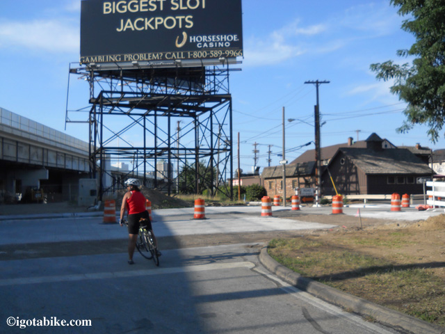
This the other end of the Abbey Avenue connector. (Abbey Avenue is crossing left to right.) Sokolowski’s University Inn is the building on the right. Turn left to cross the Abbey Avenue Bridge.

This the other end of the Abbey Avenue connector. (Abbey Avenue is crossing left to right.) Sokolowski’s University Inn is the building on the right. Turn left to cross the Abbey Avenue Bridge.

Anyway, if you had turned left on Abbey, you will go under the highway and then cross a bridge, with downtown visible on your right.
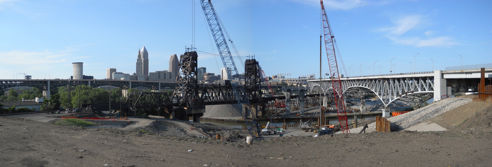
The view of downtown Cleveland from Abbey Avenue including the new bridge construction on I90.

The view of downtown Cleveland from Abbey Avenue including the new bridge construction on I90.

Roll down Abbey until it dead ends into Gehring Avenue. Turn right onto Gehring. At Lorain Road (Route 10), you will make a right to go downtown.
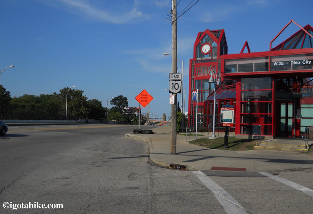
The view looking towards downtown Cleveland from Gehring Avenue near the West Side Market. The red building is the RTA station, Cleveland’s public transportion, that includes busses with bike racks and trains.

The view looking towards downtown Cleveland from Gehring Avenue near the West Side Market. The red building is the RTA station, Cleveland’s public transportation, that includes buses with bike racks and trains.

When you are at Lorain and Gehring, you will notice a tall tower across the street. That’s the historic West Side Market. It’s an old-world farmers market. You absolutely must stop in. Trust me on this one. It’s huge and there is an inside market and an outside market. They are open on Mondays & Wednesdays: 7AM – 4PM and Fridays & Saturdays: 7AM – 6PM. Also in that very same area is the Great Lakes Brewing Company restaurant and bar as well as The Garden Market Brewery and many other small shops, bars, restaurants, a bike shop and a new hostel. I repeat, it’s worth a stop in this area!
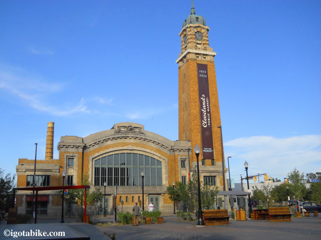
The West Side Market is celebrating 100 years this year.  They are open on Mondays & Wednesdays: 7AM - 4PM and Fridays & Saturdays: 7AM - 6PM.

The West Side Market is celebrating 100 years this year. They are open on Mondays & Wednesdays: 7AM - 4PM and Fridays & Saturdays: 7AM - 6PM.
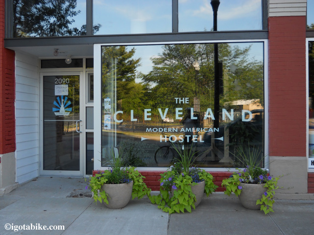
The Cleveland Hostel.

The Cleveland Hostel, located just one block south of the West Side Market is now open.
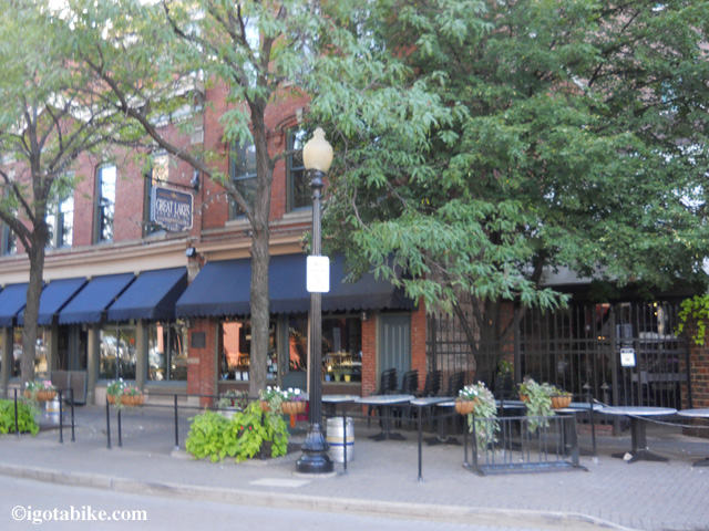
The Great Lakes Brewing Company located across the street from The West Side Market.
The Great Lakes Brewing Company located across the street from The West Side Market.

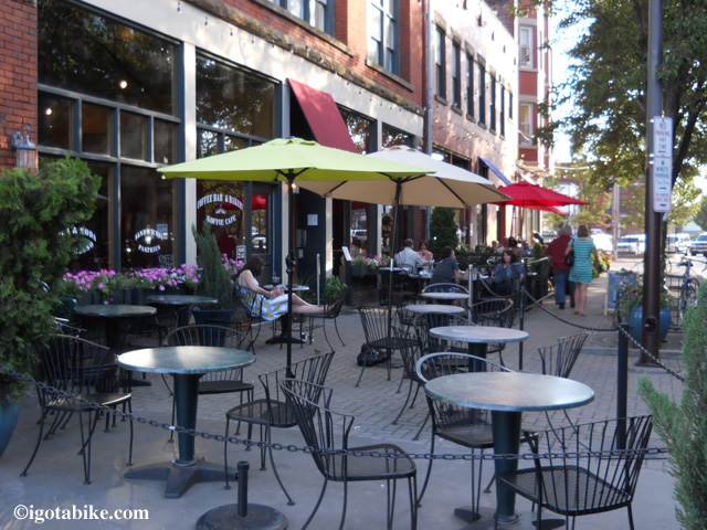
Many many places to eat and drink along West 25th Street
Many many places to eat and drink along West 25th Street

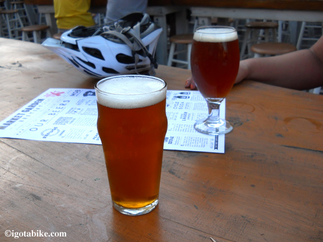
The Market Garden Brewery just opened and they make really good beer. Pictured here is the Viking and Trouble IPAs.

The Market Garden Brewery just opened and they make really good beer. Pictured here is the Viking and Trouble IPAs.

Back to Lorain and Gehring: If your turned right off of Gehring onto Lorain, you will be heading into downtown Cleveland. It’s just over the beautiful Lorain-Carnegie Bridge. Notice the art deco giants, the “Guardians of Traffic,” on either end of the bridge. By the end of the summer of 2012, there should be a nice 14’ wide bike lane across the north side of the bridge. Why they didn’t put a lane for both direction, I’ll never know, but I digress.
When you cross the bridge, you will be in downtown Cleveland, across from the Indian’s ballpark, roughly in the same place you would have arrived at had the old West 3rd Street bridge been open. At this point, Lorain Road turns into Carnegie Avenue. Stay on Carnegie and pass the ballpark. Just across East 9th on your right is the Hilton Garden Inn, the closest hotel to the Ohio to Erie Trail. Turn left on East 9th to get to Lake Erie, the Rock and Roll Hall of Fame and Museum, Great Lakes Science Center and to explore downtown.
Also, just about 5 miles east of downtown is the world class <a href=”http://www.clevelandart.org/” target=”_blank”>Cleveland Museum of Art</a> in University Circle. CMA is always free (except for some special exhibitions) and is closed on Mondays. Also in University Circle is the Botanical Gardens, the Museum of Natural History, The Crawford Aviation and Automobile Museum, and soon, the new Museum of Contemporary Art (MOCA).
It’s easy to get to University Circle from downtown Cleveland. Use Euclid Avenue, as it has been designated as a bike route with bike lanes running it’s length. Take Euclid (Route 20) out to East Boulevard. Turn left (north) on East Boulevard and all of the museums are right in front of you.
Welcome to Cleveland.

Where to stay:
The Cleveland Hostel on West 25th.
There are a lot of Hotels in downtown Cleveland with the Hilton Garden Inn being the closest to the trail.
Hilton Garden Inn
Marriott
Renaissance Cleveland
The Ritz-Carlton
Hampton Inn
Holiday Inn Express
Radisson
Double Tree
Residence Inn
Wyndham
Embassy Suites

Where to eat:
Cleveland has an enormous amount of cool places to eat. In addition to the West Side Market, Great Lakes Brewing Company and Market Garden Brewery, on West 25th Street, there are a lot of restaurants downtown, especially along West 6th Street and in Tremont.
Tremont Taphouse, Tremont
Prosperity Club, Tremont

Where to drink beer:
Oh my, Cleveland has some breweries!
Great Lakes Brewing
Market Garden Brewery
Buckeye Beer Engine
The Indigo Imp Brewery
The Brew Kettle
Fat Heads

Bicycle shops:
Joy Machines by the West Side Market
Fridrichs on Lorain Road
The Ohio City Bicycle Coop
Century Cycles

Music:
The Parkview. Awesome Blues, especially the Wednesday night jam. Great food, too. One of my favorite places in the city. Period. Westside
The Happy Dog. Very near the Parkview. Westside
Brothers Lounge. Blues. Westside
The Mardi Gras. Blues, Jazz. Downtown. Good food.
Peabodys. Downtown.
Wilberts. Downtown.
House of Blues Downtown.
Horseshoe Casino Downtown.
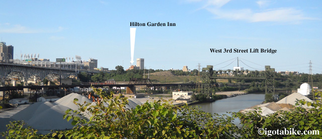
View of downtown from Tremont. You can see the West 3rd Street Lift Bridge that is closed and interupting the Ohio to Erie Trail. You can also see the Hilton Garden Inn, the closest hotel to the trail.
View of downtown from Tremont. You can see the West 3rd Street Lift Bridge that is closed and interupting the Ohio to Erie Trail. You can also see the Hilton Garden Inn, the closest hotel to the trail.


Posted in Trail Maps | Tagged , | 8 Comments

Is the Ohio to Erie Trail Paved?

Seems like many people are asking this question so I will provide some details.
The short answer is the Ohio to Erie Trail is paved in the southern end and crushed limestone in the north.
Here is more information…
The Ohio to Erie Trail spans the state of Ohio from Cincinnati to Cleveland following abandoned railroad tracks and canals that have been converted to paths for bicycles. The Ohio to Erie Trail utilizes existing trails and the organization is working to close the gaps to achieve the dream of a cross state off road route for non-motorized transportation. My estimate is the route is 60% asphalt paved trail, 25% crushed limestone trail, and 15% road route.
Traveling south from Cleveland the Ohio to Erie Trail currently begins on the Ohio and Erie Canal Towpath Trail at The Cleveland Metroparks Ohio and Erie Canal Reservation. This section (approx 8 miles) is paved and fabulous and fun with lots of twists and turns. The trail switches to crushed limestone at Rockside Road as the trail enters the Cuyahoga Valley National Park. The crushed limestone trail surface is not as bad as it sounds. The trail is smooth and worn in as it is nearly 200 years old. You can still travel at a decent speed and the scenery is spectacular. The downside is that it is dusty and it will get everywhere. You will need to clean your chain and wash your face!
As the Cuyahoga Valley National Park ends the towpath continues into Summit county and Akron. There are some sections that are paved and some that are limestone. It switches back and forth with pavement near bridge crossings and trail heads and crushed limestone in more rural sections. There is a wooden boardwalk on the southern end of Akron and some newly paved sections that eliminate the old on-road route through Akron. The Ohio and Erie Canal Towpath Trail is now contiguous from Cleveland to Massillon (the Towpath continues south to Zoar in Tuscarawas County but Guy and I cannot verify the current condition. We will ride it soon!). At Massillon you pick up the Sippo Valley Trail which is partially paved with asphalt and partially crushed limestone. There is about 1.5 miles of trail that is large gravel and is very uncomfortable, but it is short.
At the west end of the Sippo Valley Trail you arrive in the tiny town of Dalton where you pick up a road route to get to Fredericksburg. It is rolling hills with a few steep ones and is very scenic. In Fredericksburg you pick up the Holmes County Trail which is paved, one side for bicycles and pedestrians and one side for horse and buggy. The Holmes County Trail ends at Killbuck where you pick up a road route to get to Brinkhaven. Again, rolling hills with a few steep ones and a section of road that is on US Route 62 which is 55 MPH and has big trucks. Its challenging but doable.
In Brinkhaven you come to The Bridge of Dreams that crosses the Mohican River and connects to the Mohican Valley Trail which is unpaved, bumpy and full of ruts below a surface of fine baby powder like dust. It is approx 5 miles long. I do not recommend it. Its a tough choice because the alternative is Route 62. We used the Mohican Valley Trail going south and Route 62 going north.
On the other side of Mohican Valley Trail is Danville where you pick up the Kokosing Gap Trail which is paved and perfect. The rest of the way to Cincinnati is all paved. Some sections are on the road but the crushed limestone is behind you. Some sections of the Little Miami Scenic Trail near Cincinnati are paved but getting pretty bumpy as the trail cracks with age. The sections going through London and Madison County are perfectly paved and there are sections where the asphalt has a seal coat which is unbelievably smooth.
Please do not let the crushed limestone surfaces discourage you from trying this trail. The biggest obstacle is the friction and dust. Just slow down, loosen your grip, and enjoy the scenery.
If you want to eliminate some of the crushed limestone riding consider using the Bike and Hike Trail which is paved and runs on the ridge top above the Ohio and Erie Canal Towpath roughly between Valleyview and Stow. (The Bike and Hike Trail continues south but Stow is good place to get down into the Cuyahoga River Valley to pick up the Towpath.)
Here are a few links to photos of the trail and other descriptions of conditions and the daily postings from when we rode Ohio to Erie Trail north to south and back in May and June 2012.

Ohio to Erie Trail Description Posted on May 29, 2012 by Carolyn

Southbound day 1, use the arrows to continue reading daily entries
Stow Ohio Posted on May 19, 2012 by Guy

Northbound day 11, use the arrows to continue reading daily entries
Frontier Campground, Silver Springs Posted on May 30, 2012 by Guy

Ohio to Erie Trail: Holmes County Trail to Mohican Valley Trail: Killbuck to Brinkhaven Map

Information on the Bike and Hike Trail:
day ride

overnight ride

Posted in Trail Maps | Tagged | Comments Off on Is the Ohio to Erie Trail Paved?

Bike and Hike Trail Bridge at Brandywine Falls is Open!

The Bike and Hike Trail Bridge at Brandywine Falls is finally open! Yea! There are still a few things left to do on it and they will close it again for a day or two to get those things done.

Posted in Blog | Tagged | Comments Off on Bike and Hike Trail Bridge at Brandywine Falls is Open!

1000+ miles. Time for some bicycle maintenance

My 2010 Jamis Aurora was brand new when I bought it in April 2012. Guy’s Trek 520 is a 2008 and he bought it second hand in April 2012 and replaced the cassette (rear gears), the chain and a few cables making it like new at that time.

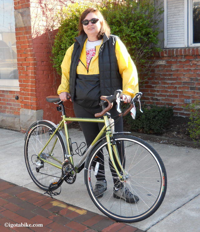
Here's Carol outside the bike shop after purchasing a new 2010 Jamis Aurora touring bike in April 2012.     Wow! What a pretty bike!

Here's Carol outside the bike shop after purchasing a new 2010 Jamis Aurora touring bike in April 2012. Wow! What a pretty bike!

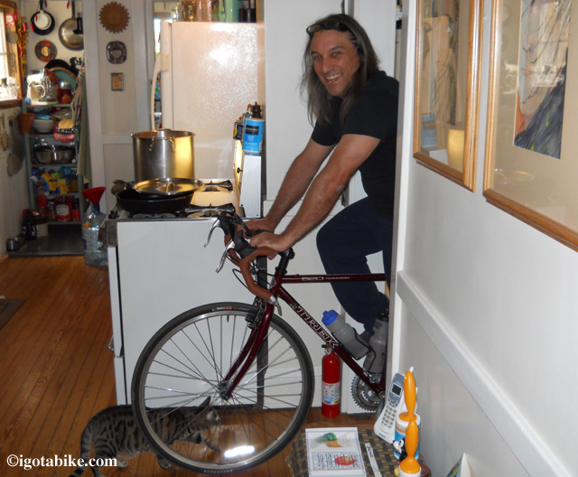
Here's Guy just after getting his just purchased second hand Trek 520 back from the bike shop with a tune-up, new chain and cassette, bar tape, Brooks saddle, a few cables and other parts making the bike like new. Its still winter in April when you live in Cleveland so Guy is checking the fit in our kitchen.

Here's Guy just after getting his just purchased second hand Trek 520 back from the bike shop with a tune-up, new chain and cassette, bar tape, Brooks saddle, a few cables and other parts making the bike like new. Its still winter in April when you live in Cleveland so Guy is checking the fit in our kitchen. That's our cat Gilly. We should have named her Mastercard. She is everywhere you want to be!

Last week (August 2012) my Jamis started to click. Urgh. It was a steady click, while peddling, and sounded like a broken ceiling fan. The clicking was on and off but always present on an uphill climb so I was suspecting a problem with the crank bearings. We were scheming a three day tour so we headed to the local bike shop to get it checked out.
This time we chose Fairview Cycle. They are Jamis dealers and Paul helped us out when we were riding the Ohio to Erie Trail in May-June 2012 and were stranded in London with a broken wheel on the Jamis. The mechanic rode my bike and of course it was silent. He disassembled the crank and lubed the bearings. He said it could be dirt and the lube job would help to let the grit work itself out. It continued to click on and off for the next 50 miles, then it stopped. I rode another 50 miles in silence. Nice. Our bikes were so quiet rolling along the Western Reserve Greenway that we were flushing out owls, hawks, herons, ducks, deer, ground hogs, and raccoons.
We got our chains checked at Fairview Cycle and both were ready to be replaced.
My Jamis is just over 1000 miles and Guy’s is closer to 1500 because he has been commuting to downtown Cleveland this summer. We have learned that it is advisable to replace the chain as soon as it starts to stretch to make the cassette last longer. We paid $20 each for the chains and $25 labor for the installation and lube job on the Jamis. A new chain makes your bike feel smooth and responsive and shifts with no effort. Ripping through a few chains a year is a good thing! It means you are riding a lot and you are happy, healthy and having a good time. Your mileage may very.


Posted in Blog | Tagged , , | Comments Off on 1000+ miles. Time for some bicycle maintenance

Ashtabula Trumball Bicycle Overnight Trip Follow Up

So the weather forecast was for a 95% chance of rain. Camping and riding in the rain is not always the most pleasant experience (we’ve done more than our share in the past), so we decided just to come home and call our trip a nice overnighter.

riding in the rain

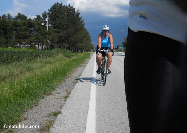
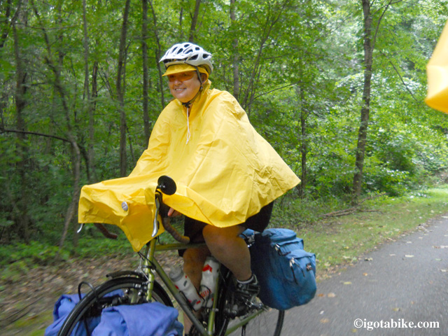
Carolyn Kay, the I Got A Bike Girl, actually enjoying a ride in the rain along the Western Reserve Greenway.

Turns out it was a good thing we did because an entire row of our tomato plants at home had completely toppled over, taking the staking armature with it. In the Fall, we put them up in canning jars. We have about 70 plants and should get between 300 and 400 pounds.
Excuse the digression.
Anyway, it did indeed storm pretty hard, and it looks as though it will be raining most of today, so I’m glad we came back. Besides, our stove died, so that meant cold dinners and no coffee at breakfast. In the rain.
The Ashatbula Western Reserve Greenway Trail (WRG) is awesome! Flat, smooth, straight and in great shape.

western reserve greenway

The Western Reserve Greenway is flat and smooth. It looked like this for forty miles!

We rode from Austinburg, just south of Ashtabula, south to Mosquito lake state park, a distance of roughly 40 miles. The town of Orwell is at the halfway point and is a great stop for lunch. We posted this as an overnighter in our Trail Maps section, HERE, with a better description of the trail and where to stay. It’s a really fun and scenic ride and is good for the intermediate rider, with just a short four mile section on a two lane state route where traffic can be challenging.

wrg scenery

Some of the wonderful scenery along the Western Reserve Greenway

Posted in Blog | Tagged , , | Comments Off on Ashtabula Trumball Bicycle Overnight Trip Follow Up

Western Reserve Greenway Overnight Bicycle Trip in Ashtabula and Trumbull Counties with Map

Level: Intermediate

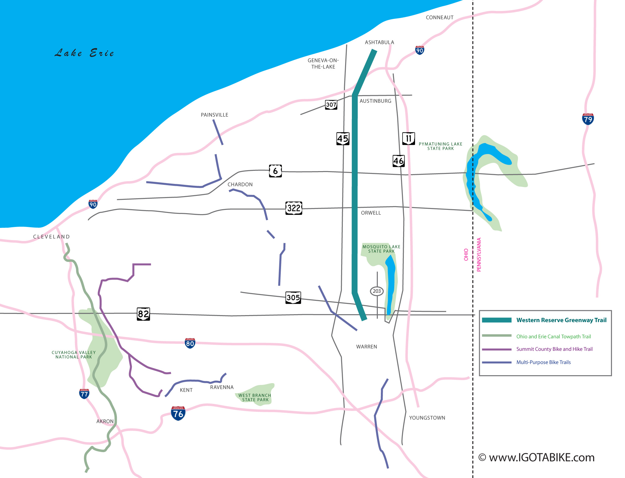
Map for Western Reserve Greenway Overnight Bicycle Trip in Ashtabula and Trumbull Counties

Map for Western Reserve Greenway Overnight Bicycle Trip in Ashtabula and Trumbull Counties

This out and back trip along the Western Reserve Greenway bicycle trail is approximately 40 miles in one direction, between the town of Austinburg, to the north in Ashtabula county, to Mosquito Lake State Park in the south in Trumball county. The trail is flat and smooth and there is only a short four mile section of road riding to the campground along SR.305 and County Highway 203. The trail is mostly shaded, but there were some parts out in the open, mostly through corn fields.

The Western Reserve Greenway is paved for 40 miles thru Ashtabula County and Trumball County in northeast Ohio near the Pennsylvania line.

The Western Reserve Greenway is paved for 40 miles thru Ashtabula County and Trumball County in northeast Ohio near the Pennsylvania line.

Starting from the north in Austinburg:
Trail head parking can be found on the north side of RT. 305, just a few hundred feet east of RT. 45. The gravel lot is very unassuming, situated right beside a small convenience store and behind Jewel’s Dance Hall. If you are parking overnight, it is best to park in the back of the lot, closest to the port-o-potty.

Western Reserve Greenway trail head parking at RT. 305 and RT. 45 in Austinburg. The red building is Jewel’s Dance Hall.

Western Reserve Greenway trail head parking at RT. 305 and RT. 45 in Austinburg. The red building is Jewel’s Dance Hall.

Head south on the trail. It is flat, smooth and straight. It is also very secluded. There are no obvious places that we saw where you can get water along the entire trail, so bring plenty.

The Western Reserve Greenway is flat, smooth and straight. We had a blast drafting on this trail. It is very rural and secluded.

The Western Reserve Greenway is flat, smooth and straight. We had a blast drafting on this trail. It is very rural and secluded.

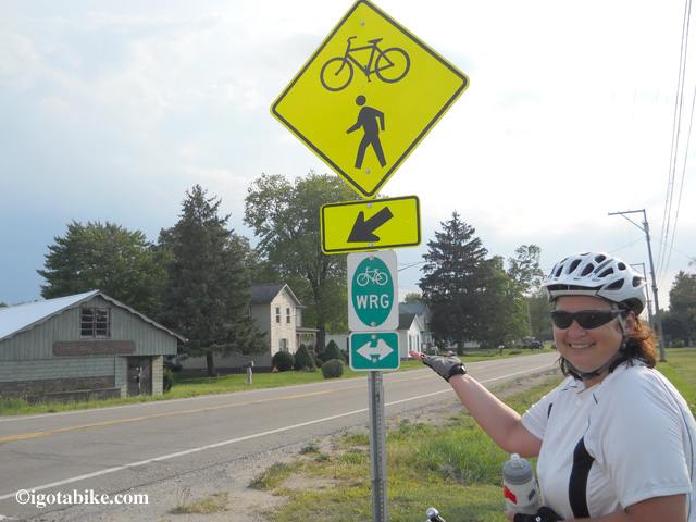
At the Village of Rock Creek, the trail takes a slight, one block (3/8 mile) detour to the west. The giant Rock Creek water tower makes an excellent landmark.
From the north: the trail ends and there was a Bike Route sign pointing to the right (west), down a road. Straight ahead is the water tower. Turn right. On the left is a small Custom motorcycle shop. Continue down the road and make a left at the first road. It was marked. It’s more of a gravel area between two roads than an actually road. The gravel road is just a connector between the two streets and dead ends at either. You can see from one street to the other. Turn left onto the next paved street and pedal down to the water tower. Turn right back onto the trail.
From the south: there is no signage indicating where to turn to continue on the trail. The trail ends at a plant with the water tower right in front of you. Turn left on the street and ride down the hill. At the bottom of the hill is the gravel patch to your right. Turn right and go up the gravel road. Turn right onto the next street. Just past the motorcycle shop on your right, you will turn left back onto the trail. Again, use the water tower to keep your bearings.

South of the town of Rock Creek is Rock Creek itself. You will cross over it on a high railroad trestle. It’s pretty scenic and there is a viewing deck off to the side. The path across the bridge is covered in some sort of leather or vinyl or something. It’s a nice place for a quick rest stop.

South of Rock Creek is a high railroad trestle with a viewing deck with a picnic table and benches and a fatastic view. The bridge is covered in some sort of leather or vinyl material.

South of Rock Creek is a high railroad trestle with a viewing deck with a picnic table and benches and a fatastic view. The bridge is covered in some sort of leather or vinyl material.

The town of Orwell is situated along RT. 322, about a mile and a half west of the trail. There are no signs at the road crossing that tells you so. Orwell is roughly the halfway point and there is a grocery store, library and several small restaurants, including the A&W that we ate at. It has free wifi and there are actually about 4 or 5 restaurants under the same roof. Just roll down 322 and you will see the signs. Remember, 322 is a State Route and the traffic is in the 50 mph range, so this is for intermediate riders with at least some experience with traffic, but it’s a piece of cake if you are used to this sort of road riding.
South of Orwell is the Trumball county line. At this point, the trail actually improves! The trail is seal coated!
Soon after entering Trumball, you will be riding through the Ohio State Mosquito Lake Wildlife Management Area where even the scenery gets better! There is a nice observation deck on the west side of the trail that makes for a very scenic rest spot. Great views!

View from the observation deck in the Wildlife Management Area.

View from the observation deck in the Wildlife Management Area.

Continue pedaling south until you get to RT. 305. There is a new trail head parking lot and picnic tables there. They were still working on it when we came by. the tables were under a shelter and we waited out some rain there. We saw no water and the toilet appears to be just a port-o-potty. We talked to a construction guy and he said there was no plan for anything better. It’s a shame, it’s such a nice trail head.

Sunside trail head of the Western Reserve Greenway at RT. 305 in Trumbell County.

Sunside trail head of the Western Reserve Greenway at RT. 305 in Trumbell County.

Sunside in the rain. There is a small shelter and picnic tables.

Sunside in the rain. There is a small shelter and picnic tables.

Turn left onto Rt. 305, heading east. Again, this is a State Route and the traffic is in the 50 mph range. Continue east down 305 for about 3 1/2 miles. You will pass a pizza shop/beer store (Carter’s) on your left. They say they will deliver to the campgrounds. Just past the beer store is County Road 203. There is a traffic light and an ice cream shop (Grumpy’s Station) on the corner. Turn left, north, on 203. The campground is about 1/2 up on the right, or east side of the road. Just across from the park’s entrance is a small, dingy convenience store. They have beer. Top shelf was Great Lakes. The campsites themselves are less than a half mile from the road (and convenience store). This is nice, since some state campgrounds have an entrance road that is miles long.

 County Road 203 just outside Mosquito Lake State Park campground.

County Road 203 just outside Mosquito Lake State Park campground.

Camping at Mosquito Lake State Park is much like camping at any other large state park in Ohio. There are plenty of open and wooded sites (234), with and without electric. Sites without were $20, sites with were $24. The front office has coffee in the morning. Remember, it’s a state campground, so alcohol is not allowed. Use a cup. There are showers and a small laundering facility and a concession stand at the marina with burgers and such. There is boating and a beach, too.
This is a great overnight trip and can easily be shorter or a little longer, depending on which trail head you park at, as there are quite a few along the entire route, at nearly every cross road. Some are nicer than others, with some being nothing more than a very un-official looking gravel patch for maybe two cars.

More information and ideas on the Western Reserve Greenway

There is great potential for combining the Western Reserve Greenway with bicycle road routes and other bicycle trails to create loops for bicycle touring and camping. The Western Reserve Greenway is a rail trail on the the former PennCentral line. The dream is to connect Lake Erie and the Ohio River. The 43 mile paved trail begins in Ashtabula and ends at Champion just north of Warren.
Our original plan was to do a 3 night tour but we adjusted to an overnight due to weather and a broken camp stove.
We chose the Austinburg trail head because it is close to I-90. The rough plan was night one at Mosquito Lake State Park; Night two at Pymatuning Lake State Park; night three at Virginia’s Beach in Conneut then back to Austinburg. We also considered making a loop by using the Western Reserve Greenway to connect with the southern end of the Summit County Bike and Hike Trail in Kent or to get to Akron to access the Ohio and Erie Canal Towpath and the Cuyahoga Valley Scenic Railroad. There are also biycle trails that could be combined with the Western Reserve Greenway that connect to Chardon and Painesville.
The landscape around the Western Reserve Greenway in Ashtabula and Trumbull counties was very flat and very rural. The roads varied from 2 lane 55 mph state route to gravel. Hopefully we get back out to this area soon to do some more tour fact finding. Stay tuned.
Posted in Trail Maps | Tagged , , | 5 Comments

Back in Cleveland

We are back in Cleveland and all is well except the weather forecast. It is good for the farmers but not so good for bicycle camping! We made home dry, all the gear is inside and Guy is picking up some carry out. We are glad we came home. The Wester Reserve Greenway is fantastic! Details to follow…
Edit from Guy: glad to be back. The tomatoes needed our attention. The trail was fantastic. Will go back again!

Posted in Blog | Tagged , , | Comments Off on Back in Cleveland