Delays and closures possible on the Little Miami Scenic Trail

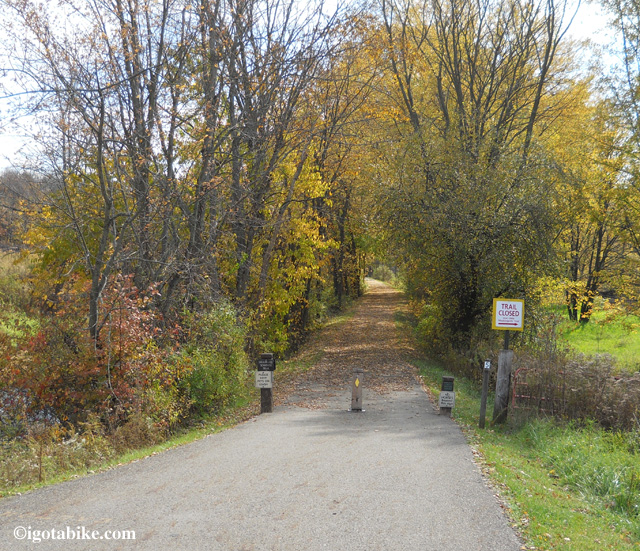
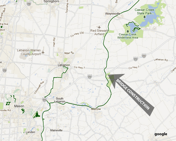
Replacing the The Jeremiah Morrow Bridges is projected to be a 6 year project and it began in 2010. Trail users should be prepared for delays and closures.

Replacing the The Jeremiah Morrow Bridges is projected to be a 6 year project and it began in 2010. Trail users should be prepared for delays and closures.

Users of the the Little Miami Scenic Trail may experience some interference as construction on the Jeremiah Morrow Bridges continues. According to the Friends of the Little Miami State Park website there is an effort to avoid weekend closures but weekday closures of up to one hour should be expected.
The Little Miami Scenic Trail, State Bike Route 1 and 3, is approximately 80 miles in length and forms the southern leg of the Ohio to Erie Trail (Xenia to Cincinnati).
The Jeremiah Morrow Bridges carry Interstate 71 over the Little Miami River gorge and the Little Miami Scenic Trail near mile marker 22 (between Wilmington Road at Mather’s Mill and St Rte 350 at Ft. Ancient).
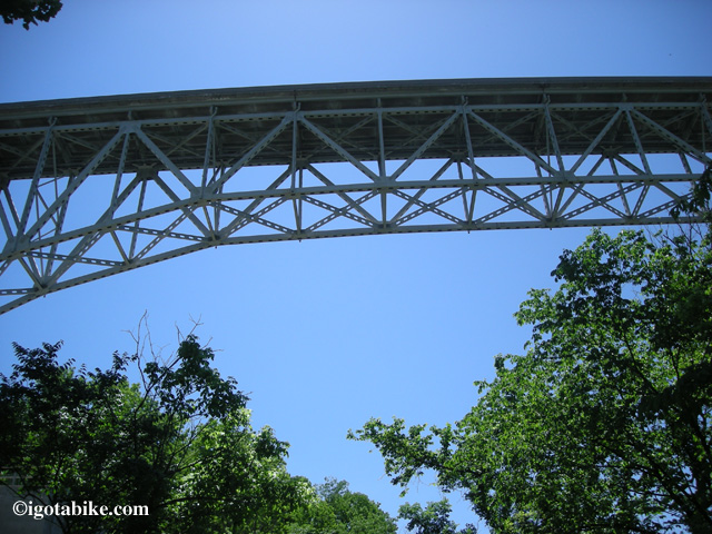
The bridges are a pair of parallel continuous truss bridges and are the same design and age as the I-35W Mississippi River bridge that collapsed in 2007. In 2010 Work began on a massive 6 year project to replace the bridges. It is reported that crews overhead are now working directly above the trail. Workers will install tarps to catch the small debris, but when the heavy equipment arrives overhead, flagmen will be positioned on the trail to shutdown access underneath the bridge. The closures are anticipated to be up to one hour in length and their frequency is unknown at this time.

Another excellent argument for wearing a helmet. Patience will be required as there are no easy workarounds.

Note: updates from local trail users (or construction workers) are encouraged and appreciated. Send e-mail to carolandguy@igotabike.com

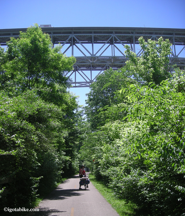
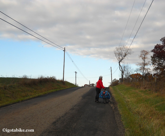
Here is Carol under the Jeremiah Morrow Bridges on day one of our 2011 bike tour.

Here is Carol under the Jeremiah Morrow Bridges on day one of our 2011 bike tour.

The Jeremiah Morrow Bridge is the highest interstate bridge in Ohio at 239 feet above the Little Miami River and is 2,230 feet long.

The Jeremiah Morrow Bridge is the highest interstate bridge in Ohio at 239 feet above the Little Miami River and is 2,230 feet long.

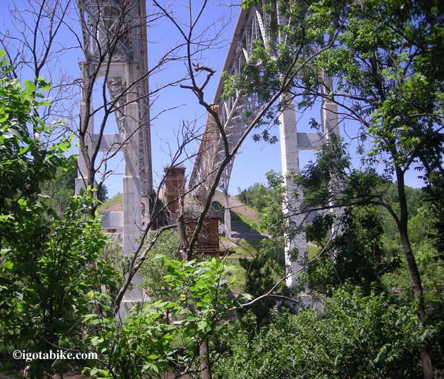
In this photo from May 2011 you can see the beginnings of one of the new bridges that is being constructed between the two old bridges. Once the new bridges are completed the old bridges will be removed. Thus trail users should get used to sharing the trail with construction workers.

In this photo from May 2011 you can see the beginnings of one of the new bridges that is being constructed between the two old bridges. Once the new bridges are completed the old bridges will be removed. Thus trail users should get used to sharing the trail with construction workers.

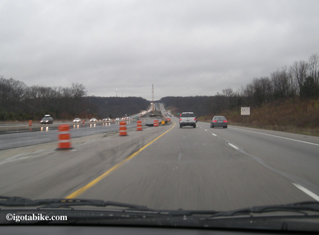
Rare for igotabike.com--here is a view from a car. This is the northbound approach to Jeremiah Morrow Bridges with construction platforms in place in November 2011.

Rare for igotabike.com--here is a view from a car. This is the northbound approach to Jeremiah Morrow Bridges with construction platforms in place in November 2011.

Posted in Blog | Comments Off on Delays and closures possible on the Little Miami Scenic Trail

Cool Tech: Airless Tires

Check out this LINK to read about some new technology airless bicycle tires. When I first stumbled across them, I was thinking solid rubber tires, like what you had on your very first bike, but these are flexible. They are also adjustable.

I wonder how heavy they are? I wonder if they could make road tires? If so, would they have as much grip?

Imagine never having to check the air in your tires again! That would be sweet! We can be pretty persnickety about our air pressures, depending on what kind of riding we will be doing. Inevitably over a weeks time, our tires lose air, and I have to continually check them. It’s such a PITA. Especially because the pump is always so difficult to get on and off the stem. (On our last ride, I ripped the stem out trying to take the pump off, giving myself a flat in my own living room. Dork.)

I wonder how the adjustment is made? Do they ride/feel like real tires?

Man, I would love to test a set of these!

Posted in Blog | Tagged | 1 Comment

How to Proofide Your Leather Brooks Saddle

How I Proofided My Leather Brooks Professional Saddle

Saddle Price: $120.oo approx., LBS

Proofide, 25 gram (0.9 oz.) Price: $12.6o incld. shipping, Ebay

OK, so when I bought my Trek 520 used, I saved enough money to get a few extra little goodies. One of those little extras that I bought was a sweet Honey colored Brooks Team Professional Classic Saddle (Model B2000409). Being that it was just about two weeks before we left on our 2012 Ohio to Erie Tour, I opted to leave the Brooks behind, because it wasn’t even close to being broken in. When we got back from the tour, I immediately re-installed the Brooks and have been riding it ever since. For those of you keeping score, that’s been about 500 miles since our return in June.

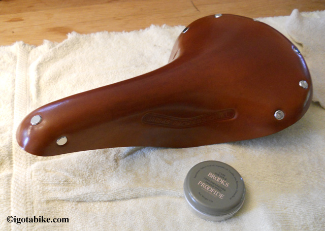
brooks saddle & proofide

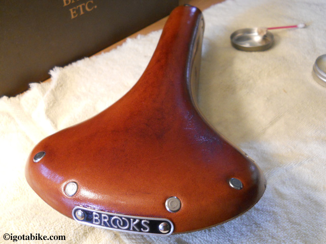
My nearly-new Brooks Professional saddle and small tin of Proofide. This pic is before Proofiding and there is about 3-400 miles on the untreated saddle.

At first the saddle was extremely slippery. It was also rather uncomfortable. I rode with an allen wrench and would stop frequently to move the saddle’s position, searching for the sweet spot. Over time, the saddle became less and less slippery and I eventually found a comfortable position for the saddle. One day I realized that it was no longer uncomfortable. It seemed to be starting to break in.
At this point, I still hadn’t applied anything to the leather, I was just riding on it. Finally, I bought some Brooks Proofide. Today I applied it.
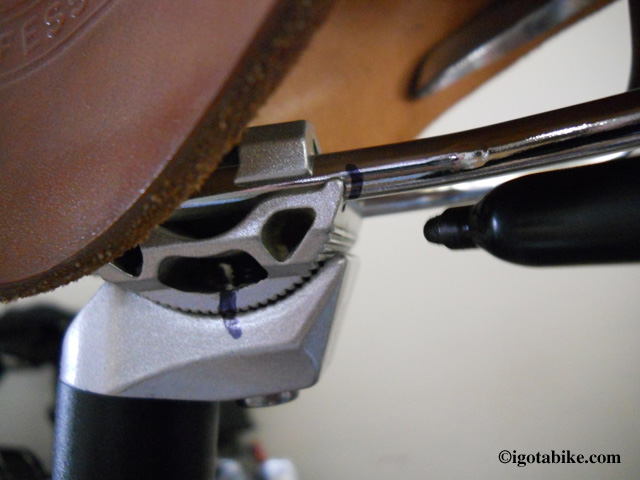
Before Proofiding my Brooks, I removed it from my bike to be able to get to all of the nooks and crannies. I carefully marked the saddle’s position with a Sharpie, first, so I could get it back into the position that took me so long to find.

Brooks saddle position

Before I removed my Brooks for Proofiding, I carefully marked the position of the saddle for tilt and fore/aft positions.

For what it’s worth, Brooks says that their Proofide is the only substance that should be used to treat your Brooks saddle.

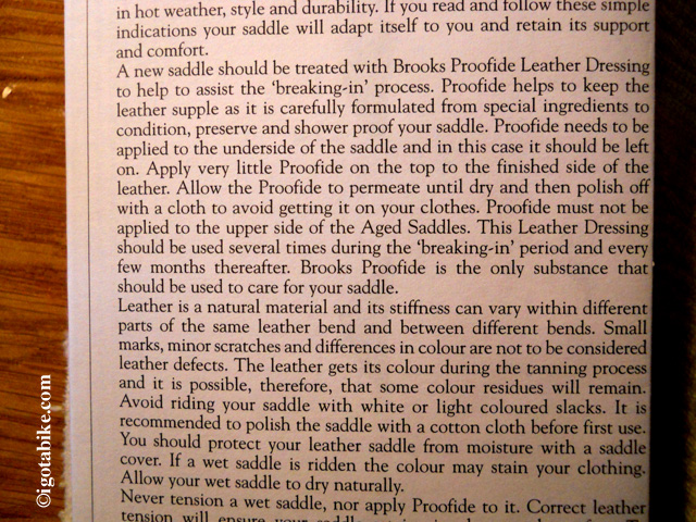
Brooks manual

The Brooks manual that came with my saddle describes the Proofide process. This is the procedure that I followed.

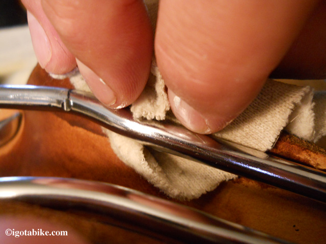
The documentation that came with the saddle said to apply the Proofide to the UNDERside of the saddle and to leave it on. I applied the Proofide with my fingers, a small cloth and a Q-Tip to get behind the frame parts and up into the nose of the saddle. It really soaked right in and darkened the leather. I paid special attention to get the edges of the saddle and the inside of the rivets. As much as the Proofide soaks in, a little bit goes a long way and I barely made a dent in the tiny 25 gram (0.9 oz.) tin.

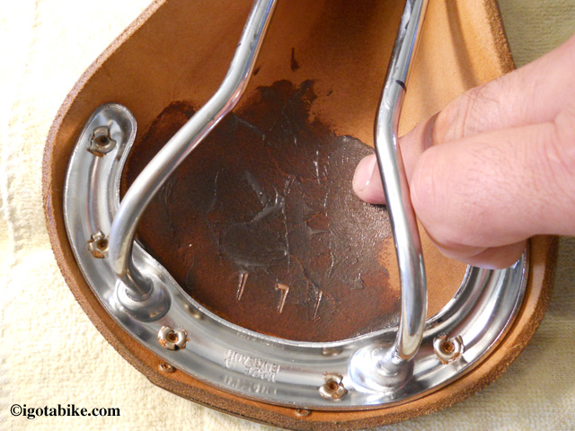
Proofide Brooks Saddle

I started with the underside of my Brooks saddle, using my fingers to Proofide the large open areas. The Proofide really soaks in on the un-tanned underside and really darkened the leather. The color change of the top side was not so dramatic.

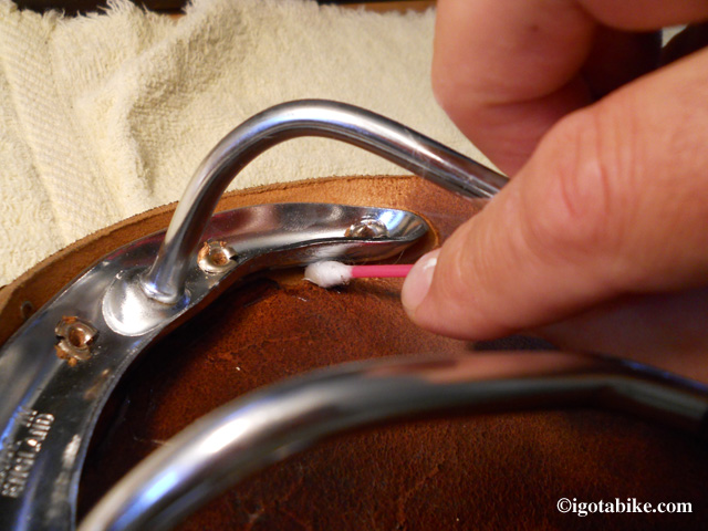
Brooks Proofide

I used a rag and a Q-Tip to get the Proofide into all the nooks and crannies around and under all of the frame components. I paid special attention to the areas around and in the middle of the rivets.

Brooks Proofide

Using a small soft cloth, I was able to Proofide up and under the saddle rails as well as all the way up into the nose of the saddle, under the tensioning mechanism. Don't forget to get the edges!

The manual also said to apply a little Proofide to the top of the saddle as well. It did not soak in as much, like it did on the bottom. I left it on for a few minutes until it started to dry, then I polished it with a soft cloth, per the instructions. It did darken the leather a bit, but it looks really good!
NOTE: The instructions make a point of saying NOT to Proofide the top of an AGED Brooks Saddle!

Brooks Proofide

My Brooks saddle top, soaking in the Proofide.

Brooks Proofide

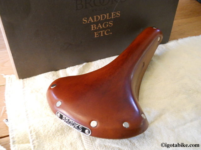
My Brooks Professional saddle, Proofided top and bottom and polished. It did darken somewhat, but the difference was not that drastic and it actually looks nicer, in my opinion.

I can’t wait to take it for a ride and see if the break-in process begins to change or accelerate. Stay tuned. I will update as the miles accumulate.

Update: June 2013.
I now have approximately 1600 to 2000 miles on my Brooks Professional. It is JUST NOW starting to break-in! Wow, at this rate, this saddle will last me for the rest of my life! It has started to conform a bit to the contours of my posterior and it is ever so slightly a bit softer. Not a lot, but noticeable. It has also started to darken. Looks nice.
So far, this is the first and only Proofide treatment for this saddle.
On this past tour, I did ride it in some rain. It’s inevitable. I tried to keep a plastic bag on it when I wasn’t sitting on it, but it did get wet (not SOAKED) and is no worse for the wear. I just let it dry out naturally. I mean, you buy leather work boots because they are tough and can withstand the elements, right?
By the way, I keep a plastic grocery bag shoved up under the saddle between the frame rails. That way, I always have rain protection for it with me, just in case. I also cover it when I lock up my bike in public, just to keep it out of sight, out of mind, you know? I usually also run a cable type lock through the saddle rails and around the frame, just to be sure.

Posted in Our Gear | Tagged , , , | Comments Off on How to Proofide Your Leather Brooks Saddle

Please Don’t Do Me Any Favors!

This one goes out to all of the Motorists out there: Please don’t do me any favors!

One of the most dangerous situations I routinely encounter is when I am road riding and I want to make a left hand turn. This situation is the worst on a road with multiple lanes in both directions or enough road width that vehicles can pass around another vehicle that is making a left hand turn. As I approach the intersection where I want to turn left, I signal my intent and wait for the oncoming traffic to clear. Suddenly, and inexplicably, a motorist in the oncoming traffic stops short, blocking traffic behind them, and signals to me to make my turn, trying to be nice. This vehicle actually has the right of way and would not have made this maneuver for another motor vehicle.

Note:(Sometimes I delay signaling my left turn until the oncoming traffic is clear trying to avoid “the favor.”)

Here is where the danger starts to multiply exponentially. If I make the turn, will there be another car coming around the car that stopped that I didn’t see that will pick me off? Most of the time, I can’t tell and I emphatically urge the  driver to move on. Usually, they reiterate their offer to let me turn. By now I have traffic bearing down on me from behind and passing me on my right, with motorists becoming angry that my bicycle is “holding up traffic,” and I now feel like I am treading water in a sea of angry two-ton steel sharks.

Now I need to decide what is the safest thing for me to do, take a chance and make the turn, or wait in the middle of traffic until I can actually verify that my path is clear. At this point, if I can’t verify that I can safely make the turn and get out of traffic, I will un-clip and put both feet flat on the ground and take my hands off the bars and hold them up, clearly signaling to the driver that I am going no where! This usually results in them cursing at me (what happened to being nice?) and suddenly speeding away which often times is also dangerous, as the traffic that was stacking up behind them are caught halfway in a maneuver trying to get around them and there is now a whole snarl of cars all accelerating quickly and not all pointed exactly straight ahead!

Whew! My hands are actually sweating as I type this!

The moral of the story? If you are driving a motor vehicle, please don’t do me any favors. Follow the rules of the road, they are there for a reason. If we all follow the same rules, everyone will know what to expect out of everyone else, traffic will flow, and I will have a chance to get home in one piece.


Posted in Etiquette/Safety | Tagged | Comments Off on Please Don’t Do Me Any Favors!

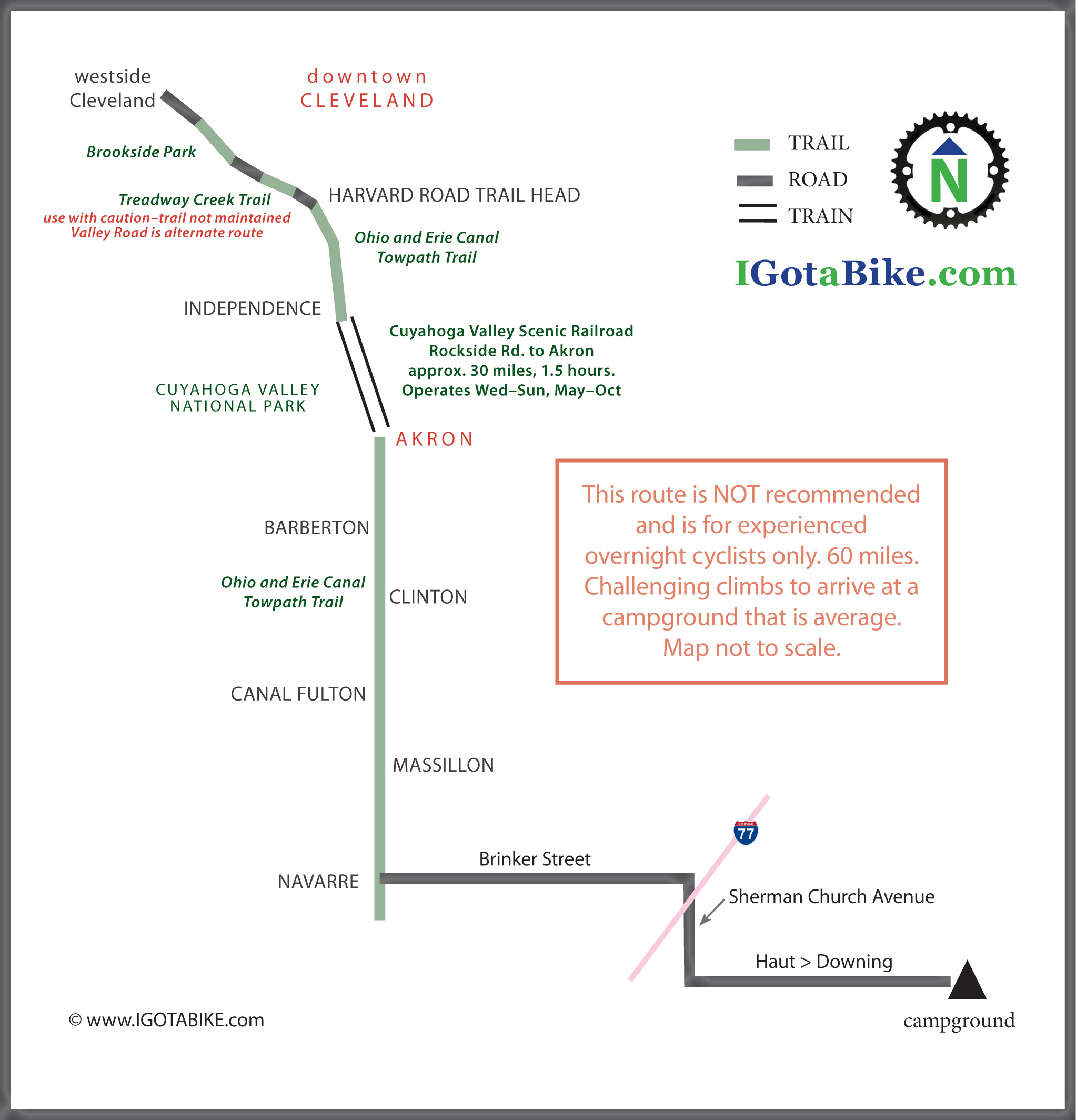
Fall overnight camping tour 120 miles: Cleveland to Navarre using the Cuyahoga Valley Scenic Railroad with Map S24O ish, part 2

Click here for part 1. We find the spot where the Ohio and Erie Canal Towpath Trail meets Canal Street / Hudson Drive, there are Parks on both sides of the street and trailhead parking. It is about 4 o’clock. It is getting dark already. We are not that surprised that our route, Brinker Street, is uphill as we were in the Tuscarawas River Valley. Where there is river, there is ridge. We we were surprised that it was so long. It was a seven mile jaunt, all basically uphill. There were a few rollers but not very helpful. We arrived at the campground at 6:15. 59 miles total for the day.
Of course the girl at the desk told us our cabin was “just up the hill!”
The campground is set up for RV’s and is not our style. Obviously they have the title of resort due to their horses. It was fun that that the horses were right outside our window.

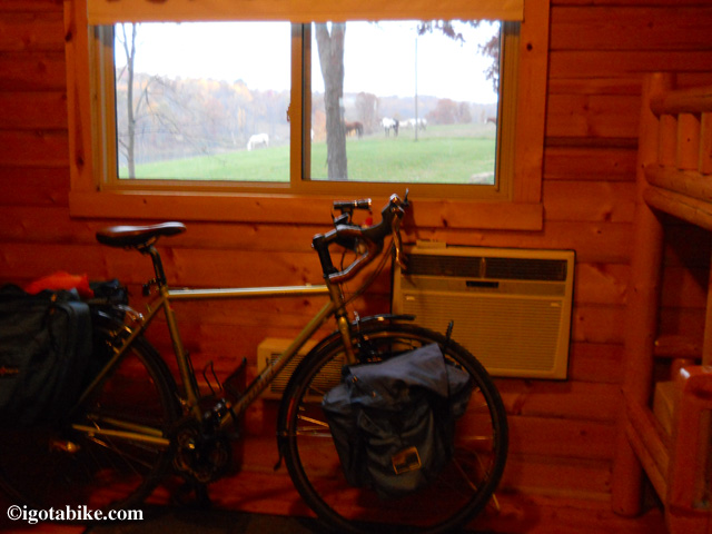
View from our cabin with the horses just outside.

View from our cabin with the horses just outside. Note the built in heat and air conditioning.

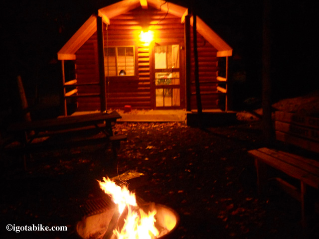
We settle in, get showered, build a fire and order some food. Perfect.
We are careful not to stay up too late so we don’t miss the train.

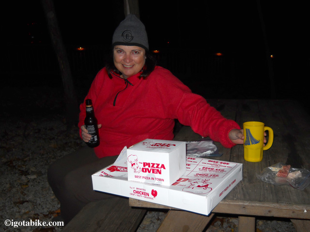
Yes I am drinking bottled beer! Octoberfest! (12 fluid ounces + the bottle x 6 x 7 miles ∞ incline = ∞ delicious.)

Yes I am drinking bottled beer! Octoberfest! (12 fluid ounces + the bottle x 6 x 7 miles ∞ incline = ∞ delicious.)

The fire felt great it was chilly. Pizza, fire, beer, cabin.

The fire felt great it was chilly. Pizza, fire, beer, cabin.

Next morning we have fried chicken for breakfast while loading up the bikes. No coffee. We are pedaling by 8:30 a.m. It is cold. I am wearing everything I brought–except my raincoat.

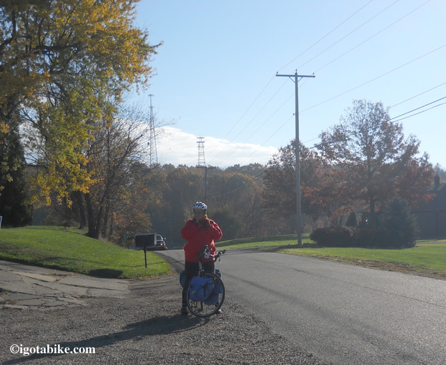
The first photo at first light on the first hill on the second day.

The first photo at first light on the first hill on the second day.

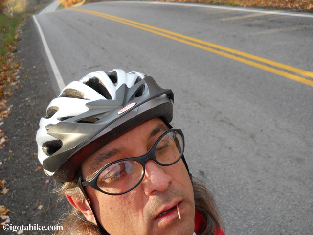
Guy is dazed by the early morning incline and takes a rare self portrait.

Guy is dazed by the early morning incline and takes a rare self portrait.

Soon the fog breaks away, the clouds start to thin and we see blue sky!

Here comes the change in the weather! Hello blue sky!

Here comes the change in the weather! Hello blue sky!

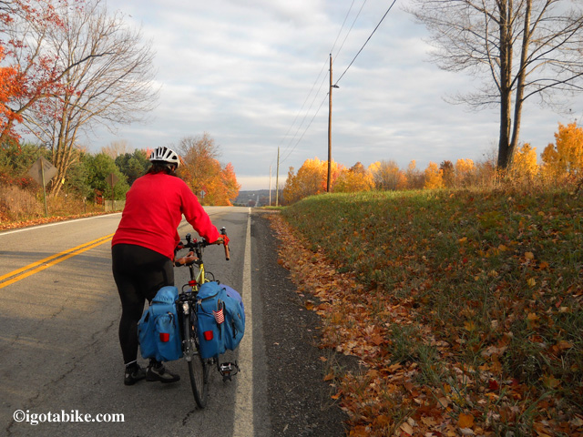
Its still hilly. Definitely in our favor in this direction but we chose to walk several of the hills so we wouldn’t get sweaty, then chilled.

The top.

The top.

I am smiling because the towers are behind us. On the next section Guy’s computer recorded the max speed at 43 mph.

I am smiling because the towers are behind us. On the next section Guy’s computer recorded the max speed at 43 mph.

You can see the bad towers in this photo.
We arrived at the trail at 9:45 a.m., about an hour faster than the reverse route the night before.

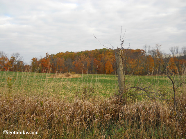
Does this look like an oil painting?

Does this look like an oil painting?

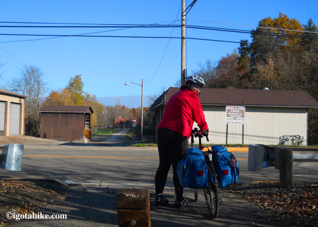
Wooster Road in Navarre is the best route into town. (view facing north looking at “Water Park.”)

Wooster Road in Navarre is the best route into town. (view facing north looking at “Water Park.”)

The bicycle bridge in Clinton. Years ago we thought this bridge was cool and unique. Now we know that there are bridges like this, just for bicyclist all across the state of Ohio.

The bicycle bridge in Clinton. Years ago we thought this bridge was cool and unique. Now we know that there are bridges like this, just for bicyclist all across the state of Ohio.

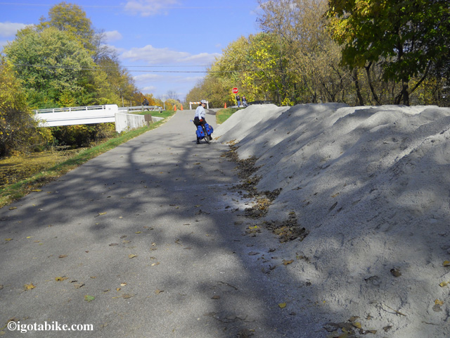
25 tons of future bike trail improvements, near Barberton.

25 tons of future bike trail improvements, near Barberton.

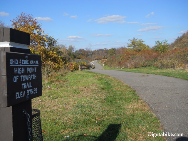
High point of the Ohio and Erie Towpath Trail is just south of Akron.

High point of the Ohio and Erie Towpath Trail is just south of Akron.

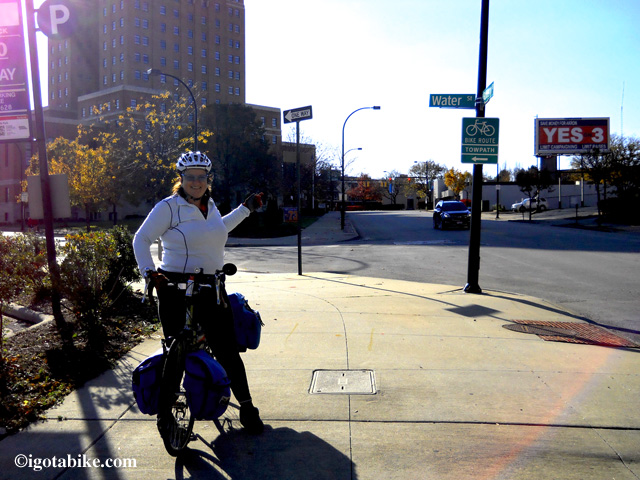
LOOK! New signs in downtown Akron!

LOOK! New signs in downtown Akron!

We arrive  in Akron for enough time so get some real food. We have been eating leftover pizza and nuts all day. We arrive at the train station 15 minutes before the train is due to arrive.

Just waiting on the train.

Just waiting on the train.

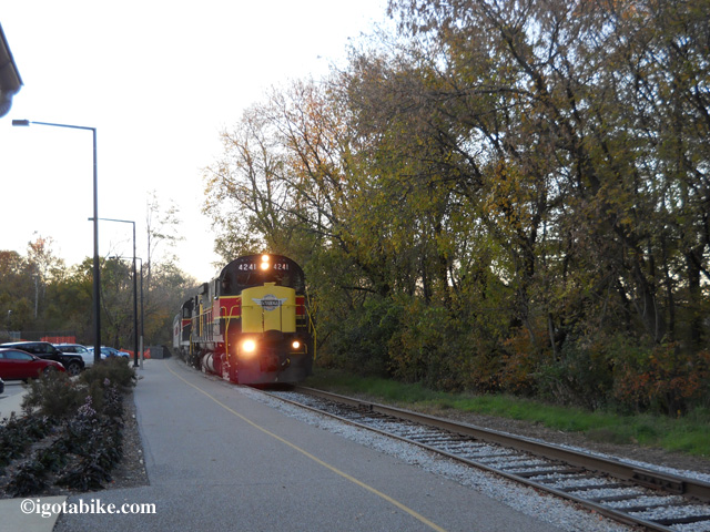
And here is this fabulous Cuyahoga Valley Scenic Railroad arriving at the Akron station, running a tad-bit late.

And here is this fabulous Cuyahoga Valley Scenic Railroad arriving at the Akron station, running a tad-bit late.

We don’t mind waiting on the train except daylight is fading, fast!

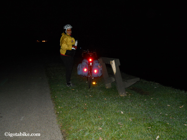
By the time we detrain it is fully dark and 14 miles to ride. My reflectors work!

By the time we detrain it is fully dark and 14 miles to ride. My reflectors work!

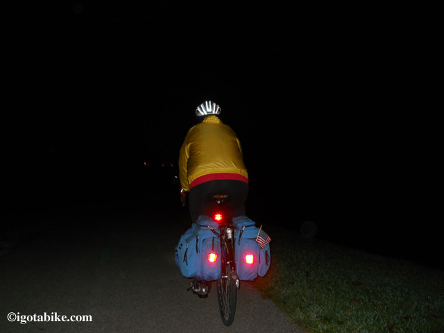
This is the first time we ever got home after dark fully loaded­... I mean the bikes are fully loaded.

This is the first time we ever got home after dark fully loaded­... I mean the bikes are fully loaded.

We arrive safely at home just before 10 p.m. Wow what a ride! We are so tired all we can figure out to eat is the rest of the left over pizza. At least we could warm it up in the oven!

We are really glad we went on this trip and are hoping for another chance for a quick tour before the snow arrives.

Posted in Blog | Tagged , | Comments Off on Fall overnight camping tour 120 miles: Cleveland to Navarre using the Cuyahoga Valley Scenic Railroad with Map S24O ish, part 2

Fall overnight camping tour 120 miles: Cleveland to Navarre using the Cuyahoga Valley Scenic Railroad with Map S24O ish, part 1

For those of you who read the previous entry about our fall tour you know that selecting the route for this trip had many parameters that influenced our decision including: the ever present constraint of available time to get away; shortened daylight hours; weather; the absence of our truck (that transports our bicycles to trail heads afar); the Cuyahoga Valley Scenic Railroad schedule and a desire to go south through Akron.
We were suddenly able to get away with enough time for three days of riding (Sat-Mon) but that is an odd number and makes getting to a destination and back tricky. That is what put us onto the idea of using the train to fill in some gaps. We looked at several options including the idea to pedal to Portage Lakes State Park. We put that on the idea list for next time. It is about 15 miles south of Akron.
We settled for two days of riding and would use the train to get us far enough away from the urban areas to have access to camping. The weather forecast for Sat was pretty foreboding: 60% chance of rain and a headwind and only 45 degrees; but Sunday was predicted to be picture perfect in the mid 50’s. The weather was expected to be perfect on Monday too BUT the train only runs Wed-Sun.
We identified a campground east of Navarre with a good reputation. I called to find out: the route from the trail was fine for bicyclist, (more on this later) they make coffee at the camp store in the morning (no need to bring a stove), the famous Canton area Pizza Oven would deliver to the campground (no need to bring any cooking gear) and they have cabins (no need to bring a tent). Perfect! Nice light load.
So I figure we can leave the house and ride to the Rockside Road train station to catch the morning train to Akron. (replacing approximately 30 miles of biking with a fantastic scenic train ride for only $2 each) From there I guess its  about 36 miles to Navarre heading south on the Ohio and Erie Canal Towpath. Then 7 miles of road riding to the campground. Great! 43 miles! We’re in love with the idea.
“Oops, sorry Guy I forgot to add the miles from the house to the train station!” OK so its 10 more miles. That makes it 53 with a nice break mixed in. “OK we can do it, let’s go!” Around this time the radio plays the weather forecast and they are talking about sustained winds and gusts, of course, from the south! “Who cares about wind, we can do, let’s go!”
“One more thing, to catch the morning train it will barely be light when we leave the house Saturday morning and when we detrain on Sunday night it will 7 p.m. and it will be getting dark soon.” “Perfect! We finally get to use our new headlights. I can mount a second one to each bike!”
Let’s go!
We know that provisions along the Towpath can be slim and we need to be careful not goof around too much and run out of daylight or miss the return train. I spend the next day getting good food together so we don’t “need” to stop anywhere. We are both stoked up as we load up the panniers and get ready to ride. The winters are long here. Its been weeks since our last overnight tour to Ashtabula.
We decided to use both front and back panniers to balance our loads. We were not carrying much but it was fluffy. We needed to bring cold weather clothes and raincoats, a tarp to cover the bikes, sleeping bags, towels & shower shoes and off the bike shoes. We also carried extra bicycle clothes and bicycle gloves in case we got soaked, a small soft sided cooler packed with protein, some fruit and nuts, a few tools, extra tubes, patches, a pump, and first aid kit including bourbon. I opted to be luxurious and warm and carry the sheets we bought in Brookville on the “big” tour earlier this year.
Guy is “Mr. Plan For It” and he does not consider himself “on-time” unless he is early. He convinced me that we should leave even earlier, fully dark, to make sure we catch that 9 a.m. train. Good thing because when we were just about ready to leave we got flat in our own living room! Guy was adding air and the stem ripped, back tire of course. While I finished off the last minute tasks and did a cat count Guy installed a new tube. The old tube was thin and wimpy compared to the new. Guy said it looked as old as the bike.
So finally, we pedal off at 7:30 a.m., fifteen minutes behind Guy’s “plan for it” departure time and it is light, overcast, chilly but not bad, no traffic and great. When we made the turn into Brookside Park off RT 42 a giant buck crossed the path in front of us. Luckily our experience kicked in an we looked not at him but where he came from and there was another buck only 15 feet from us. Yikes, we were in between them in rutting season! Guy hollars “pedal”! (sorry no pics!)
We continue to navigate through the neighborhoods and all the stores are still closed and no one is around. Feels like Christmas! We arrive at the Harvard Road trail head, the northern terminus of the Ohio and Erie Canal Towpath Trail and there are no cars in the parking lot. We continue south keeping an eye on the clock. All I have is a clock–my bicycle computer broke so I cannot see the mileage.
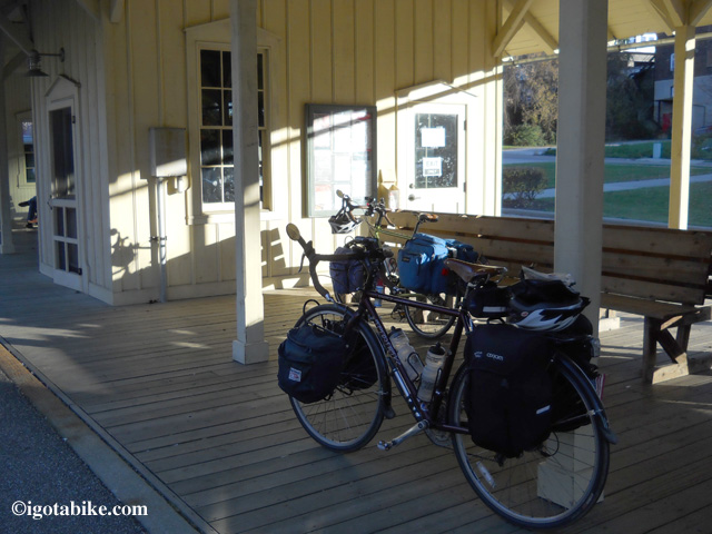
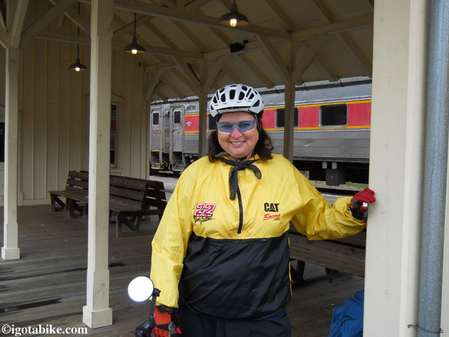
We arrive at the train platform 15 minutes early and the train men call out to us a hearty greeting. They remember us! They do have to lift our bikes onto the train and they are heavier than most. Plus we always give them a good story. The staff and service on the CVSR is top notch.

We left the house at 7:30 and it was just getting light. We arrived at the Cuyahoga Valley Scenic Railroad Rockside Road station 15 minutes before the 9 a.m. departure. This was pretty lucky since Guy got a flat tire that morning and it was 4 miles further than I remembered.

We left the house at 7:30 and it was just getting light. We arrived at the Cuyahoga Valley Scenic Railroad Rockside Road station 15 minutes before the 9 a.m. departure. This was pretty lucky since Guy got a flat tire that morning and it was 4 miles further than I remembered.

Guy points out that the odometer says 14 not 10. I say oops, looks like a 60 mile day. He smiles.
Turns out we are the only bicyclist aboard and we got the “biker car” to ourselves. All the way to Akron, no cyclist! The last time we did the bike Aboard there were dozens and dozens of cyclist.
We detrain, saddle-up and pedal off at 10:45 a.m. Its still overcast, not too chilly, pretty windy and there are encouraging peeks of sun as we pedal through the Towpath sections south of Akron.

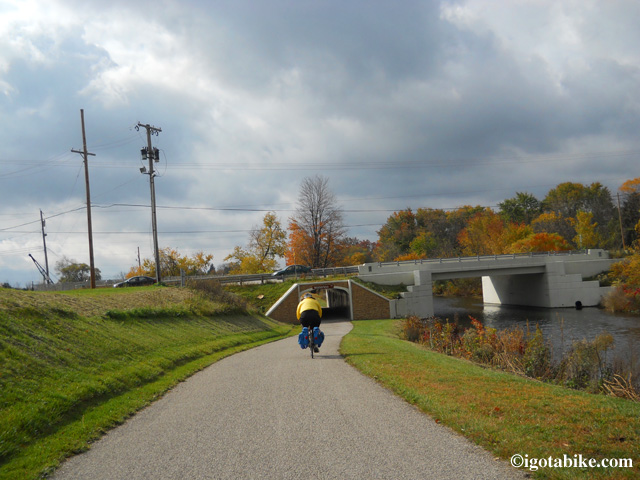
We were hoping the blue sky would win out over the clouds as we road south through Akron around 11 a.m. This is the new section that goes under Waterloo Road.

We were hoping the blue sky would win out over the clouds as we road south through Akron around 11 a.m. This is the new section that goes under Waterloo Road.

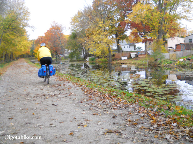
The ride through Barberton was spectacular with the trees reflecting in the water. The sections through the PPG property are really nice. It is lined by a wire fence but it cannot obstruct the beautiful landscape. We commented on how it felt like wilderness, like backpacking.

The Ohio and Erie Canal Towpath through Barberton is neat because you see into the backyards of all the homes / clubhouses along the way.

The Ohio and Erie Canal Towpath through Barberton is neat because you see into the backyards of all the homes / clubhouses along the way.

The weather was pretty dismal, and windy. We were the only trail users that day which made us feel like we were in the wilderness. I finally figured out my jacket was not “breaking the wind” but filling up with it. I was much better off without it. I guess I need a new bicycling jacket. Hello, Santa?

The weather was pretty dismal, and windy. We were the only trail users that day which made us feel like we were in the wilderness. I finally figured out my jacket was not “breaking the wind” but filling up with it. I was much better off without it. I guess I need a new bicycling jacket. Hello, Santa?

The Ohio and Erie Canal Towpath through PPG property.

The Ohio and Erie Canal Towpath through PPG property.

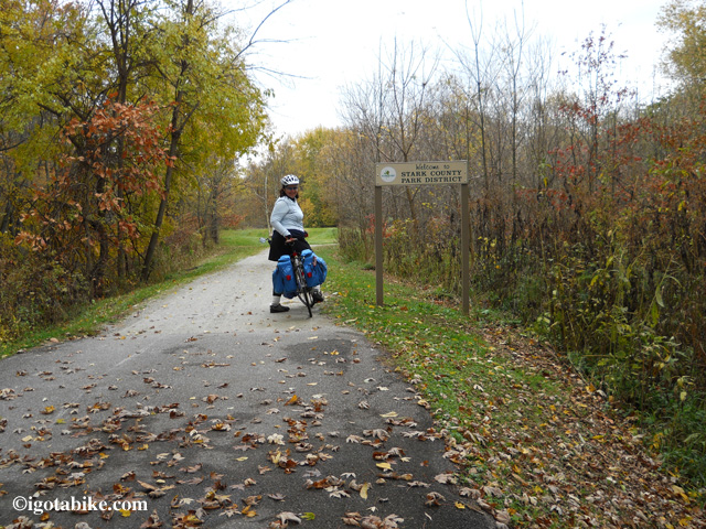
Its neat that there is a county line marker here and it always feel like a victory to reach Stark county by bike. Also feels like a victory to leave Stark County. (note the “pavement” change!)

Its neat that there is a county line marker here and it always feel like a victory to reach Stark county by bike. Also feels like a victory to leave Stark County. (note the “pavement” change!)

South of Canal Fulton there was an erroneous trail detour. Finally we arrived in Massillon. We stopped on the bridge, with the Hampton Inn in site, around 3 o’clock and called the campground. One cabin left and they agreed to hold it. (we did not make a reservation because rain or other calamity that prevents us from arriving would mean no refund.) We peddled on south, still on the Towpath.

Its has been five years since we have been on this section and it is pretty rough. The trail surface is inconsistant switching back and forth from crushed limestone to larger gravel and we had to dismount once to get through some deep sand. Sections were oversized black gravel that was not comfortable. When we arrived in Navarre we left the trail at the Water Park on Wooster Road and headed up to Main Street to buy some beer. Its rural down here and bordering on Amish country. Even though there are seven miles to go its the last chance for supplies.
We easily navigate through town and find Brinker Road going straight up.
Continued in next post…

Posted in Blog | Tagged , , | Comments Off on Fall overnight camping tour 120 miles: Cleveland to Navarre using the Cuyahoga Valley Scenic Railroad with Map S24O ish, part 1

Finding a route for a Fall tour with overnight camping

Last weekend Guy and I had a break in our schedules and a break in the weather and were itching to do another overnight bike tour. So I dug into the maps and tried to dream up a good route. Since we had been told by several cyclist that they had trouble finding the new Towpath route through Akron I wanted to go there to get a better understanding of the trouble spots.
We had enough time for three days of riding (Sat-Mon) but that is an odd number and makes there and back an obstacle. We had to settle for two days of riding. Turns out that was good—we needed the third day for rest!
Another obstacle is to get far enough away from the urban area where we live to find a campground that is close to a trail and accessible by bike. Another consideration was we needed to leave from our house since our truck is in the shop. (hello Ben, is it finished yet?) Also since it is late October daylight is short, basically 7 am – 7 pm.
We had the brilliant idea to once again utilize the fabulous Cuyahoga Valley Scenic Railroad and their Bike Aboard deal where you and your bike can ride the train for only $2. The train shuts down for the season at the end of October so it seemed appealing to get one more ride. The train runs Weds-Sun.
I found a campground east of Navarre that looked good. They have cabins so we could leave the tent at home. Pizza Oven delivers there so we left all the cooking gear at home. Nice, light load. I spoke to campground owner who told me the route from the Ohio and Erie Canal Towpath Trail out of Navarre to the campground was good for cycling. She has obviously never been on a bicycle. The seven mile on road route began after 50 miles on the Towpath and was straight uphill. Steep and long and one after another. Even that flat parts were on a significant  incline.
We were stunned and a bit aggravated but maintained a cheery, steady, but weary pace.
I remember someone saying “we never should have tried this” and “we will never make it back to train on-time!”
In a situation like this you can’t help but thinking “I should have tested this route in my car.” If I had tested it in my car I would not have done it. We had a great time and it is a great story and a great memory. I also remember someone saying “wow look at those colors on the trees,” “the sky is so pretty,” “this trail is awesome,” “look its a: hawk, falcon, owl, doe, buck, another buck, ducks and more ducks, wooly bear, black squirrel, gray squirrel, red squirrel, rabbit, snake, great blue heron and so on.
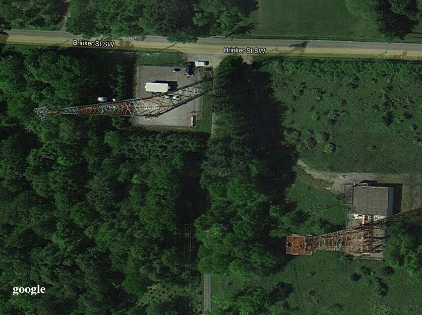
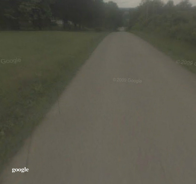
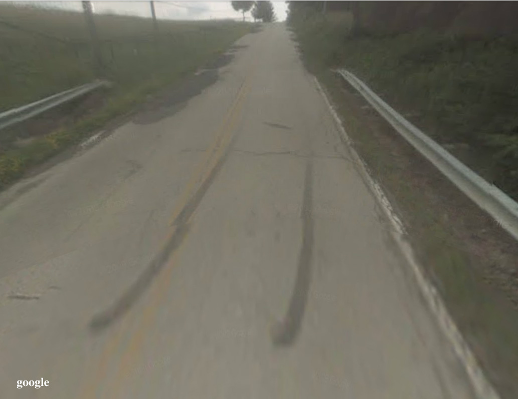
So we don’t regret the trip but we don’t necessarily recommend it either. I did learn some things about route finding. Towers are bad, usually very bad. They are always located at the top. When you look at google satellite everything looks so flat. In hindsight I see the towers that could have clued us in on the seriously steep climb. Also now that I am home I can see that on google maps there is a street view available of this spot. If I had looked at it I probably would have not selected this route. The streetview camera also tends to flatten things out but it gives you an idea of the terrain.
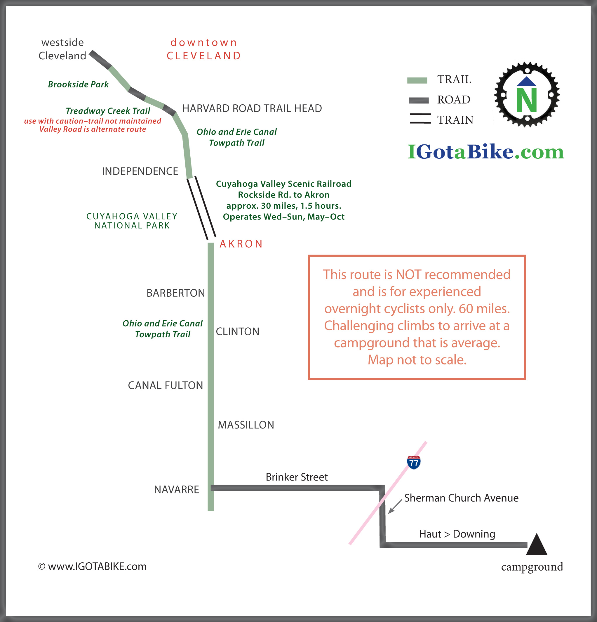
More of the story and many great photos to come. Even though the route is not recommended I designed a map to show where we went.
P.S. There are new signs that mark route through Akron. Way to go Summit County! We will update the Akron route details soon.

towers on google satallite

When you look a google satellite everything looks so flat. When you see towers beware! Towers are bad, usually very bad. They are always located at the top.

beyond the towers

Even after we climbed up from the river valley to the towers there were still many more hills to come. This google streetview is looking east from in front of the towers and you can see the next hills in the distance.

Haut Streetview

Finally to the last turn onto Haut and it is uphill too. Its fun to look back at the route using google streetview.


Posted in Blog | Tagged , , | 1 Comment

Chris is riding the Ohio to Erie Trail this week!

Chris is riding the Ohio to Erie Trail solo on a Rivendell Sam Hilbourne, north to south

Chris is riding the Ohio to Erie Trail solo on a Rivendell Sam Hilbourne lightly loaded with classic style front and rear bags. He is riding north to south.

He must be living right to get this great weather so late in the season! Chris is riding “door to door.” He departed from from a family member’s house on the eastside of Cleveland on Sunday and is aiming to arrive at his home in Cincinnati on Thursday.
In a nice coincidence Guy and I happened to be on a section of the Ohio to Erie Trail this past weekend and discovered a glitch in Chris’s route just south of Canal Fulton in Stark County. We were able to send him an e-mail which he received just a few miles before he reached the erroneous detour saving him from an unnecessary bumpy ride.

Heading south on the Ohio and Erie Canal Towpath in October 2012 we followed the detour sign south of Canal Fulton directing us to use the Olde Muskingum Trail and it was rough! Scenic and secluded but bumpy and mostly two track. On the return we stayed on the towpath and discovered that it was open, urgh. The detour is between Butterbridge Road and High Mill Avenue where ther is an an old bridge that crosses the river that is closed to motorist. The Towpath Trail is on the east side of the river and the Olde Muskingum Trail is on the west side and runs between Cherry Street in Canal Fulton and Forty Corners Road. When we were going north we saw other signs with garbage bags over them. Maybe there was supposed to be bag over this sign. How about some tape!

Heading south on the Ohio and Erie Canal Towpath in October 2012 we followed the detour sign south of Canal Fulton directing us to use the Olde Muskingum Trail and it was rough! Scenic and secluded but bumpy and mostly two track. On the return we stayed on the towpath and discovered that it was open, urgh. The detour is between Butterbridge Road and High Mill Avenue where there is an an old bridge that crosses the river that is closed to motorists. The Towpath Trail is on the east side of the river and the Olde Muskingum Trail is on the west side and runs between Cherry Street in Canal Fulton and Forty Corners Road. When we were going north we saw other signs with garbage bags over them. Maybe there was supposed to be bag over this sign. How about some tape!

We got an e-mail from Chris last night after he had successfully arrived at the Millersburg Hotel.
Here is an excerpt from his e-mail…
Day 1 was very nice, weather and all, and a good way to start the trip. The ride from the east side to downtown Cleveland was over residential streets through Lyndhurst, South Euclid and Cleveland Heights, then down Monticello, Mayfield and Euclid.
Euclid Ave on a Sunday morning was very easy to navigate. I originally planned to take the Detroit-Superior bridge into Ohio City but decided to go down to the flats instead, taking Columbus Ave to cross the river. Abbey is now open both directions, but it is signed “no bikes on roadway.” I had to take the road anyway because the sidewalk was blocked in one place with construction junk.

After riding through Tremont I picked up the trail above Steelyard Commons. the trail was fairly busy throughout and especially so in Peninsula, where I stopped for a beer and to check out the score of the Browns-Colts game.

Left the trail at Botzum to head to my sister-in-laws house in Fairlawn. It was a long climb out of the valley but I got that back with an easy ride to start out the next morning. Arrived ahead of schedule with tired legs. Dinner was Salmon (thanks Kathleen!) and I was in bed before 10.

Day 2 started mostly downhill to the trail. I kept a steady pace and arrived in Canal Fulton for lunch. It’s a charming little town, built around the canal, and a good place for a stop. On to Barberton and Massillon, which the trail only skirts- I passed Barberton without really knowing it. The Sippo Valley trail was nice and fast. I didn’t notice any headwinds even though it was due west.

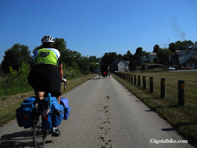
Dalton to Fredricksburg was a chore! The afternoon was warm and a little humid (I can’t imagine what it was like for you in 90-degree weather) and I didn’t have good feel for the distances. I kept thinking the next turn should be “soon” but it never was! It was scenic, though, Amish farms, buggies, groups of kids walking home from school. By the time I got to Fredricksburg I was bonked. I took about a 20 minute rest at a pizza place, then ground out the last ten miles to Millersburg. The Holmes County trail was cool. I saw a couple of buggies headed in the opposite direction and lots of evidence (ahem) that the trail gets used that way.

Overall, the trails were far less busy today than yesterday, which I guess should be no surprise.

I feel much better after having a shower!!  On to dinner. I am saddle sore. I hope that improves.

NOTES:
Euclid Avenue runs east to west in Cleveland connecting downtown Cleveland and University Circle and passes through the sprawling Cleveland Clinic campus. Euclid Avenue recently underwent a massive re-design that includes bike lanes and the buses run down the center of the street in dedicated bus lanes. Nice, but, still has the typical problems of bike lanes. Particularly the dangerous situation when a motorist cuts off the cyclist when they cross the bike lane to make a right turn.

Chris’s route through the flats (past the Ohio City Bike Co-op) is not bad but the Columbus Avenue Bridge is notoriously dangerous for cyclists as it has a tricky metal grate surface and a medium sized climb up to the Westside Market area.

We will get an update on the conditions of the Abbey Bridge. I cannot fathom the “no bikes” rule. This neighborhood is filled with cyclist and there is not an easy work-around.

Yikes! The climb out from Botzum is grievous! It is one of the problems with the Ohio and Erie Canal Towpath. It is profoundly beautiful down there in the valley but is very tough to get up and out.

The stop in Pennisula is more evidence of the connection between beer and bikes!

The Ohio and Erie Canal Towpath passes Barberton about a mile from the town at the Snyder Road Trailhead where there are nice restrooms and a drinking fountain. There is a bike shop in Barberton and The Green Diamond is a great place to eat.

One of the murals painted on the ceiling of the Green Diamond Grille & Pub in Barberton about a mile from the Snyder Road Trailhead on 2nd Street. R-D Bike Shop is directly across the street.

One of the murals painted on the ceiling of the Green Diamond Grille & Pub in Barberton about a mile from the Snyder Road Trailhead on 2nd Street. R-D Bike Shop is directly across the street.

The pizza place in Fredricksburg is Lems and is in the center of town. They also have great ice cream!

Lems in Fredricksburg has great pizza, ice cream and nice picnic tables out front. There is a grocery store across the street.

Lems in Fredricksburg has great pizza, ice cream and nice picnic tables out front. There is a grocery store across the street.

Here is Carol on the Holmes County Trail in May 2012 having a similar experiece to Chris's with an Amish buggy ahead and "evidence" on the trail. Another good argument for fenders!

Here is Carol on the Holmes County Trail in June 2012 having a similar experience to Chris's with an Amish buggy ahead and "evidence" on the trail. Another good argument for fenders!

Three cheers for Chris for sending this great e-mail after a long day of peddling and before dinner! Go Chris go!

As I am typing this it is stormy but warm in Cleveland. Hoping it is nice and sunny for Chris today as he powers on down the Holmes County Trail, the tough climbing on route 6, the steep and fast big truck Route 62, the bumbity bump Mohican Valley Trail, the fabulous Kokosing Gap Trail, big truck Route 3 /36, The Heart of Ohio Trail, the on-road route into Sunbury and down the Old Route 3 bike trail to Westerville. That’s a lot of peddling!

Chris will be riding Route 6 today. This photo shows Carol pushing her loaded Jamis Aurora up on of the more memorable hills in May 2012.

Chris will be riding Route 6 today. This photo shows Carol pushing her loaded Jamis Aurora up on of the more memorable hills in May 2012.

Hope the weather looks just like this when Chris rides the Heart of Ohio trail today. It was picture perfect for us in June 2012.

Hope the weather looks just like this when Chris rides the Heart of Ohio trail today. It was picture perfect for us in June 2012.

FOLLOW-UP: Chris made it to Westerville (north of Columbus) as planned on the third day and was heading for Xenia on his fourth day. He started to experience some extreme pain in his Achilles tendon around mid-day. He made it London and then had to make the tough decision to call for help. Cleveland to London in 4 days, 262 miles. Nice!


Posted in Blog | Tagged | Comments Off on Chris is riding the Ohio to Erie Trail this week!

Fall bicycle tour, 120 miles in two days

Fall bicycle tour

Fall is a great time for a bicycle tour with spectacular views and the rhythmic sound of leaves crunching under your wheels.

We just got back from an exciting and challenging fall bicycle tour. We departed from our front door on Saturday, Oct 20 at 7:30 a.m. and returned Oct 21 at 10 p.m. with a total of 120 miles. The route was unique and arduous with some tough weather on Saturday and spectacular weather on Sunday. The tail end of the ride was in the dark and a brisk 42 degrees!
We will post more details soon. Time for a nap, or two!

Posted in Blog | Tagged , , | Comments Off on Fall bicycle tour, 120 miles in two days

Ohio To Erie Trail Through Columbus with map, north to south

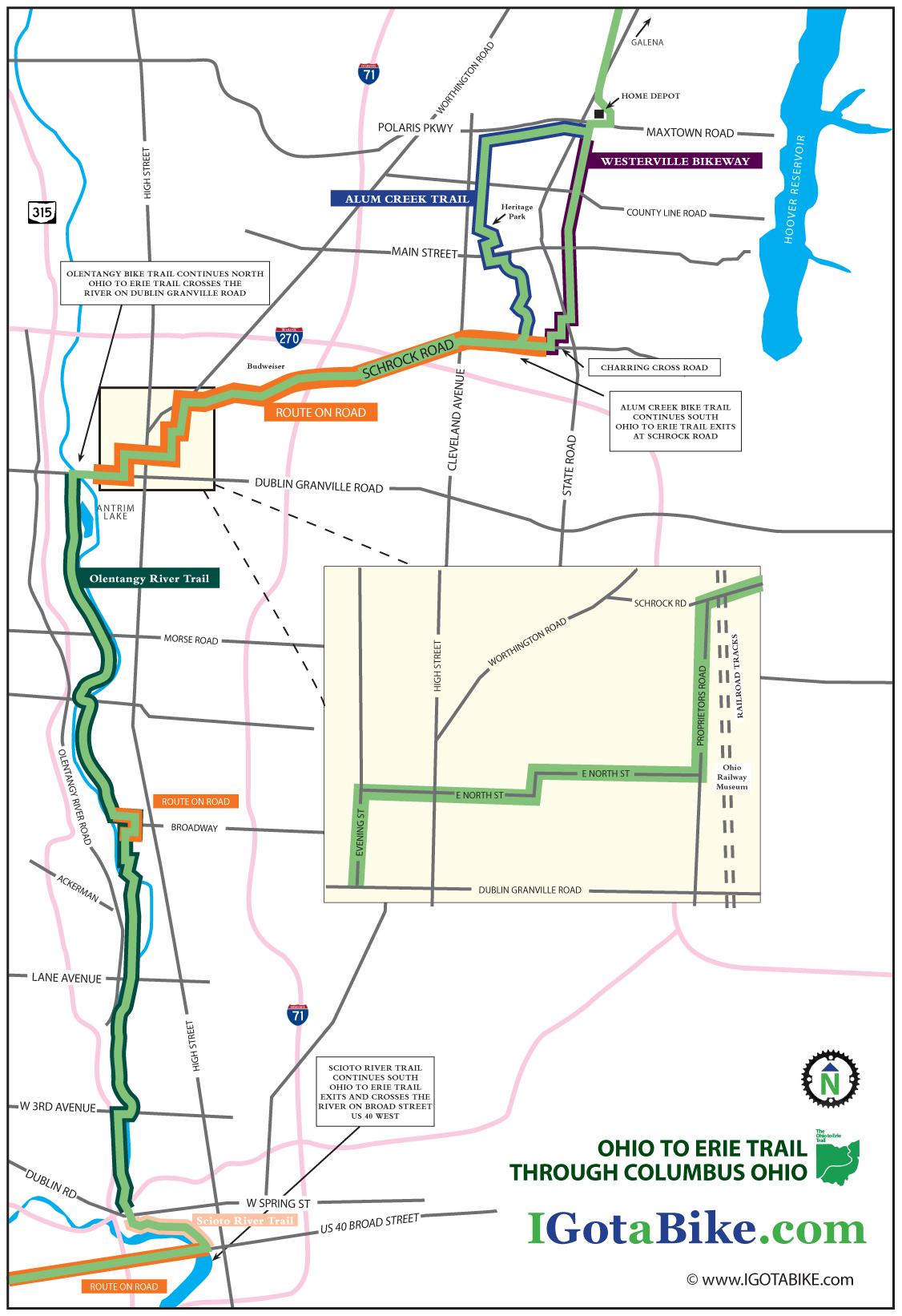
On the north end of Columbus it is riders choice to use the bike trail that goes through Alum Creek Park or the bike trail that goes through Westerville. Schrock Road is used to connect these trails to the Olentangy River Trail and the Scioto River Trail to US Route 40 / Broad Street. The road riding is a bit difficult in spots and finding the next turn can be tricky but it is overall a very nice route considering the challenges of urban riding. It is approximately 25 miles.

UPDATE February 2014: New section south of Columbus via the Scioto Trail

Until late 2013 the Ohio To Erie Trail used the Broad Street Bridge at Marconi. The new route follows the Scioto Trail west of Columbus. This new section is made possible by the  bridges that cross the Scioto River 3 times. This new route eliminates several miles of road riding on US 40 Broad Street between Marconi and Westgate. The recommended road route is illustrated on Map 3, Panels  3, 4 & 5 of the Ohio To Erie Trail Printed Maps. You still need to use US 40 Broad Street to get under Interstate 270.

UPDATE April 2013: The Olentangy Trail detour between Lane Avenue and Dodridge is over. The Olentangy Trail is now contiguous through the Ohio State University campus.
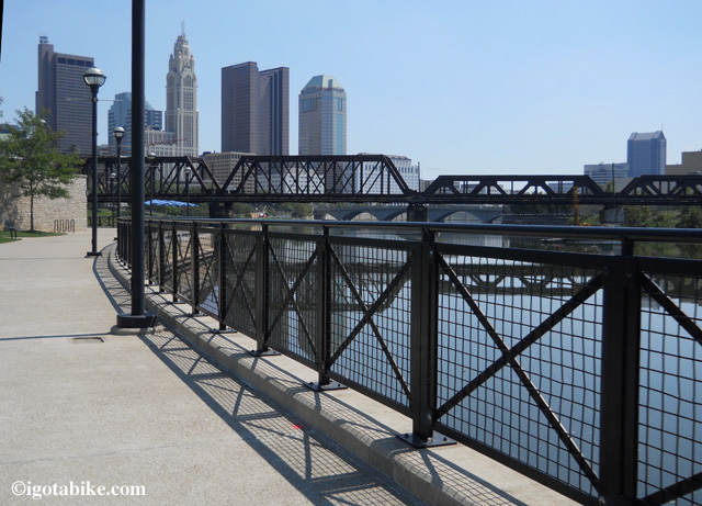
View from The Scioto River Bicycle Trail southbound approaching downtown Columbus.
View from The Scioto River Bicycle Trail southbound approaching downtown Columbus.

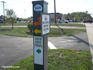
When we rode through Columbus in August 2012 we saw many new posts that “appear” to be marking the turns in the trail. They are green, metal, 4 x 4 posts, about chest high. This one included stickers for the Ohio to Erie trail but all others were blank.
When we rode through Columbus in August 2012 we saw many new posts that “appear” to be marking the turns in the trail. They are green, metal, 4 x 4 posts, about chest high. This one included stickers for the Ohio to Erie trail but all others were blank.

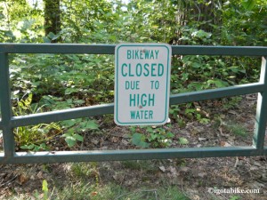
In several places there are gates and signs indicating that the Alum Creek Trail is subject to flooding. Remember you have the Westerville Bike Trail as an alternate route in case of poor conditions.

In several places there are gates and signs indicating that the Alum Creek Trail is subject to flooding. Remember you have the Westerville Bike Trail as an alternate route in case of poor conditions.


NORTH TO SOUTH:
When approaching Columbus from the north you will be riding on the bike trails that parallel N State Street and the Hoover Reservoir. As you exit the woods there is UDF (convenience store with ice cream and restrooms) that is the landmark for the beginning of the Columbus route. The bike trail turns south (left) and travels behind a giant retail complex that contains a Home Depot and Krogers (grocery / liquor mega store). You will pass behind the Trek store and they provide free air and water to cyclist at their back door.
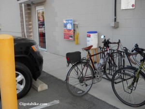
The bicycle trail travels behind a giant retail complex where there is a Trek store and they provide free air and water to cyclist at their back door.

The bicycle trail travels behind a giant retail complex where there is a Trek store and they provide free air and water to cyclist at their back door.

At the south end of this section, near the Home Depot entrance, you will cross Maxtown Road which is also known as Polaris Parkway. There are restaurants here so if you need to refuel this is a good place to do it.
This is where you choose to use the bike trail that goes through Alum Creek Park or the bike trail that goes through Westerville. Using the Alum Creek trail is slightly longer because it travels at an angle, maybe 2 miles. We rode both and both are pleasant. Flip a coin if necessary.
WESTERVILLE BIKE TRAIL SOUTH:
To use the Westerville route the bike trail makes a left after crossing Maxtown Road to turn south and go behind another mega retail complex. The trail surface is perfectly smooth and seal coated and much of it is lined with shade trees. There are lots of road crossings–we counted seven. Many of them are small residential streets but all require a full stop as traffic is heavy in this suburban retail area. The tricky spot is where the bike trail appears to end at South State Street. On the north side is the dedication marker for the Ohio to Erie Trail which is a brass plaque mounted on a knee high boulder. From this spot it is difficult to see that trail continues south. Use the crosswalk to get across State Street and then turn left to continue south. The trail picks up again in about 300 feet and there are bike route signs.
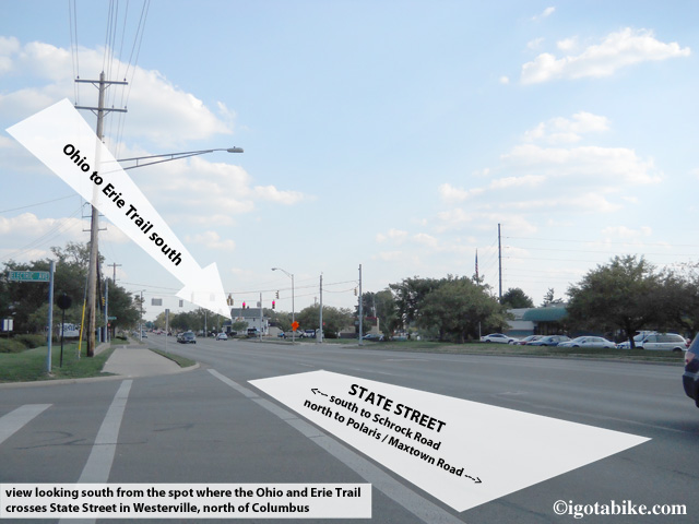
The Westerville bike trail bike trail appears to end at South State Street. From this spot it is difficult to see that trail continues south on the other side of S State Street.

The Westerville bike trail bike trail appears to end at South State Street. From this spot it is difficult to see that trail continues south on the other side of S State Street.

This is a short connector that will take you behind more retail stores and dump you onto Charring Cross road which will take you to Schrock Road where you will turn right to continue south. (note that on the other side of Schrock Road Charring Cross Road is called Brooksedge Blvd.
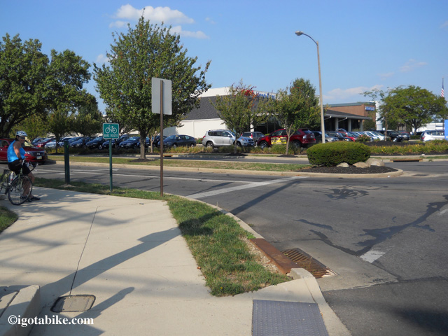
Intersection of Charring Cross Road and Schrock Road where you will find the Westerville bike trail terminus.

Intersection of Charring Cross Road and Schrock Road where you will find the Westerville bike trail terminus.

ALUM CREEK BIKE TRAIL SOUTH:
To use the Alum Creek trail do not turn left after crossing Maxtown Road near the Home Depot entrance. Continue west on the bike trail that is on the south side of Maxtown Road. It is newly paved and perfectly smooth and seal coated.
Follow this for approximately 3 miles and turn left at Cleveland Avenue where the bike trail is nice and wide and concrete (basically an oversized sidewalk) and follows along the east side of Cleveland Avenue. (note: if you miss the turn the bike trail dead ends)
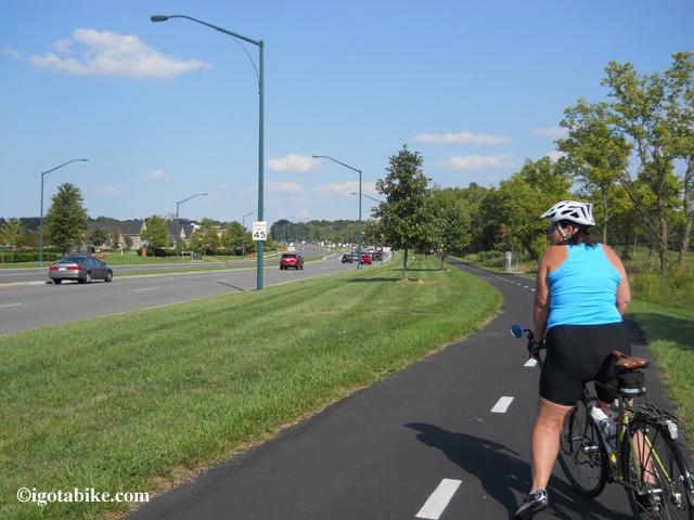
The bike trail on the south side of Maxtown Road / Polaris Parkway which connects to the Alum Creek Trail via Cleveland Avenue. In this photo Carol is facing east, following the northbound Ohio to Erie Trail.

The bike trail on the south side of Maxtown Road / Polaris Parkway which connects to the Alum Creek Trail via Cleveland Avenue. In this photo Carol is facing east, following the northbound Ohio to Erie Trail.

(NOTE DANGER: do not attempt to get across Interstate 71 using Polaris Parkway as it is profoundly dangerous. It is the worst place I have ever been on a bike and I have been in some bad spots! There are many hotels and restaurants here, just choose one that is on the east side of 71 or use an alternate route.)
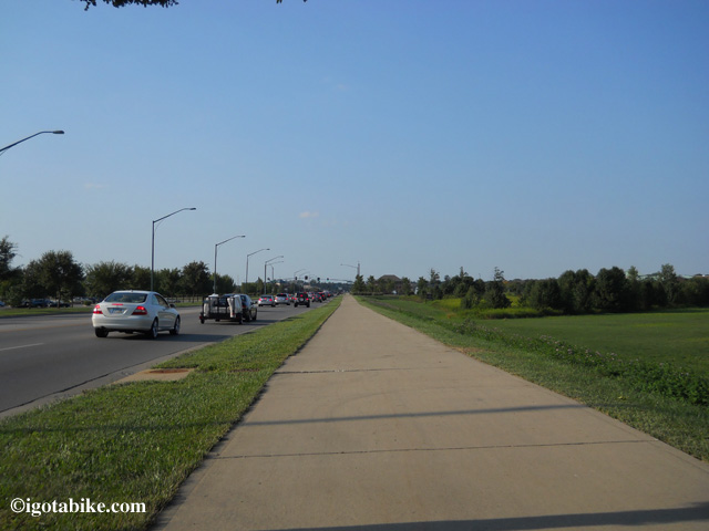
The bike trail on the east side of Cleveland Avenue. The view in this photo is looking north.

The bike trail on the east side of Cleveland Avenue. The view in this photo is looking north.

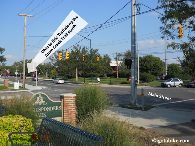
After traveling about 2 miles south on Cleveland Avenue you will notice a giant sports complex on the right and the super sized Westerville Recreation Center on the left and the trail will cross a bridge and turn left into Heritage Park. (there are bike trail connectors that go under the bridge and connects to the Sports Complex) After very a short distance turn right to follow the brick lined bike trail that takes you up to Main Street where you turn left to cross in front of the Westerville Fire Department and Senior Center. Use the cross walk to get across Main Street and pick up the bike trail with a right turn at the bridge.
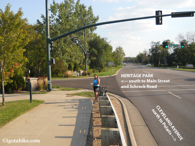
The bike trail departs from Cleveland Avenue and continues through Heritage Park.
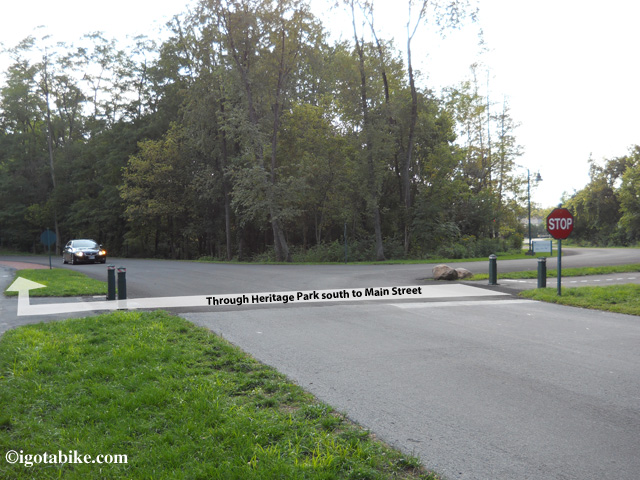
The bike trail departs from Cleveland Avenue and continues through Heritage Park.

You are only in Heritage Park for a few hundred feet before you need to cross the park road and turn right and follow the brick lined bike trail, facing traffic, to get to the crossing at Main Street.
You are only in Heritage Park for a few hundred feet before you need to cross the park road and turn right and follow the brick lined bike trail, facing traffic, to get to the crossing at Main Street.

On the other side of Heritage Park the bike trail crosses Main Street after passing in front of the Westerville Fire Department, First Responders Park and the Senior Center. The trail picks up on the other side of Main Street before crossing the bridge.
On the other side of Heritage Park the bike trail crosses Main Street after passing in front of the Westerville Fire Department, First Responders Park and the Senior Center. The trail picks up on the other side of Main Street before crossing the bridge.

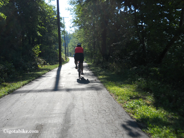
The Alum Creek Trail is nice and scenic. In this photo Carol is riding south in the early morning, late August 2012.

The Alum Creek Trail is nice and scenic. In this photo Carol is riding south in the early morning, late August 2012.

The trail continues past a lake and through the woods. You need to exit the trail with a left turn before the trail goes under Schrock Road and continues south. (on the other side of the bridge there are exit ramps so you are able to access the trail from both sides of Schrock Road) There are no signs to tell you it is Schrock Road, the trail going under the bridge is your landmark.
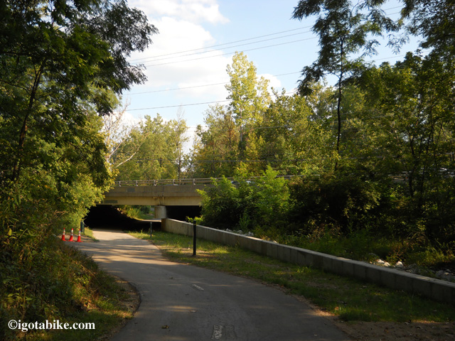
There was no sign to mark the exit from the Alum Creek Trail to Schrock Road when we were there in August 2012. The trail going under the bridge is your landmark. There is a new green metal 4 x 4 post on the right marking the the exit to the left, past the orange construction cones. Continuing foward under the bridge takes you under Schrock Road and further south on the Alum Creek Trail. Currently, The Ohio to Erie Trail exits here, to the left, to get up to the road, and turns right to cross the bridge and follow Schrock Road to connect to the Olantangy Trail.

There was no sign to mark the exit from the Alum Creek Trail to Schrock Road when we were there in August 2012. The trail going under the bridge is your landmark. There is a new green metal 4 x 4 post on the right marking the the exit to the left, past the orange construction cones. Continuing forward under the bridge takes you under Schrock Road and further south on the Alum Creek Trail. Currently, The Ohio to Erie Trail exits here, to the left, to get up to the road, and turns right to cross the bridge and follow Schrock Road to connect to the Olentangy Trail.

SCHROCK ROAD TO THE OLENTANGY TRAIL (approximately 7 miles)
There are bike lanes along both sides of Schrock Road but we found them littered with debris; take the lane. This is a giant thoroughfare with heavy traffic. You will go over Interstate 270 and over Interstate 71 and past the Budweiser plant then across the railroad tracks where you immediately turn left onto Proprietors Road.
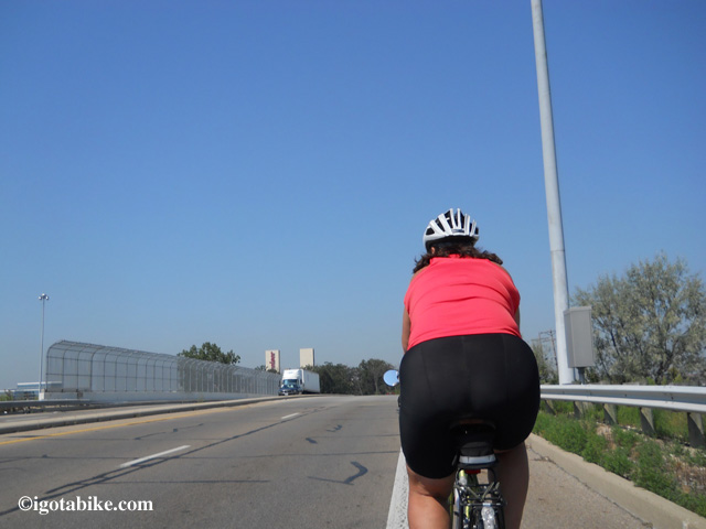
Schrock Road, southbound, over Interstate 71 with the Budweiser plant in sight. Carol says, “In this photo I should have taken the big lane. The marked and signed bike lane was full of debris.”
Schrock Road, southbound, over Interstate 71 with the Budweiser plant in sight. Carol says, “In this photo I should have taken the big lane. The marked and signed bike lane was full of debris.”

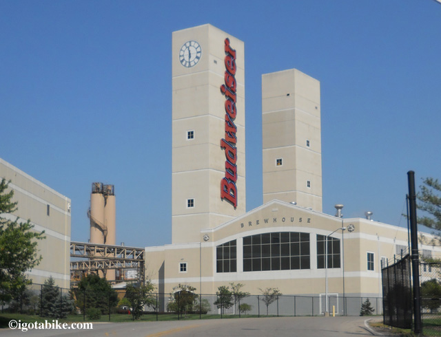
The Budweiser plant can be seen for miles and makes a good landmark along the east end of Schrock Road, no comment on the beer.

The Budweiser plant can be seen for miles and makes a good landmark along the east end of Schrock Road, no comment on the beer.

There is a lot to see at the Ohio Railway Museum and it makes an un-missable landmark to turn right onto E North Street from Proprietors Road. (unless you are so busy looking at the the trains that you fail to notice that E North is directly across the street from the trains!)

There is a lot to see at the Ohio Railway Museum and it makes an un-missable landmark to turn right onto E North Street from Proprietors Road. (unless you are so busy looking at the the trains that you fail to notice that E North is directly across the street from the trains!)

When you see the Ohio Railway Museum on your left turn right onto E North Street and continue across High Street until E North dead ends into Evening where you turn left. The best way to stay out of traffic is to follow Evening to cross Dublin Granville Road and immediately turn right onto the residential street that runs along Dublin Granville Road facing traffic. The marginal residential road becomes a bike trail that will fork at a soccer field. Bear right to go up a ramp and get onto the bridge that crosses the Olentangy River, (on the sidewalk / bike trail, facing traffic) on Dublin Granville Road and turn left onto The Olentangy Trail at the intersection of Dublin Granville Road and Route 315.
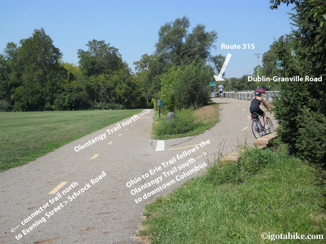
This is the approach to the Olentangy trail on the marginal road / bike trail that follows Dublin Granville Road on the south side of the street, facing the Dublin Granville Road traffic. Veer uphill to the right to cross the bridge on the bike path along Dublin Granville Road.
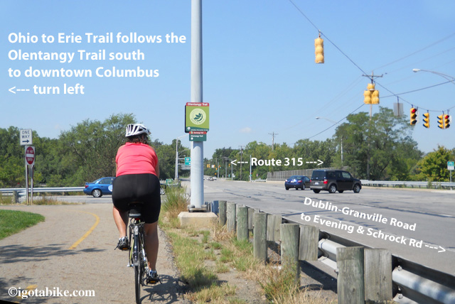
Turn left (south) on the Olentangy trail after crossing the bridge on the bike path along Dublin Granville Road. There is a sign here but not very helpful.

OLENTANGY TRAIL TO US 40 / BROAD STREET (APPROX 11 MILES)
The Olentangy Trail travels south along a chain link fence with Route 315 on your right. (NOTE: there are other bike trails that go north on both sides of the river and there are “gopher holes” that take you under the intersection of 315 and Dublin Granville Road. Be very careful here as cyclists and motorists are everywhere).
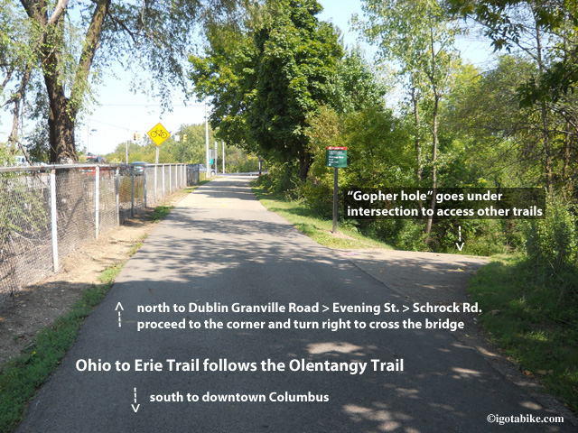
Ignore the “gopher holes” that go downhill and under the intersection of Route 315 and Dublin Granville Road. This photo is looking north approaching Dublin Granville Road.
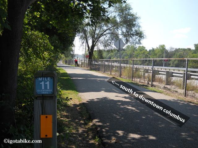
Continue south on the Olantangy Trail along the chainlink fence that parallels Route 315.

Continue south on the Olentangy Trail along the chainlink fence that parallels Route 315.

Soon the trail leaves the roadside and ducks into the woods. There are many side spurs and connectors along the way but you can follow the yellow lines that are painted down the center of the main path. There is a drinking fountain in Antrim Park.
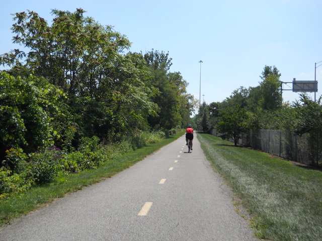
The Olantangy Trail is a nice ride and is marked with a center line. There are many side spur bicycle path connectors and the center line can help to keep you on the main trail.

The Olentangy Trail is a nice ride and is marked with a center line. There are many side spur bicycle path connectors and the center line can help to keep you on the main trail.

The trail comes up to the road to use the bridge to cross the river at W Henderson Road and continues south with the river on your right. This is typical for the Olentangy Trail. Several times the trail comes up to the road only to cross a bridge and then heads off into the treeline on the other side.
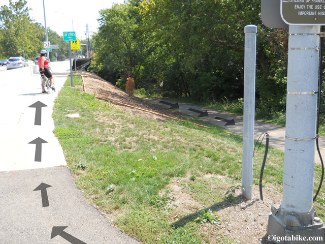
The trail comes up to the road to cross the river at W Henderson Road. This is typical for the Olantangy Trail. Several times the trail comes up to the road only to cross a bridge and then heads off into the treeline on the other side.

The trail comes up to the road to cross the river at W Henderson Road. This is typical for the Olentangy Trail. Several times the trail comes up to the road only to cross a bridge and then heads off into the treeline on the other side.

There is short section of the trail that goes on the road through a neighborhood in Clintonville. (It is a nice area with beautiful homes and gardens.) It is well signed, easy to navigate, and is approximately 1 mile. (the trail dead ends onto Northmoor – turn right on Olentangy Blvd which turns into W Kenworth – turn right on Milton – turn right on Delhi – turn left on Riverside Drive and the route becomes trail again at the intersection of Riverside and W Como Avenue.)
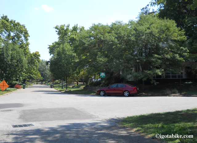
No worries as the trail goes on the road in Clintonville. It is well signed as it continues south through the neighborhood full of beautiful homes and gardens. Your only worry will be trying to figure out why you don’t live here, right on the trail!

No worries as the trail goes on the road in Clintonville. It is well signed as it continues south through the neighborhood full of beautiful homes and gardens. Your only worry will be trying to figure out why you don’t live here, right on the trail!

UPDATE APRIL 2013: The detour described below has ended. The Olentangy Trail is now contiguous through the Ohio State University campus. Use the detour route if you want to experience Buckeye country.

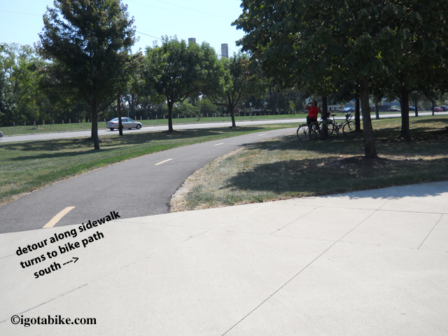
There is a marked detour where the trail follows W Dodrige Street behind a temporary concrete barrier for 500 feet and then crosses Olentangy River Road at Ackerman Road. The trail appears and re-appears and as it utilizes sidewalks along Olentangy River Road and goes along the sidewalk in front of the Jack Nicklaus Museum and the Schottenstein Center and turns left to cross the Suspension Bridge at Lane Avenue.
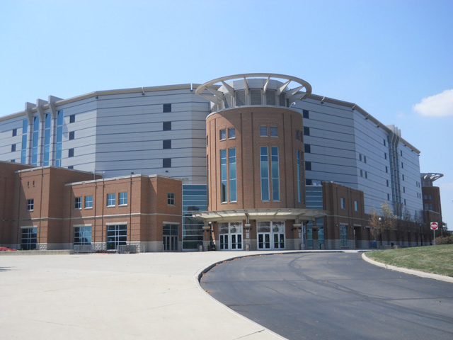
The Schottenstein Center is the landmark for navigating the Olantangy Trail detour through the Ohio State University campus. The detour follows Olantangy River Road on the west side of the street between Ackerman Road and Lane Avenue.

The Schottenstein Center is the landmark for navigating the Olentangy Trail detour through the Ohio State University campus. The detour follows Olentangy River Road on the west side of the street between Ackerman Road and Lane Avenue.
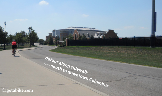
The marked detour on the Olantangy Trail utilizes sidewalks in front of the Jack Nicklaus Museum and the Schottenstein Center which can be seen just ahead on the right of this photo.
The marked detour on the Olentangy Trail utilizes sidewalks in front of the Jack Nicklaus Museum and the Schottenstein Center which can be seen just ahead on the right of this photo.

In front of the Schottenstein Center the on-sidewalk detour of the Olantangy Trail turns back into a recognizable bike trail.

In front of the Schottenstein Center the on-sidewalk detour of the Olentangy Trail turns back into a recognizable bike trail.
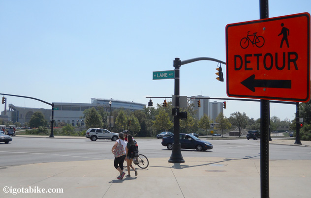
In front of The Schottenstein Center the Olantangy Trail detour through the Ohio State University campus turns left at Lane Avenue to cross the suspension bridge.
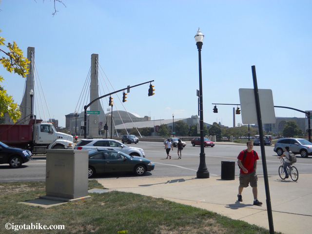
In front of The Schottenstein Center the Olentangy Trail detour through the Ohio State University campus turns left at Lane Avenue to cross the suspension bridge.

At Lane Avenue the Olantangy Trail detour through the Ohio State University campus turns left to cross Olantangy River Road and the suspension bridge.

At Lane Avenue the Olentangy Trail detour through the Ohio State University campus turns left to cross Olentangy River Road and the suspension bridge.

Immediately after crossing the bridge turn left on the bike trail to go under the bridge and continue south with the river on your right.
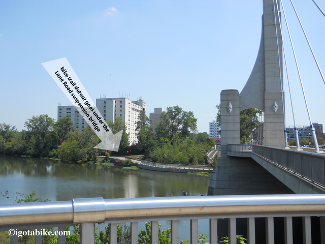
On the north east side of the Lane Avenue suspension bridge the Ola ntangy Trail picks up below the bridge. To continue south the river will be on your right. The trail heading north is closed, thus the detour.

On the north east side of the Lane Avenue suspension bridge the Olentangy Trail picks up below the bridge. To continue south the river will be on your right. The trail heading north is closed, thus the detour.

(This section was closed for construction earlier in the year and was detoured by sending cyclist up into the city streets and sidewalks away from the river just below The Shoe [football stadium]. We saw one detour sign that they forgot to take down. The correct route is to stay along the river.)
You will cross the river again and go under 315 at West Third Avenue and there are gopher holes under the bridge to access the trail from either side of the road. Continue south with the river on your left.
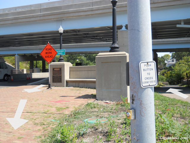
The trail comes up to the road to cross the river and go under Route 315 at West Third Avenue. This is typical for the Olantangy Trail. Several times the trail comes up to the road only to cross a bridge and then heads off into the treeline on the other side. There are gopher holes under the bridge to access the trail from either side of the road.

The trail comes up to the road to cross the river and go under Route 315 at West Third Avenue. This is typical for the Olentangy Trail. Several times the trail comes up to the road only to cross a bridge and then heads off into the treeline on the other side. There are gopher holes under the bridge to access the trail from either side of the road.

Immediately after crossing Dublin Road / W Spring Street The Olentangy trail continues south but you need to turn left to continue toward downtown Columbus on the Scioto River Trail.

UPDATE February 2014: New section south of Columbus via the Scioto Trail

Until late 2013 the Ohio To Erie Trail used the Broad Street Bridge at Marconi. The new route follows the Scioto Trail west of Columbus. This new section is made possible by the  bridges that cross the Scioto River 3 times. This new route eliminates several miles of road riding on US 40 Broad Street between Marconi and Westgate. The recommended road route is illustrated on Map 3, Panels  3, 4 & 5 of the Ohio To Erie Trail Printed Maps. You still need to use US 40 Broad Street to get under Interstate 270.

IGotABike.com is proud to be the official online distributor of the new and free
Ohio to Erie Trail Map Kit! Click here to order.
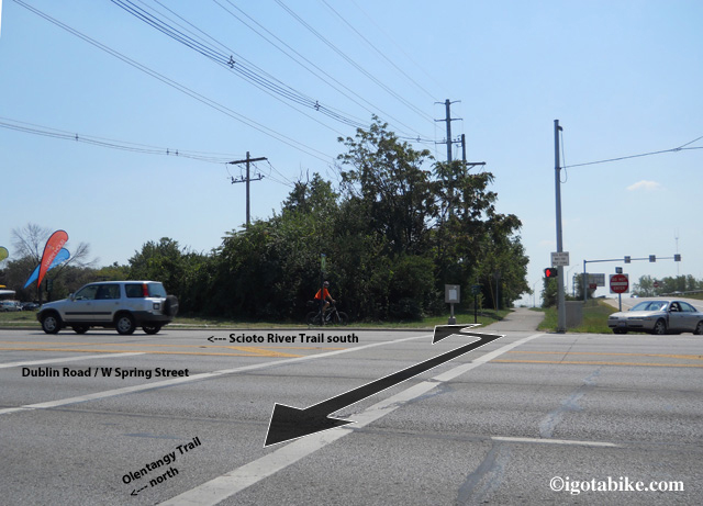
Immediately after crossing Dublin Road / W Spring Street The Olentangy Trail continues south. To continue toward downtown Columbus turn left on the Scioto River Trail.
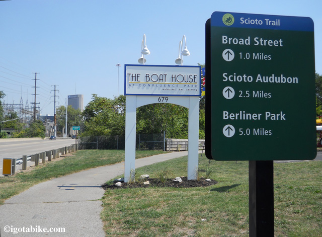
 

Cool! A sign! Scioto River Trail terminus at Dublin Road / W Spring Street where it intersects with the Olantangy Trail.

Cool! A sign! Scioto River Trail terminus at Dublin Road / W Spring Street where it intersects with the Olentangy Trail.

When you see a replica of the ship Santa Maria at the elaborately carved bridge you have arrived at US 40 / Broad Street. Exit the trail and turn right to follow  US 40 / Broad Street west to proceed south to Cincinnati.
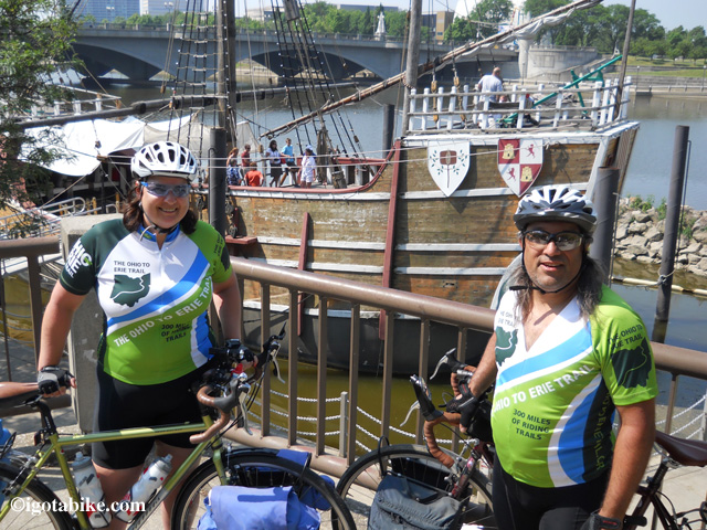
The replica of the ship Santa Maria is your landmark for the spot where you exit the Scioto River Trail and turn right to cross the river and continue on US 40 / Broad Street. The bridge in the background of this photo is US 40 / Broad Street.

The replica of the ship Santa Maria is your landmark for the spot where you exit the Scioto River Trail and turn right to cross the river and continue on US 40 / Broad Street. The bridge in the background of this photo is US 40 / Broad Street.

There is not much to say about US 40 / Broad Street. It is big, mean, urban and not very bicycle friendly. The Ohio to Erie Trail is over 300 miles of fantastically beautiful scenery and easy-going routes with a few rough spots. US 40 / Broad Street is one of the not so pretty places. However it is only 8 miles so hammer down and get it over with. Use caution at the highway crossings.

UPDATE February 2014: New section of the Camp Chase Trail

There is a newly paved section of the Camp Chase Trail between Galloway and Georgesville. (south of Columbus, north of London). There is also a newly recommended route that uses Norton Road and Hall Road to eliminate a section of Galloway Road. The new trail section eliminates riding on Alkire Road and utilizes the Battelle Darby Creek Metropark Road from Kropp Road. The route still uses the Alkire Road bridge to cross the Darby Creek at Georgesville. The recommended road route is illustrated on the Ohio To Erie Trail Printed Maps. IGotABike.com is proud to be the official online distributor of the new and free Ohio to Erie Trail Map Kit! Click here to order.
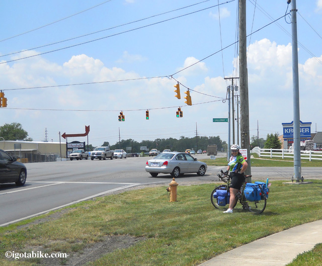
Intersection of US 40 / Broad Street and Galloway Road is where you turn left to make your way to the trailhead at The Battelle Darby Creek Metropark.

Intersection of US 40 / Broad Street and Galloway Road is where you turn left to make your way to the trailhead at The Battelle Darby Creek Metropark.

Note: You will no longer see the intersection pictured above when following the new road route Norton Road and Hall Road. Note the Krogers grocery store. Except for one gas station / mini mart along Galloway Road this is your last chance to stock up on food and water before arriving in London.

Congratulations you made it through Columbus–on a bike! For more information and additional photos you can check out the entry for this route going south to north.
 

Posted in Trail Maps | Tagged , , | 5 Comments