Volunteers Needed for Towpath Construction in Tuscarawas County, Saturday, May 4th

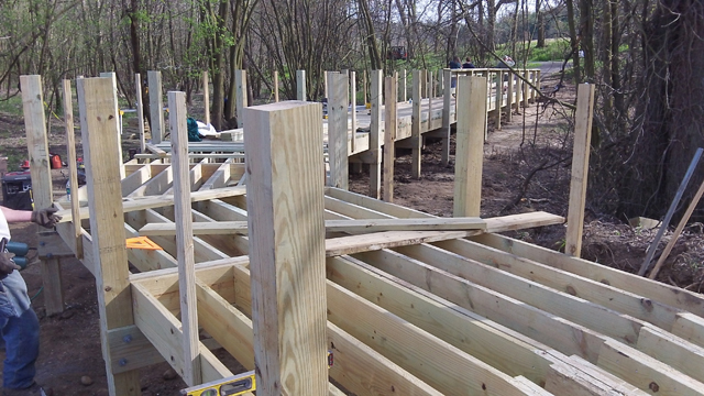
Boardwalk construction on the Towpath Trial outside of Zoar in Tuscarawas County. Photo courtesy George Ebey

Boardwalk construction on the Towpath Trial outside of Zoar in Tuscarawas County. Photo courtesy George Ebey.

Construction crews have been working to expand the Ohio & Erie Canal Towpath Trail in Tuscarawas County building an additional 2.7 miles from Zoar to Zoarville. This will make 83.7 miles of the trail  completed from New Philadelphia to Cleveland, with 16.3 additional miles being developed in Tuscarawas, Stark and Cuyahoga counties. Currently they working to finish boardwalks near the wetland areas.
George Ebey of Ohio & Erie Canalway Coalition tells me that the volunteer effort to build the boardwalks in Tuscarawas has been phenomenal. The first of the 2 boardwalks is completed and they have started on the second.
Here is his request for volunteers:

“We will be conducting another boardwalk volunteer workday this Saturday, May 4th on the Towpath Trail outside of Zoar in Tuscarawas County.  All of the posts are set and the frames are hung.  All that is left to do is to lay the final pieces of decking and finish installing the handrails.  We anticipate this to be the final workday for this project.  If  you are interested in participating please let me know.  We still need plenty of help to finish up this last remaining section.

We are particularly looking for anyone who has a cordless drill for laying the decking.  We will meet at the Canal Lands lot on Dover Zoar Rd at 8:00 am and then relocate to the worksite from there.  All volunteers are welcome and lunch will be provided.

In addition, there is a section of ground at the Canal Lands lot that needs to be seeded for grass.  This area is hard packed and will need to be tilled up before the seed can be set.  We are looking for anyone with a rototiller who would be willing to come out this day and help us till up the ground for seeding.  The more of these we have the better.  If you or anyone you know would be interested in helping with this please let me know.

Thank  you for your time and consideration.
George Ebey
Posted in Blog | Comments Off on Volunteers Needed for Towpath Construction in Tuscarawas County, Saturday, May 4th

Does anyone ride the Cardinal Greenway?

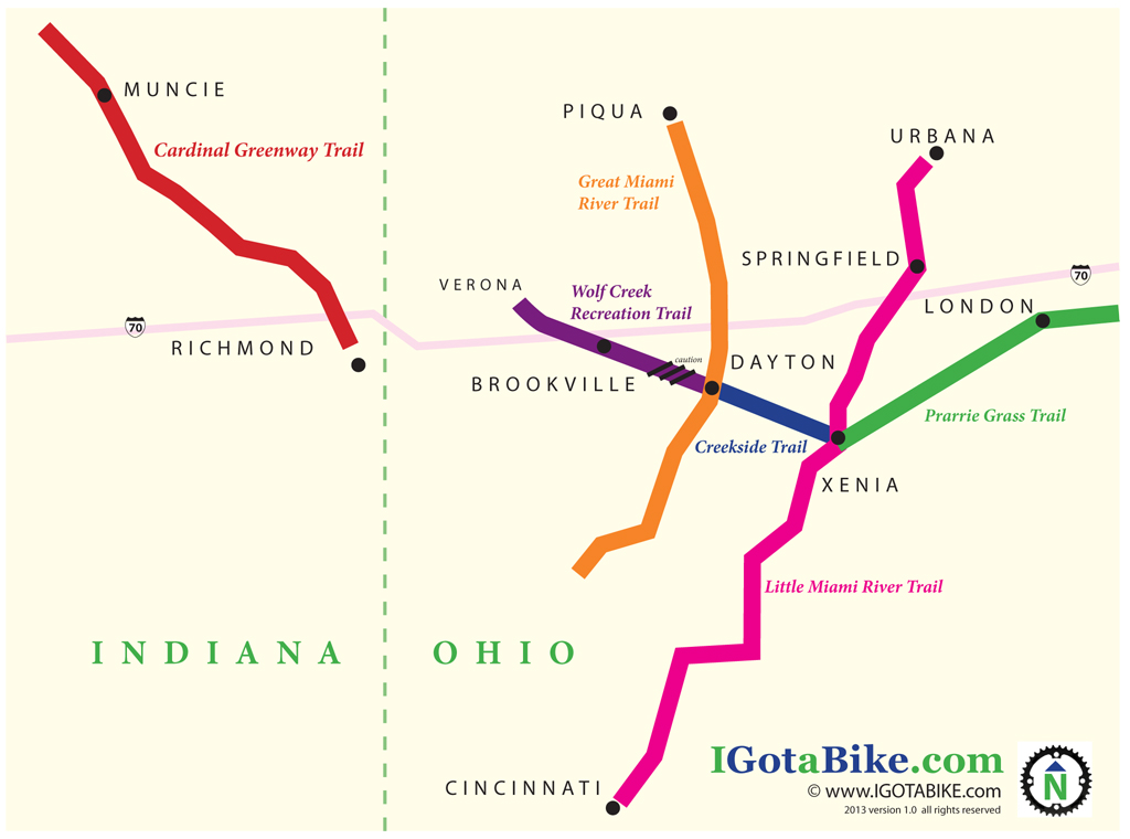
Guy and I are considering riding our bicycles to Indiana to check out the Cardinal Greenway Trail. The trail, as far as I can tell, is currently in two segments. There is about 50 miles of trail that travels form Richmond to Muncie, Indiana. There is a break in the trail then there is another segment that goes to Marion.
We have never been in this part of the Hoosier state. We remember someone telling us that the “gorge” trail is gorgeous and there are great places to swim.
We are planning to go to The Tall timbers KOA in Brookville, Ohio which is about 25 miles from Richmond. One of the great things about traveling by bicycle in southwest Ohio is it is really flat and rural. You don’t really “need” a bike trail because all the roads are so great. We are hoping that the roads in eastern Indiana are the same way.

The back roads in south west Ohio are flat and perfect. This photo is from a day ride to Verona while camping at the Tall Timbers KOA in Brookville, Ohio.

Once we make it to Muncie we would turn east and “bushwack” (aka road ride) over to Piqua to get back on the Miami Valley Trail system. Looks like route 28 would be a good choice.
In 2011 we bushwacked from Piqua to Urbana to make a loop out of the Great Miami and Little Miami Scenic Trails. It was perfect. We used route 36 and it was flat and easy. The masthead photo on this website is from Route 36 just outside of St Paris.

US Route 36 near Fletcher, Ohio is great on a bike.

We would love to get some input from anyone out there who is familiar with the area. Sign-in and leave a comment or send us an email from the contact page.

Posted in Blog | Comments Off on Does anyone ride the Cardinal Greenway?

Getting Started Bicycle Touring: Rain Gear and Ponchos

With a quick search on the internet you will find that you could spend hundreds of dollars on a jacket for bicycling in the rain. They probably work great. You could get Gore-Tex, Supplex or a wide variety of high tech fabrics. Something like this is probably a good idea in situations where exposure or hypothermia is a risk. Realistically we are all mostly riding in warm weather and with a cell phone so you are not going to get hurt if you get wet. All you need is something simple.
For short warm weather rides we each carry cheap old fashioned drug store ponchos. They are great because they are cheap, compact, disposable, and readily available. They are not so good because they are hot and your hands, handlebars and feet get wet. They also tear easily.

A cheap old fashioned drug store ponchos is compact, disposable, and readily available.

A cheap old fashioned drug store ponchos is compact, disposable, and readily available.

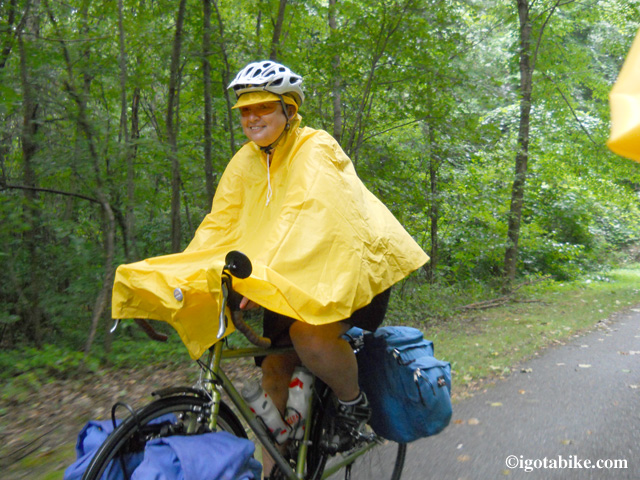
A step up from the drugstore variety is the bicycling poncho. We each got one of these from ebay for about $15 in 2012. We have only needed them once but they worked very well. My hands, handlebars and feet all stayed dry. My mirror was still usable. The hood with brim fit fine under my helmet and helped to keep the rain off my glasses. There is a clip to attach the poncho to a brake cable to keep it in place–it works great!

You can get a bicycling poncho for about $15. Works well to keep your hands and gloves and feet and shoes dry. The detacheble hood with brim also works well.

You can get a bicycling poncho for about $15. Works well to keep your hands and gloves and feet and shoes dry. The detachable hood with brim also works well.

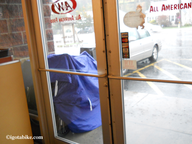
It would be nice to have some kind of rain covers for the panniers but that is just another thing to carry. Everything inside the panniers is first put into a plastic bag. It would be a bummer if the panniers got soaked but that has never happened. There is usually someplace to take shelter to wait out a rain shower. We also carry a really nice tarp that can cover the bikes.

Here are our bikes tucked under our cool tarp that our friend Nancy gave to us. If is fabric, has multiple tie downs and packs down very small.

Here are our bikes tucked under our cool tarp that our friend Nancy gave to us. If is fabric, has multiple tie downs and packs down very small.

Posted in Getting Started | Tagged | Comments Off on Getting Started Bicycle Touring: Rain Gear and Ponchos

Getting Started Bicycle Touring: How to pack for a bicycle tour, says the girl

Women always ask me how do I get along for weeks on the bicycle with not much room for clothes. This is definitely a case where less is more. I have learned that the less you have, the less you have to look after and less you have to pack and clean and the more happiness you have. We always make at least one trip to the post office to mail stuff home.
The photos here are from our 2011 bike tour in southern Ohio. We loaded the bikes in to our pick-up truck and drove to the Xenia station and parked it there for two weeks. We took off on our bicycles and rode the Little Miami Scenic Trail south to Cincinnati and crossed the Ohio River to get to my brother’s house using Kentucky Route 8. My brother drove us, and our bikes, to the southern end of the Great Miami Trail and we went north to Dayton, Brookville, Piqua, Urbana, Springfield, London and finally back to Xenia. Totaled 450 miles.
We both had flat bar aluminum road bikes that we forced into touring bikes. It worked. We rode at least 4000 miles with this set-up. Guy rode a Raleigh Route 66 and I had a Giant FCR.

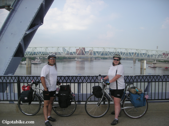
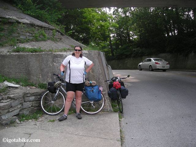
Guy and Carol on loaded aluminum road bikes forced into duty as touring bikes as we cross the Ohio River to Kentucky. We rode these bikes from 2007 to 2011 and went on three big tours and many smaller weekend or overnight tours.

It wasn’t the greatest because the front wheels were squirreley because the weight was too high. Both bikes had carbon forks and no braze-ons so getting a rack on the front was a challenge. I also had no idea that the aluminum frame was making things hurt.
The front racks we used are not such a great idea. They attach to the brakes. But, like I said, it worked. My front rack came with a three compartment mini pannier. This is where we put all the tools, spare tubes, cable lock, first aid kit, and snacks.
My vintage rear panniers are huge. I have to be careful not to over-stuff them or it gets too heavy. In one side I carried the tent and stove and our towels. I had my clothes, u-lock and off-the-bike shoes on the other side. We used bungee cords to attached the rolled up thermarest sleeping pads. The back pockets carried our cups and utensils, tent poles and other misc.
Guy’s vintage front panniers were also too high making his bike hard to handle. In the front he carried our sleeping bags and rain ponchos. In the back he carried the stove fuel, cook set, flask, food and his clothes and u-lock and off-the-bike shoes on the other side. He also had a trunk for books, maps, and misc. We had a small insulated bag on his front to try to keep food cold.
The next year we bought steel bikes, Guy a Trek 520 and a Jamis Aurora for me. I love my bike. I love it because it is steel. With a steel bike you get proper braze-ons so you have more options for mounting racks and panniers.

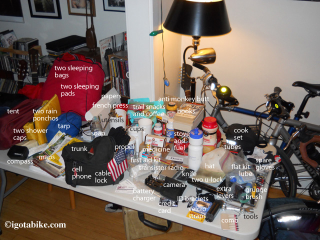
This is acutally the 2012 gear pile but it is always about the same.

See our bicycle camping checklist here.

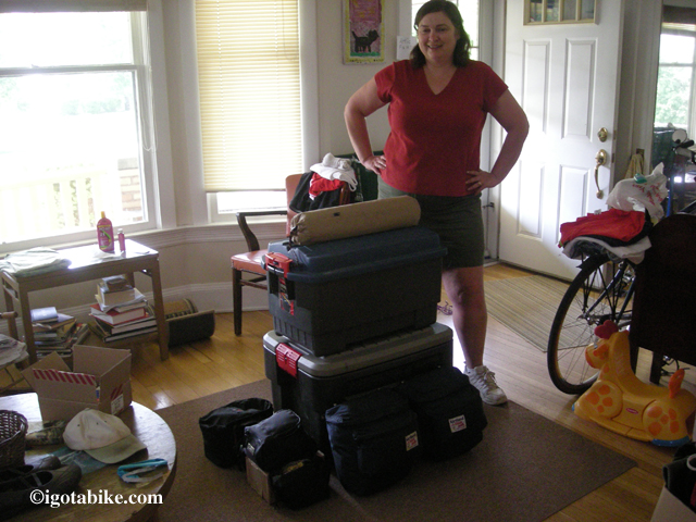
The stack in front of me is what we are taking on the bicycle tour for two weeks in 2011.

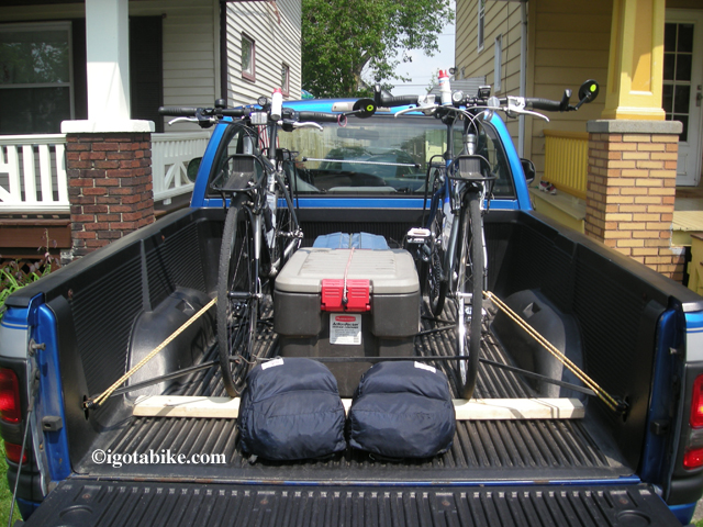
Here is all the gear and bikes loaded in the truck for the drive to Xenia.

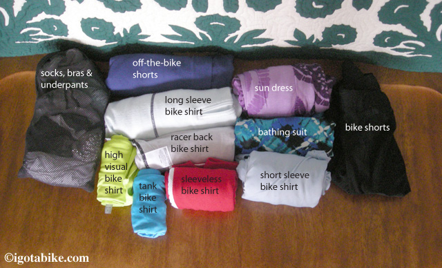
This is clothes I brought for two week tour in 2011. I took the photo while wearing a set of cycling clothes— So I had 2 pair of bike shorts and one more shirt. Missing from the pile is long pants. It was hot and the long pants I brought were heavy so I mailed them home. I regretted that when it got cold again a few days later. I also had a light wind breaker and a cheap rain poncho and a baseball cap. This is still a lot of clothes, it could be trimmed down but I like to be comfortable. I always roll my clothes--they pack down smaller and don’t get wrinkled. The short sleeve white bike shirt is key to cover up from too much sun.

In this front view of Guy's bike you can see how high his front panniers are mounted making his bike wobble.

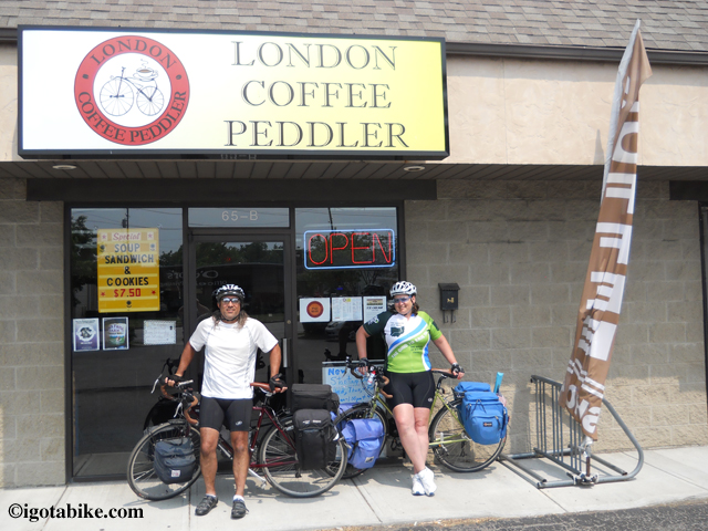
The London Coffee Peddler

Here we are with our new steel bikes outside The London Coffee Peddler on the 2012 tour. Notice how low the panniers are in front. We fit the sleeping pads inside my new vintage front panniers so there is nothing lashed on to either bike.

Posted in Getting Started | Tagged | Comments Off on Getting Started Bicycle Touring: How to pack for a bicycle tour, says the girl

A Perfect Meeting at the fork in the Ohio to Erie Trail

Captain Blue and Carol meet at the fork in the trail.

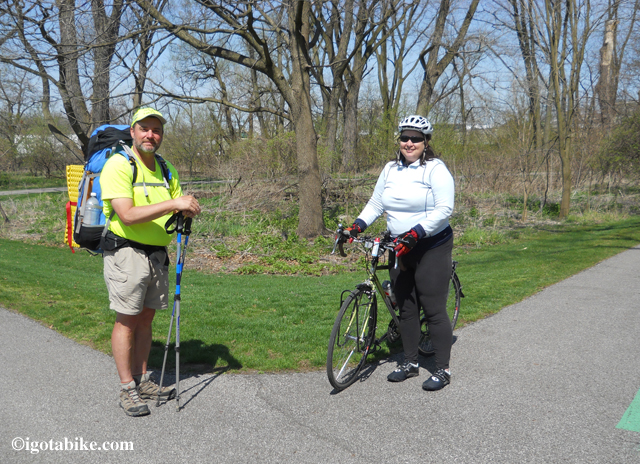
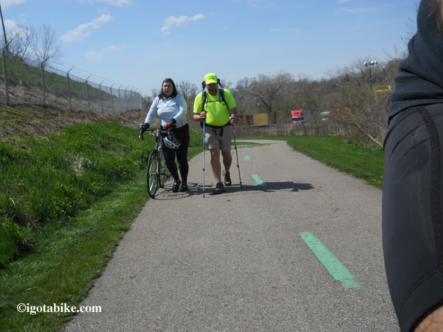
There is a fun 1/8 mile loop dee lou fork in the trail in the Ohio and Erie Canal Metroparks near the Harvard Road trail head. This is where we found Captain Blue just as he was wondering which way to go. It was his last navigational trick on his 300+ trek from Cincinnati.
We walked with him awhile and shared some stories about the route and talked about ideas for the igotabike Ohio to Erie Trail Guide.
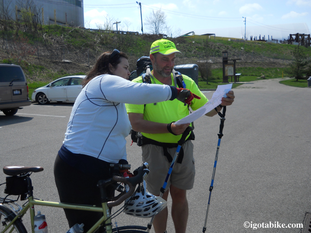
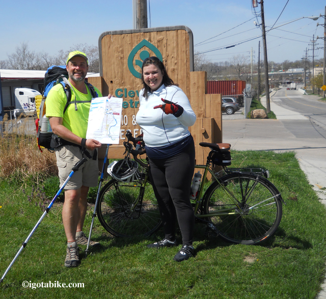
I got a big smile on my face when Andy pulled a piece of paper out of his pocket and unfolded the igotabike map of Cleveland. We knew he could find his way since he had the map so we gave him a big congratulations and parted ways. We took off down Quigley Road and he headed up to Tremont and on to Lake Erie in downtown Cleveland.

Walking is so slow!

Its easy! Just follow the map.

Andy printed the igotabike Cleveland map at Staples. Stand by the igotabike Trail Guide will be available for sale very soon.

Andy printed the igotabike Cleveland map at Staples. Stand by the igotabike Trail Guide will be available for sale very soon.

Posted in Blog | Tagged , | Comments Off on A Perfect Meeting at the fork in the Ohio to Erie Trail

April 17th Spring Training Ride

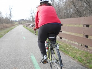
Action shot!

This afternoon the weather seemed nice at around 50 degrees and sunny with blue sky. Surprise we ditched our laptops and hopped on our bikes. Lucky for us.
We headed over to the Rocky River Reservation of the Cleveland Metroparks. This is one of our regular training routes and it totals 16 miles. From our house it is six miles to the Stinchcomb entrance. From here we go north and exit at the Emerald Necklace Marina near where the Rocky River dumps into Lake Erie. Then we weave through the neighborhoods back home. The wind kicked up and blew us backward. The internet said 21 mph sustained NE.
Hey “2manyhills” we stopped for a sandwich on the way home.

Here is Carol at the Public Landing Emerald Necklace Marina near where the Rocky River dumps into Lake Erie.

Emerald Necklace Trail Rocky River Reservation of the Cleveland Metroparks

This section of the Rocky River Reservation of the Cleveland Metroparks is just south of the mouth of the river and was hit hard by hurricane Sandy in 2012.

Posted in Blog | Tagged , | Comments Off on April 17th Spring Training Ride

April 14th Spring Training Ride

Went for a nice little 22 mile training ride this afternoon. We’re getting an earlier start than last year, which is good.

Started the day off with a flat rear tire on my Trek… in my LIVING ROOM!

Ha! I guess that’s way better than on the road. Turns out there was a hole in the inside of the tube. Weird. I guess that’s a “pinch” flat. I don’t know.

Anyway, I patched it and we hit the road. Basically rode down Ridge through Brookside Park, up Memphis to Broadview, down Broadview to West Schaaf (an excellent biking road) then down into the Cuyahoga Valley along the Ohio and Erie Canal Towpath and headed north. From there we exited the trail at the Harvard Road Trail Head, up through Tremont, then back out Lorain Avenue to home.

Fun.

It was neat to be on the trail at this time of year. You could see way through the trees. The temperature was perfect- right around 50 degrees. I’m glad we went. I can tell what needs work: The palms of my hands and my wrists got pretty sore, and so did the bottoms of my feet.

I don’t care- it’s just so great to be out riding again!

april 14, 2013

April 14, 2013 on the Towpath Trail!

Added by Carolyn: We have always been less than diligent at keeping a daily bike ride journal. Should we put it on this website?

We rode on January 12, 2013 , in the Rocky River Reservation of the Cleveland Metroparks and totaled 16 miles but we felt like that was part of the 2012 season.

On March 30th we arrived an hour late for our nieces birthday party so we could squeeze in a ride. We went up and down the neighborhood streets like ten year olds. We rode 5 miles but were never more than a mile from our front door.

On April 4th we rode to downtown Cleveland and went back and forth, to and fro, and up and down and in and out of the flats getting the information for the Cleveland bridge update. 14 miles total

On April 9th we rode over to check on the condition of the Treadway Creek Trail and it still abandoned. We came back west via Tremont to Lorain Avenue. 14 miles total.

Season total as of 4/14/13 is 54 miles.

Posted in Blog | Comments Off on April 14th Spring Training Ride

Cleveland Bridge Construction Update Spring 2013

UPDATE May 11. 2013 the West 3rd Street Bridge is now open. Doesn’t matter. West 14th Street through Tremont is the best way to go.

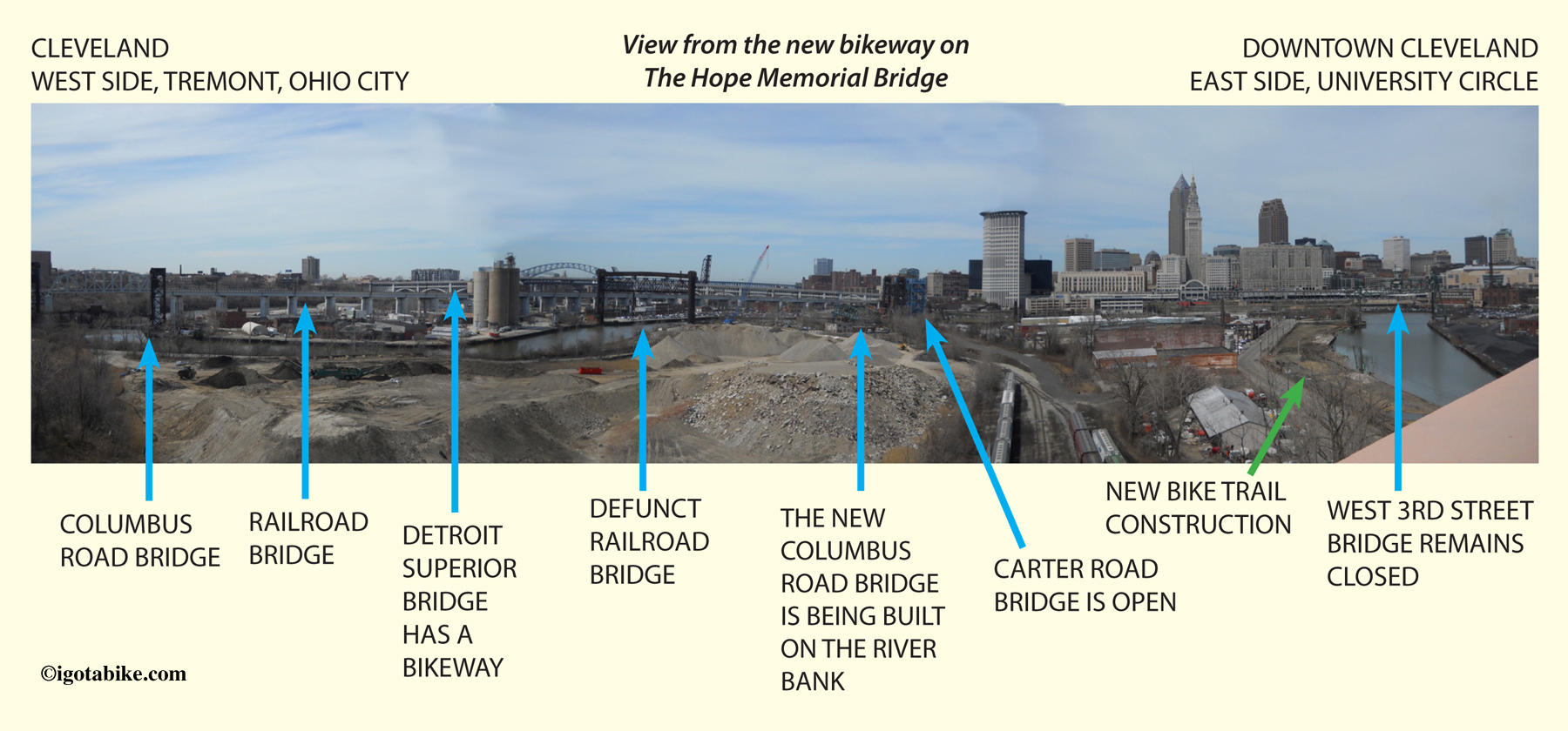
The official route of the Ohio to Erie Trail remains blocked due to the West 3rd Street Bridge being closed. (see the workaround map here) The Abbey Street bridge is now open in both directions. The new bikeway pedestrian section of the Hope Memorial Bridge is complete and open. Construction of the new Interstate 90 bridge is well underway and continues to make routes unpredictable with roads opening and closing daily.
Navigating from the Ohio to Erie Trail head at Harvard Road to and around downtown Cleveland (see description and map here) by bicycle is a bit complicated because of the Cuyahoga River. Cuyahoga translates to crooked river and it is very crooked. The land around the river, known as “the flats” is a large pit and you need to know how to get down in there, find a way to cross the river and then back up and out the other side. There is a lot of industry and few roads. Or you can go over the flats and the river on one of two bridges: The Hope Memorial Bridge (AKA Lorain Carnegie Bridge) or the Veterans Memorial Bridge (AKA Detroit Superior Bridge). Both of these bridges have a bikeway that is separate from vehicle traffic.

The Ohio to Erie Trail accesses downtown via the West 3rd Street Bridge. The route travels from Harvard Road, along Jennings Road and behind Steelyard Commons and exits the bike path onto Quigly Road which brings you to the West 3rd Street Bridge which is persitantly closed. The purported plan is to open the West 3rd Street Bridge very soon so that the Columbus Road Bridge can be repaired. However the projected date has passed.

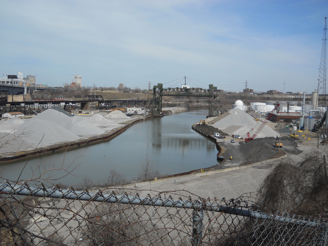
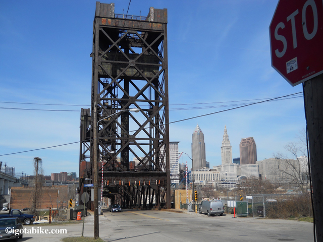
The West 3rd Street Bridge is rumored to be opening soon so the Columbus Road Bridge can be closed.

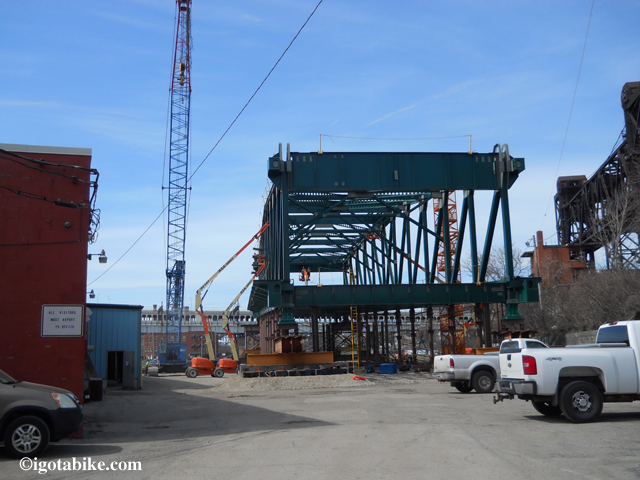
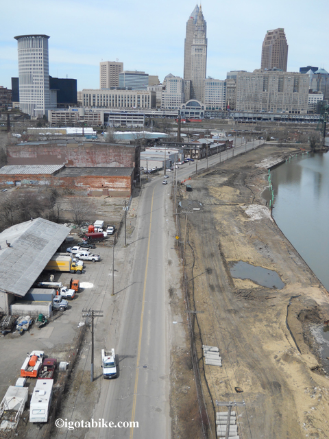
Workers are constructing a new platform for the Columbus Road Bridge in a parking lot along the river bank. The city needs to open the West 3rd Street Bridge before they can install this new bridge section.

The Columbus Road Bridge will close for repairs in 2013.

The igotabike workaround route has you continue on the bike path behind Steelyard Commons and under Quigley Road and up a small hill into Tremont on West 14th Street and across the Abbey Avenue Bridge to access the Hope Memorial Bridge. In 2012 the Abbey Avenue Bridge was under construction and was closed. It is now open. There are bike lines on the approach to the bridge and plenty of room on the bridge. Also in 2012 The Hope Memorial Bridge was under construction and they added a bikeway to the north side of the bridge which is now open. If you are traveling east you are expected to cross the six lanes of traffic on both sides of the bridge to access the bikeway.

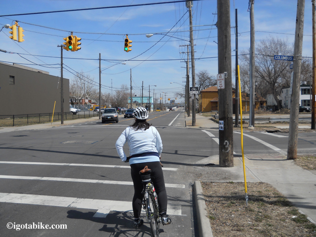
The Abbey Avenue Bridge construction is complete. Turning left at this intersection takes you downhill to the Columbus Road Bridge which is scheduled to close for renovation in 2013.

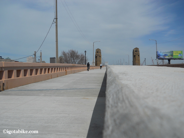
The Hope Memorial Bridge bikeway is on the north side of the bridge is now open.

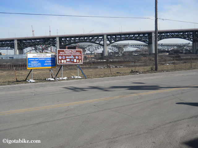
They are building a bike trail along Scranton Road.

The sign says there will be a bike trail along Scranton Road. That is The Hope Memorial Bridge and Interstate 90 bridge in the background.

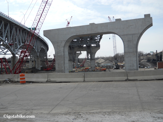
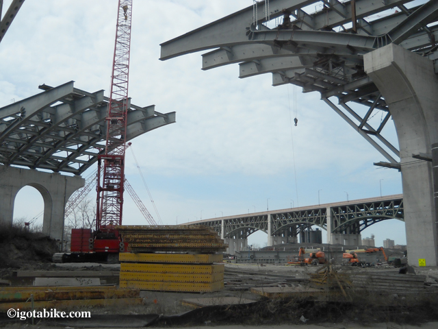
Interstate 90 travels over the Cuyahoga River on steel truss arch bridge (left) of the same age and design as the I-35W bridge in Minneapolis that collapsed into the Mississippi River in 2007. ODOT is building a replacement bridge right next to it and the construction routinely causes road closures.

The new Interstate 90 bridge that crosses the Cuyahoga River routinely causes road closures and traffic snarls but it is very interesting to watch. The construction is more of a problem for motorist—on a bike there is usually a way around.

Posted in Blog | Tagged , | Comments Off on Cleveland Bridge Construction Update Spring 2013

Andy has boots, no bike

A few weeks ago Guy and I got a call from Andy asking us for information on the Ohio to Erie Trail. He was keenly interested in information on route finding and mileage as he was planning to hike the Ohio to Erie Trail. That’s right, I said hike, not bike.

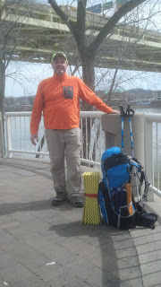
Here is Andy, AKA Captain Blue, on day 1 of his 300 + hike on the Ohio to Erie Trail.

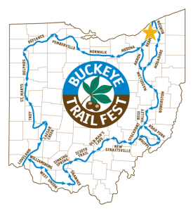
Andy left yesterday from Yeatman’s Cove in Cincinnati and plans to walk the 300+ miles to arrive in Cleveland in 3 weeks. He is headed to the Buckeye Trail Fest which is in Kirtland, Ohio on April 25-28.
Last year Andy hiked the entire Buckeye Trail, which is a 1,444 miles loop around the state of Ohio.

The Buckeye Trail is for hikers, not bikers.

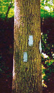
Much of the Buckeye Trail and the Ohio to Erie Trail are contiguous in the the north along the Ohio and Erie Canal Towpath Trail and the Little Miami Scenic Trail in southern Ohio. You may have seen the blazes. The Buckeye Trail is marked by light blue rectangles painted on trees.

The Buckeye Trail is marked with blue blazes. Pictured here is a double blaze indicating a right turn.

It was fun getting to know Andy and considering the cross-state route on foot. Guy and I were once avid backpackers but traded in our packs for panniers a few years back. We have experience backpacking in many different places so we can relate to Andy’s pace and gear.
He was likely feeling pretty chipper as it was the first really nice warm day since winter.
It was in the mid 50s in Cleveland so it was likely in the 60s in Cincinnati.
Guy and I went out for a crazy twisty zigging and zagging bike ride around downtown Cleveland and back and forth across the Cuyahoga River checking the condition of the bridge construction, or not. Details and photos soon…

Posted in Blog | Comments Off on Andy has boots, no bike

Biking and typos

Who could have guessed that riding a bike could lead to problems with typographical errors.
Jody, an igotabike subscriber, pointed out that the word Olentangy was misspelled on our website.
The maps for the route through Columbus that follow the Olentangy Trail have been wildly popular and have been viewed by hundreds of people. If you are one those folks please be advised that the correct spelling is Olentangy (not Olantangy).
This was a pretty painful goof as the error appeared on the maps, on the photos, in the captions, in the descriptions, in other posts and more. It could have been worse. According to wikipedia the river should have been named keenhongsheconsepung.
Thanks Jody for making the effort to help us get it right.
Guy and I are always interested in local information, updates, tips, corrections, suggestions.

Posted in Blog | Tagged , | 1 Comment