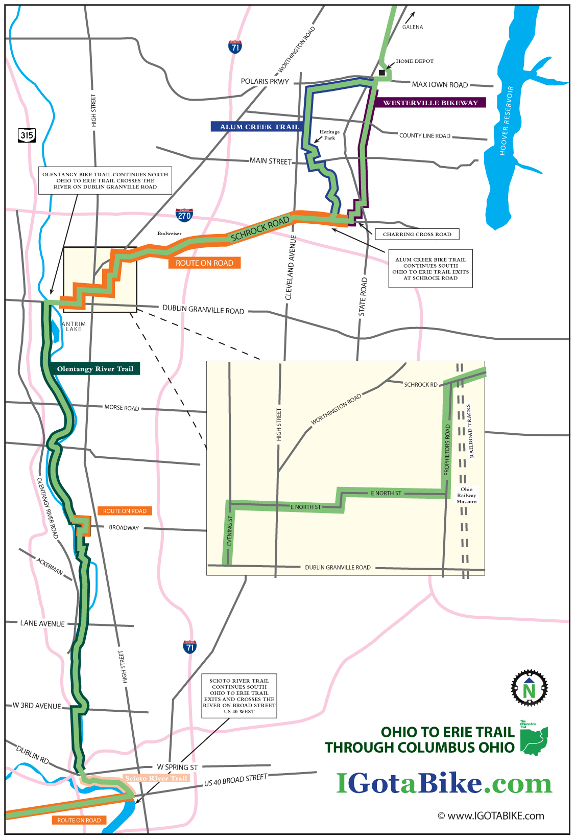
The Ohio To Erie Trail through Columbus is fairly easy to navigate going south to north. From US 40 / Broad Street you pick up the The Scioto River Trail in downtown Columbus and then follow the Olentangy Trail north to Dublin Granville Road where the route switches to on-road and follows Schrock Road east. Then it is riders choice to use the bike trail that goes through Alum Creek Park or the bike trail that goes through Westerville. The road riding is a bit difficult in spots and finding the next turn can be tricky but it is overall a very nice route considering the challenges of urban riding. It is approximately 25 miles.
UPDATE February 2014: New section south of Columbus via the Scioto Trail
Until late 2013 the Ohio To Erie Trail used the Broad Street Bridge at Marconi. The new route follows the Scioto Trail west of Columbus. This new section is made possible by the bridges that cross the Scioto River 3 times. This new route eliminates several miles of road riding on US 40 Broad Street between Marconi and Westgate. The recommended road route is illustrated on Map 3, Panels 3, 4 & 5 of the Ohio To Erie Trail Printed Maps. You still need to use US 40 Broad Street to get under Interstate 270.
UPDATE April 2013: The Olentangy Trail detour between Lane Avenue and Dodridge is over. The Olentangy Trail is now contiguous through the Ohio State University campus.
For the north to south route click here.
US 40 / Broad Street to Dublin Granville Road via The Scioto River Trail and The Olentangy Trail (approx 11 miles)
Traveling east on US 40 / Broad Street you will come into downtown Columbus and will need to pick up the Scioto River Trail north. Look for a giant museum called COSI on your right and a replica of the Santa Maria down below the bridge on your left. This is where you turn left to head north on the Scioto River Trail immediately after crossing the river at the north west corner of Broad Street and Marconi Blvd. The trail begins in a park just above the ship and heads north with the river on your left.
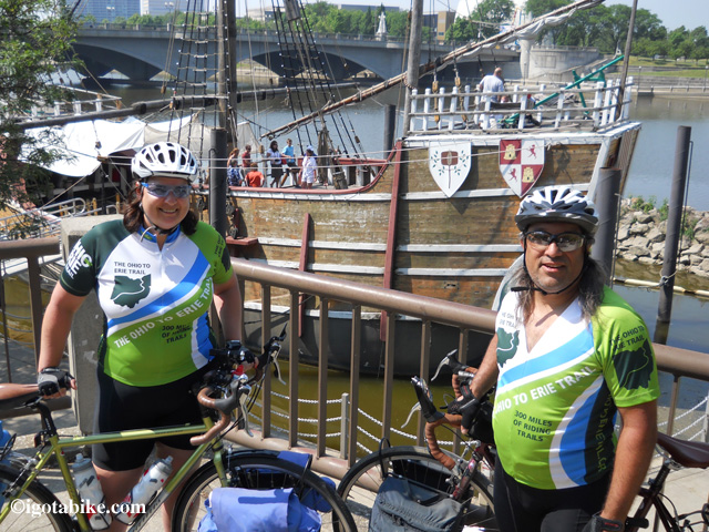
The replica of the ship Santa Maria is your landmark for the spot where you exit US 40 / Broad Street and turn left after crossing the bridge to pick up the Scioto River Trail. The bridge in the background of this photo is US 40 / Broad Street.
It is just one mile to the intersection with The Olentangy Trail where you turn right and cross Dublin Road / W Spring Street to continue north on The Olentangy Trail. There is a giant boating club just as you approach the interchange.
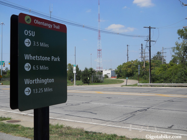
There is a sign at the intersection of the Scioto River Trail and The Olentangy Trail. This view is looking north.
There is a sign at the intersection of the Scioto River Trail and The Olentangy Trail. This is where you turn right to leave the Scioto River Trail and continue north on The Olentangy Trail. (NOTE to through cyclist from far away: OSU is Ohio State University, Whetstone is a local park and Worthington is a suburb to the north where you will turn to follow Dublin Granville Road.)
The Olentangy Trail is fairly well signed and has a yellow dashed line down the center that will help to keep you on course as there are many side spurs and connectors that do not have the painted dash lines.
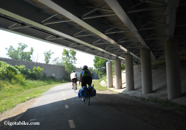
The Olentangy Trail has a yellow dashed line down the center that will help to keep you on course as there are many side spurs and connectors that do not have the painted dash lines. Follow the yellow dashed line.
(note: this is actually a southbound photo from day 5 of our 3-week long 2012 tour with our buddy Scott leading the way) Its a nice shot of the dotted line.
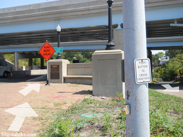
“Gopher holes” go under the bridge to access the trail from either West Third Avenue. Continue north with the river on your left.
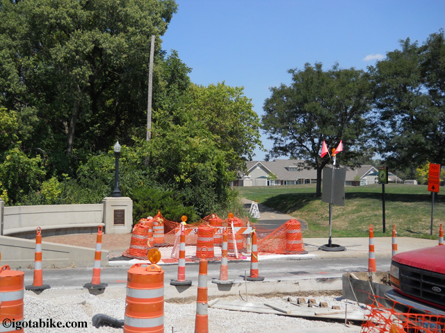
In August 2012 the bridge crossing West Third Avenue along the Olentangy Trail was under construction. Continue north following the detour around the block, and after construction continue through the tiny Harrison North Park pictured here.
UPDATE APRIL 2013: The detour described below has ended. The Olentangy Trail is now contiguous through the Ohio State University campus. Use the detour route if you want to experience Buckeye country.
At Lane Avenue The Olentangy Trail is detoured and you will make a hairpin turn to the right to go up to the road and turn right to cross the suspension bridge.
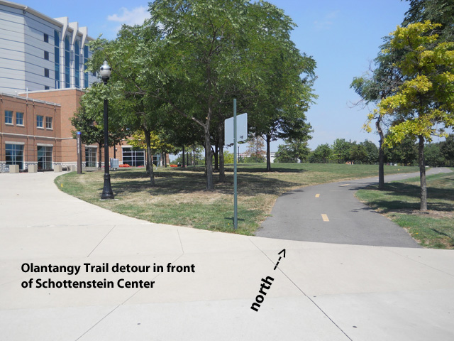
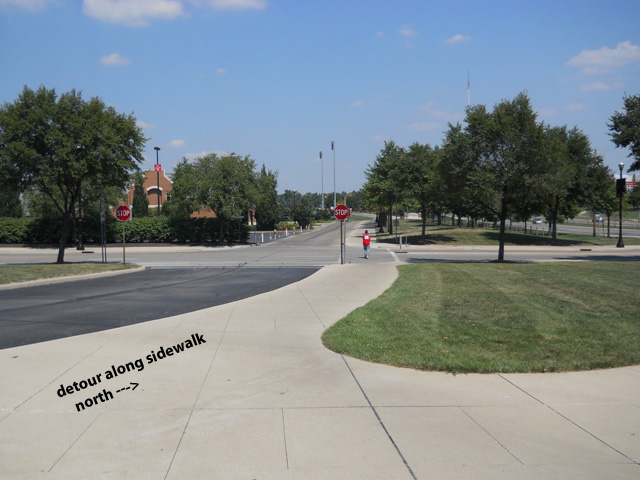
Use the crosswalk to cross Olentangy River Road and turn right and follow the sidewalk in front of the Schottenstein Center.
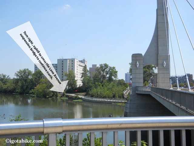
The Olentangy Trail is detoured, turn to the right to go up to Lane Avenue and turn right to cross the suspension bridge. You will be in front of the Schottenstein Center.
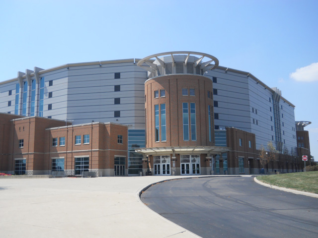
The Schottenstein Center is the landmark for navigating the Olentangy Trail detour between Lane Avenue and Ackerman Road.
The Schottenstein Center is the landmark for navigating the Olentangy Trail detour through the Ohio State University campus. The detour follows Olentangy River Road on the west side of the street between Lane Avenue and Ackerman Road.
Follow the detour signs as the trail appears and re-appears and as it utilizes sidewalks along Olentangy River Road and passes in front of the Jack Nicklaus Museum.
The trail will take you back across Olentangy River Road at the intersection of Ackerman and you will be on W Dodrige Street, facing traffic, behind a temporary concrete wall for 500 feet and you will turn left into Schiermeier Olentangy River Wetland.
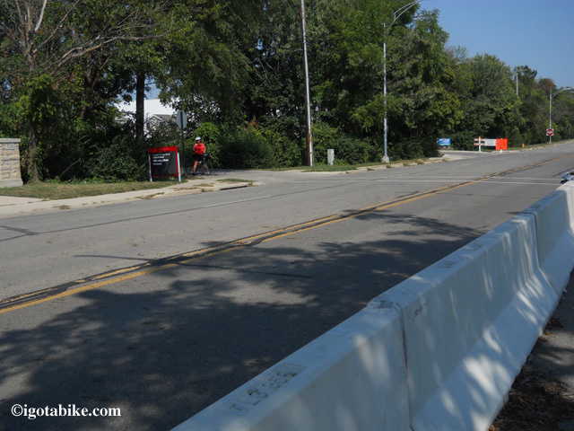
Following the detour along W Dodrige Street, you will be behind a temporary concrete wall for 500 feet and you will turn left into Schiermeier Olentangy River Wetland.
As the trail continues north it utilizes the road for a short distance through the Clintonville neighborhood. (It is a nice area with beautiful homes and gardens.) It is well signed, easy to navigate and approximately 1 mile. (At the intersection of Riverside and W Como Avenue the trail dead ends and follows Riverside Drive – turn right on Delhi – turn left on Milton – turn left on W Kenworth which turns into Olentangy Blvd – turn left on Northmoor and the route becomes trail again as Northmoor dead ends into Northmoor Park)
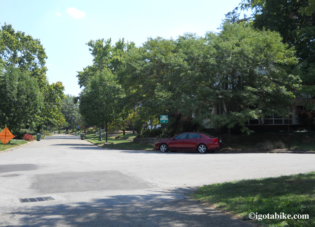
No worries as the trail is well signed as it continues north and utilizes the road for a short distance through the Clintonville neighborhood full of beautiful homes and gardens. Your only worry will be trying to figure out why you don’t live here, right on the trail!
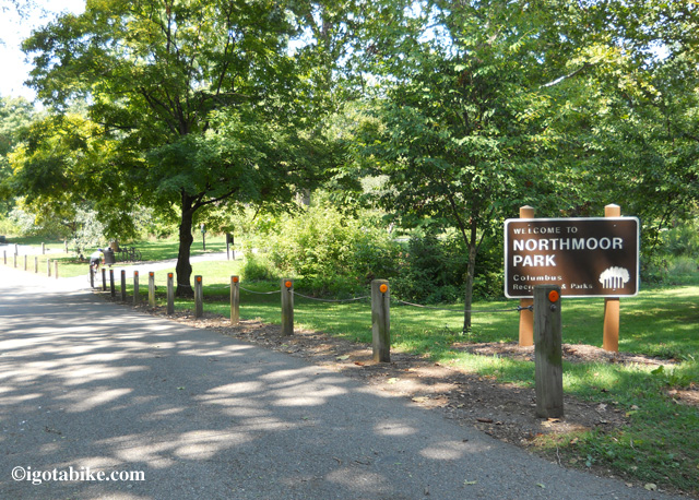
The route becomes trail again as Northmoor dead ends into Northmoor Park. There are picnic tables just ahead and a drinking fountain coming up at Antrim Lake.
Just after passing through the Park of Roses and Whetstone Park the trail follows the road to cross the river at W Henderson Road and continues north with the river on your right. There is hairpin blind turn and a fish-eye-mirror mounted on a tree to aid your view. Use caution here.
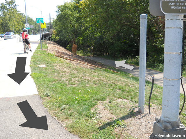
In a now familiar fashion the Olentangy Trail exits the treeline to follow the road-side trail to cross the bridge over the Olentangy River and continue north. In this photo Carol is facing south. The arrows point north.
There is a drinking fountain along the trail in Antrim Park. The trail exits the woods and travels along-side a chain link fence that parallels Route 315.
When the trail arrives at the intersection of Dublin Granville Road turn right and cross the river using the Dublin Granville Road bridge and proceed on the trail that parallels Dublin Granville Road.
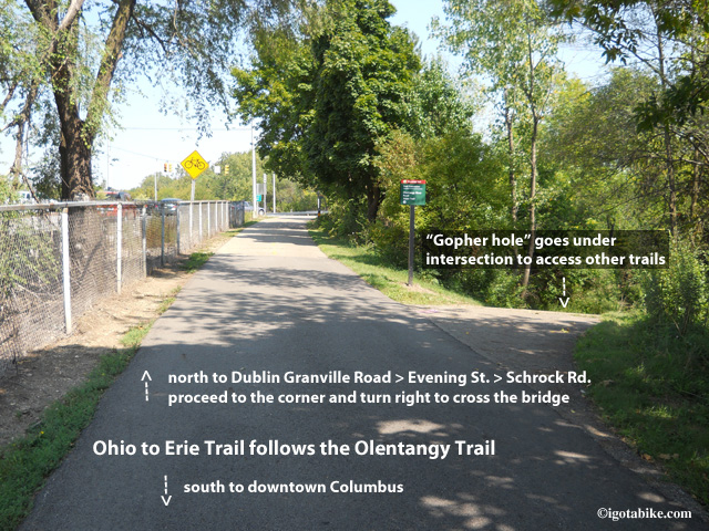
To follow the Ohio to Erie Trail north ignore the “gopher holes” that take you under the intersection of 315 and Dublin Granville Road. Turn right and cross the bridge on Dublin Granville Road.
THE OLENTANGY TRAIL AT DUBLIN GRANVILLE ROAD TO WESTERVILLE
Just across the Dublin Granville Road bridge you will follow the trail as it dead ends into a neighborhood street that parallels Dublin Granville Road. (Ignore the bike trail that is a 180° hairpin right turn that goes under the bridge and goes north.) Continue forward to head east to continue the northbound route of the Ohio to Erie Trail.
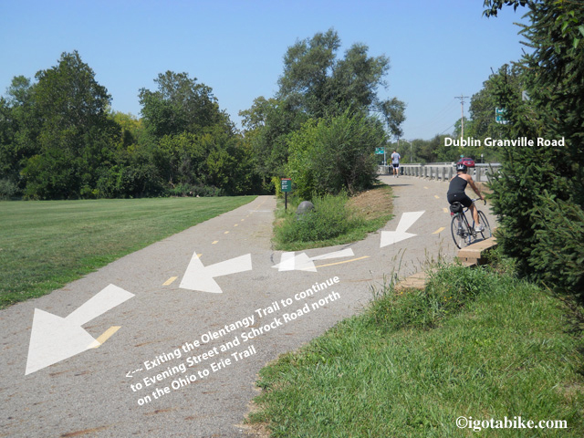
Just across the Dublin Granville Road bridge you will veer downhill and follow the trail as it dead ends into a neighborhood street that parallels Dublin Granville Road. Ignore the hairpin turn.
Follow this little side street up to the traffic light and turn left onto Evening Street. Turn right on E North. You will cross High Street. Turn left at Pingree to stay on E North and follow it until it dead ends at Proprietors Road, turn left. You will see the Ohio Railway Museum at the intersection of E North and Proprietors Road.
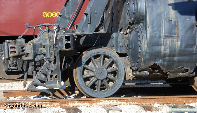
You can’t miss seeing the the Ohio Railway Museum at the intersection of E North and Proprietors Road where you will turn left to get to Schrock Road.
Follow Proprietors Road until it dead ends at Schrock Road where you turn right and cross the railroad tracks. Follow Schrock Road past the Budweiser plant. You will go over Interstate 71 and over Interstate 270. You are now approaching the place to choose to use the bike trail that goes through Alum Creek Park or the bike trail that goes through Westerville. We rode both and they are equal in distance and both are pleasant.
ALUM CREEK TRAIL:
To use the Alum Creek Trail you will access the trail at the Schrock Road bridge that crosses Alum Creek. Just past the bridge turn right onto the trail and use caution as it makes a right hand hairpin turn to go under the bridge and continue north.
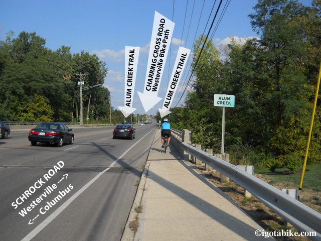
There is access to the Alum Creek Trail from both sides of Schrock Road at the bridge that crosses Alum Creek. The Westerville Bike Trail terminus is just ahead, uphill at the intersection of Charring Cross and Schrock Road.
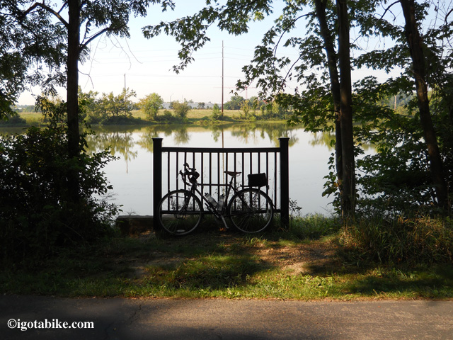
The Alum Creek Trail is nice and scenic and passes by a Lake. Guy’s Trek 520 is the perfect bike for exploring The Alum Creek Trail and the route through Columbus—even without panniers!
You will wind through the woods past a lake and along a pasture and will come to a bridge where the trail continues forward to Main Street or turns right to go under the bridge.
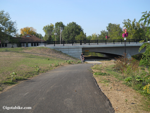
This photo shows the Main Street bridge with a bike trail going under the bridge where it dead ends into the parking lot behind the Senior Center. Stay up on top and go forward on the bike bath (out of view, left) up to Main Street to turn left.
Go forward to Main Street and turn left on the trail, facing traffic and go down to the crosswalk to cross Main Street in front of the Westerville Senior Center. Follow the trail past a 911 Monument and in front of the Westerville fire department.
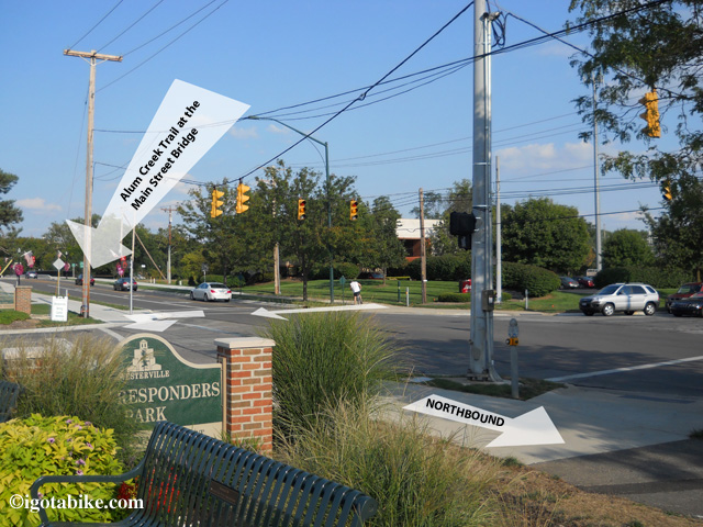
The Alum Creek Trail crosses Main Street in front of the Westerville Senior Center. Follow the trail past First Responders Park and the Westerville fire department. This view is looking south.
Just beyond the Westerville fire department the bike trail picks up again and the trail is separated from vehicles by bricks as you enter Heritage Park.
Pick up the brick lined bike path that heads into the woods. In 1000 feet you will turn left at the balusters and exit Heritage Park.
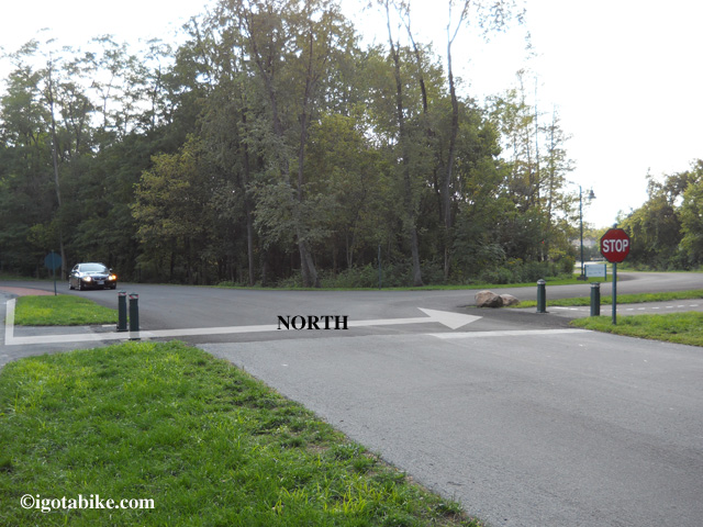
After a short distance along the brick lined path you need to cross the street at the bollisters to exit Heritage Park and go toward Cleveland Avenue. If you miss this turn the bike trail goes into the park and makes a loop. There was no sign when we were there but there is a green 4 X 4 post.
At Cleveland Avenue turn right to cross over the river on the bike path bridge that parallels Cleveland Avenue on the east side of the street. There are connector trails that take you under the bridge to a giant sports complex that you will see ahead of you on the left. You want to go over the bridge.
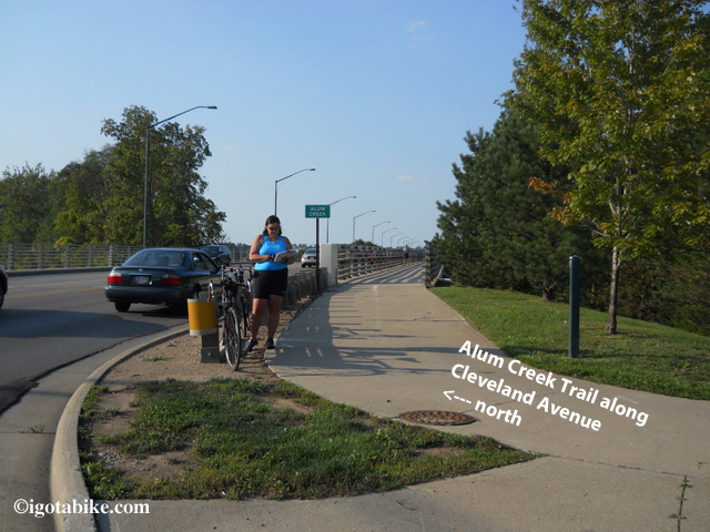
After exiting Heritage Park turn right to cross over the river on the bike path bridge that paralells Cleveland Avenue.
Follow the concrete bike path north and turn right on the bike path at the intersection of Cleveland Avenue and Polaris Parkway which turns into Maxtown Road.
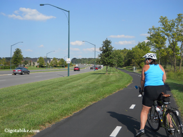
The bike trail on the south side of Maxtown Road / Polaris Parkway which connects to the Alum Creek Trail via Cleveland Avenue.
To continue north cross Maxtown Road near the entrance of Home Depot and turn right on the path, facing traffic, for 200 feet and follow the trail when it turns left to go behind Home Depot.
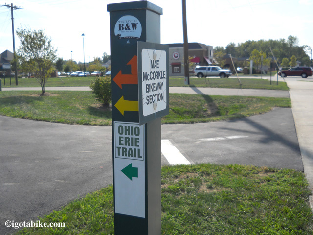
The bike trail north crosses Maxtown Road near the entrance of Home Depot. There is a sign that markes the crossing. This is the spot where the Westerville Bike Path and The Alum Creek connector bike trail meet.
You will pass behind the Trek store and they provide free air and water to cyclist at their back door. Continue on this trail where it turns right at the UDF and heads into the treeline and follows Old Route 3 along the Hoover Reservoir and continues north to Cleveland.
WESTERVILLE BIKE TRAIL:
Continue on Schrock Road and cross over Alum Creek and the Alum Creek bike trail and proceed uphill a short distance to the traffic light and turn left onto Charred Cross Road. (note that on the other side of Schrock Road Charring Cross Road is called Brooksedge Blvd.)
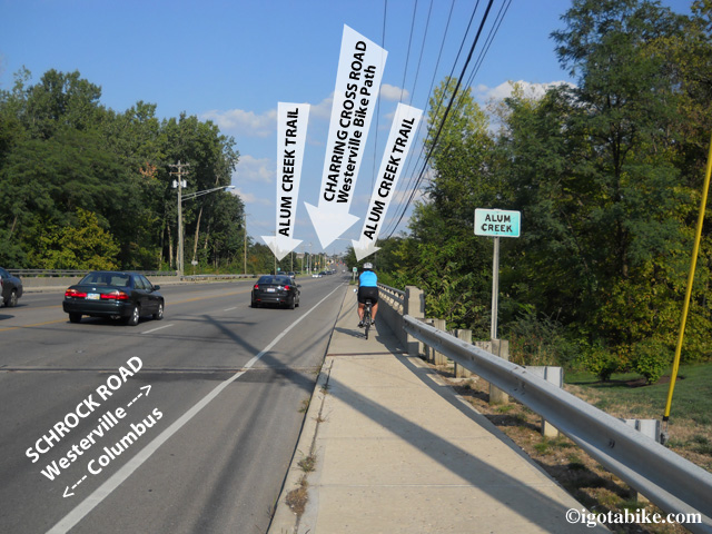
The Westerville Bike Trail terminus is at the intersection of Charring Cross and Schrock Road just beyond the Scrock Road bridge that crosses Alum Creek and the Alum Creek Trail.
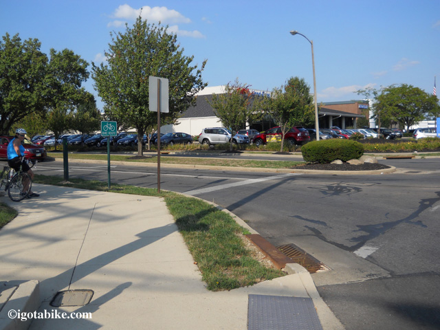
Intersection of Charring Cross and Schrock Road. terminus of The Westerville Bike Trail is a few hundred feet down Charring Cross and turns right to connect to S State Street.
Head down Charring Cross Road a few hundred feet and look for the bike trail on your right. This is a short connector that will take you up to S State Street where the trail turns left onto the sidewalk and appears to end. Follow the sidewalk down to the traffic light and use the cross walk to pick up the trail on the other side of State Street. There is a dedication marker for the Ohio to Erie Trail which is a brass plaque mounted on a knee high boulder. There are benches and shrubs and the trail heads into the treeline behind a Speedway gas station.
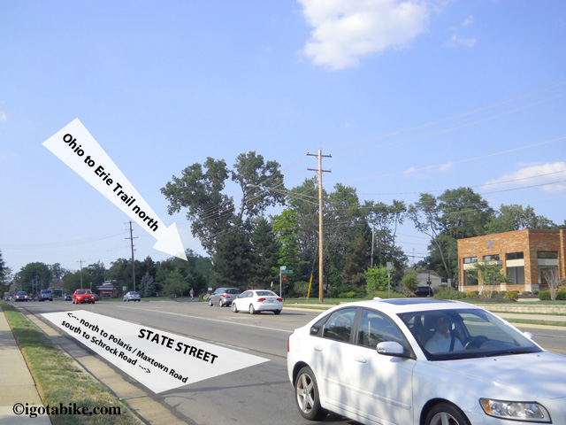
After picking up the bike trail connector from Charring Cross Road the trail appears to end. It is difficult to see that trail continues on the opposite side of S State Street.
The trail continues north through the neighborhood and there are many road crossings–we counted seven. Many of them are small residential streets but all require a full stop as traffic is heavy in this suburban retail area. The trail continues and runs behind condos, retail complexes, past a bail field and will arrive at Maxtown Road which is also known as Polaris Parkway. To continue north cross Maxtown Road near the entrance of Home Depot. This is the spot were the Westerville Bike Path and The Alum Creek connector bike trail meet and the is an Ohio to Erie Trail sign on a green metal post. After crossing Maxtown Road turn right on the path, facing traffic, for 200 feet and follow the trail when it turns left to go behind Home Depot. You will pass behind the Trek store and they provide free air and water to cyclist at their back door. Continue on this trail where it turns right at the UDF and heads into the treeline and follows N State Street along the Hoover Reservoir and continues north to Cleveland.
See wasn’t that easy!
This is awesome!! Best detail I’ve seen for a difficult section of the route.. I would have loved to have this for last summer’s ride. I’m pretty sure I’ll be riding it again this summer so I’ll keep checking back for up dates. Thank you.