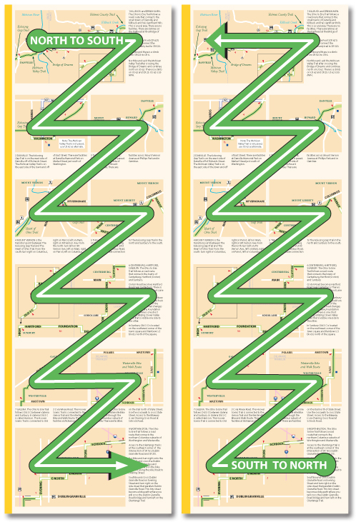
The Ohio To Erie Trail Printed Maps were designed to be easy to use if you are traveling north to south or south to north. The map panels and the accompanying text was created to be useful regardless of your direction of travel wherever possible. In the places where this is not possible the material is presented in a north to south order. The numbering of the maps and map panels is also oriented north to south. (Cleveland to Cincinnati).
The maps are printed on four sheets of paper with an overview map and section information on one side and detail map panels on the other side. The sheets are numbered and color coded. North is always up, at the top of each sheet and panel.
1 North Ohio Millersburg – Cleveland to Killbuck
2 North Central Ohio – Killbuck to Columbus
3 South Central Ohio – Columbus to Xenia
4 Southern Ohio – Xenia to Cincinnati
Each detail map panel is numbered. If you are traveling north to south read the panels top to bottom. If you are traveling south to north read the panel bottom to top.
The Ohio To Erie Trail Printed Maps read north to south and south to north
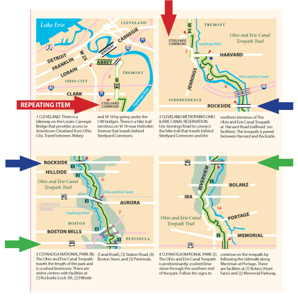
On each map panel there is one element, usually a road, that is repeated from the previous panel so you can remain orientated.
The Ohio To Erie Trail printed map panels have repeated elements.
 The maps are available from the Ohio to Erie Trail Fund with a donation of $5 per map kit.

