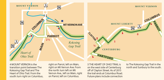
The Ohio To Erie Trail Printed Maps contain the most current information on newly paved trail sections and changes to the road routes of the Ohio To Erie Trail. Late in 2013 some new construction allowed several miles of road riding to be replaced by trail in key areas.
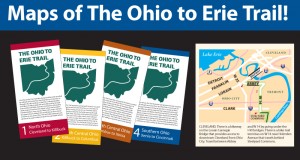 The maps are available from the Ohio to Erie Trail Fund.
New section of the Heart of Ohio Trail is Paved
The Heart of Ohio Trail is a gem! It is now paved between Columbus Road in Mount Vernon and Clayton Road in Centerburg. This new section of the Heart of Ohio Trail and the newly recommended road route is illustrated on Map 2, Panels 4 & 5 of the Ohio To Erie Trail Printed Maps.
The 2.5 miles between Thayer Road and Mile marker 11 on Rt 3 /36 is the latest section to be paved. This is an outstanding achievement as it keeps you off the 55 mph big road. There is still a 2.5 mile section of road riding to connect the Heart of Ohio Trail to the Kokosing Gap Trail but the connection is via smaller roads. There is a new recommended route that follows Main and Parrot between the Kokosing Gap trailhead on Mt Vernon Avenue to the Heart of Ohio Trail terminus on Columbus Road.
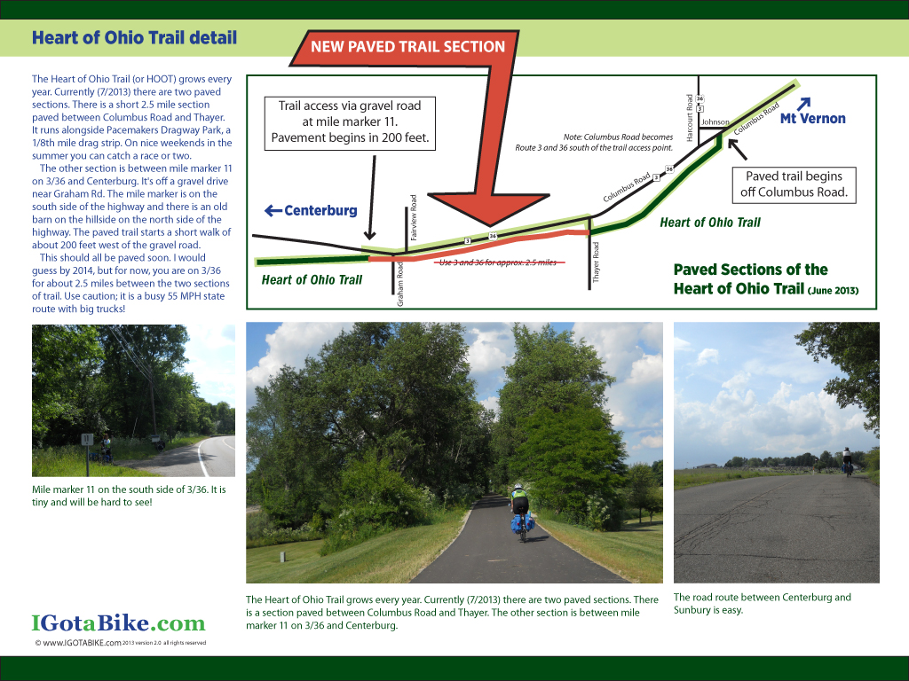
The IGotABike Ohio To Erie Trail Guide, Heart of Ohio detail, page 24
The IGotABike Ohio To Erie Trail Guide has a detail map and photographs with a description of the Heart of Ohio Trail on page 24. This map shows the connecting route using Columbus Road rather than Main and Parrot and does not show the new section of trail. (click here to see more on The IGotABike Ohio To Erie Trail Guide)
New section south of Columbus via the Scioto Trail
Until late 2013 the Ohio To Erie Trail used the Broad Street Bridge at Marconi. The new route follows the Scioto Trail west of Columbus. This new section is made possible by the bridges that cross the Scioto River 3 times. This new route eliminates several miles of road riding on US 40 Broad Street between Marconi and Westgate. The recommended road route is illustrated on Map 3, Panels 3, 4 & 5 of the Ohio To Erie Trail Printed Maps. You still need to use US 40 Broad Street to get under Interstate 270.
New section of The Camp Chase Trail
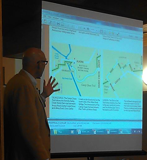
Jerry Rampelt has the new Ohio To Erie Trail Maps on
the big screen showing the new Camp Chase Trail section.
There is a newly paved section of the Camp Chase Trail between Galloway and Georgesville. (south of Columbus, north of London). There is also a newly recommended route that uses Norton Road and Hall Road to eliminate a section of Galloway Road. The new trail section eliminates riding on Alkire Road and utilizes the Battelle Darby Creek Metropark Road from Kropp Road. The route still uses the Alkire Road bridge to cross the Darby Creek at Georgesville.
It is not clear if this is open all the way through. There may be one bridge that did not get opened before the winter arrived. We will get an update as soon as things thaw out.
Guy and I are eager to ride to these new section so we can update our Trail Guide. In the meantime please shoot us an email with questions and reference the printed maps.
Here is photo for all you snowbirds wondering what winter looks like in Ohio.
Bikes or skis a trail in Ohio is a great place to be.
