Steve Wartenberg of The Columbus Dispatch writes an article about the new printed Ohio to Erie Trail Maps.
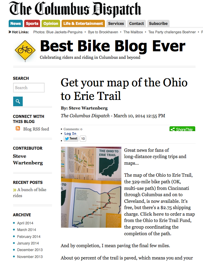
Steve Wartenberg of The Columbus Dispatch writes an article about the new printed Ohio to Erie Trail Maps.
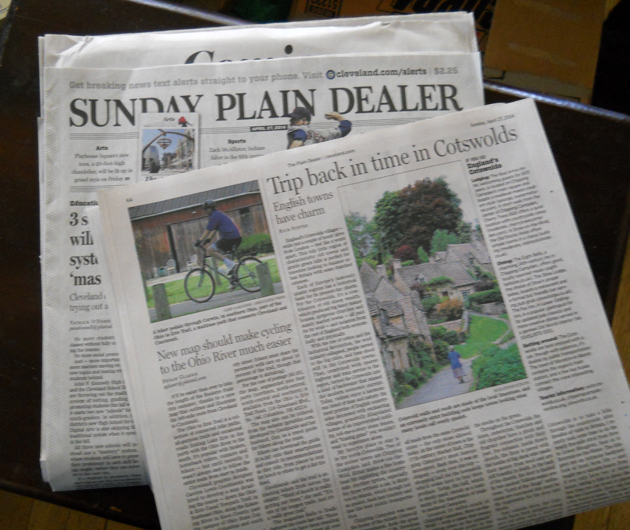
It is great day at I Got A Bike! Be sure to check out a new article by Susan Glaser, Travel Editor for The Plain Dealer.
New map helps bikers navigate the Ohio To Erie Trail; plus, GOBA deadline approaches
The article discusses the recently released printed maps of The Ohio To Erie Trail and the nationwide excitement for bicycle touring in Ohio. You can read the article on page K4 of the Sunday April 27, 2014 issue of the The Plain Dealer.
Read the article online at Cleveland.com
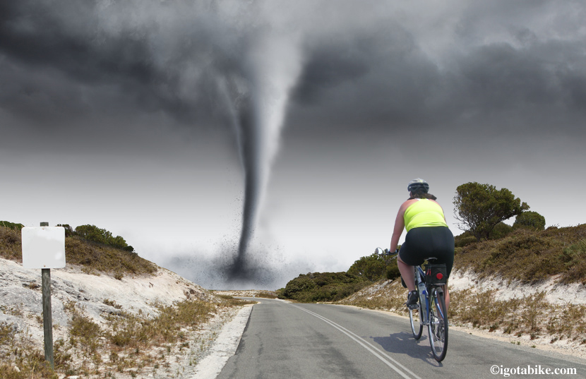
First Bicycle Ride of 2014 and Its a Nice Windy Day
The spring has been long in coming. There have been a couple nice warm days but it has been so windy that our bikes remained parked and covered in winter dust with nearly flat tires.
Saturday night we went to a party and saw one of our bicycle hero friends. This man is one of those guys who is was born to bike–extra tall, extra long and extra lean. He is on a race team and commutes a significant route to his day job. He told us that he rode his bike to work 3 days last week.
While not normally overly competitive, Guy and I were both somewhat shamed and jealous.
So Sunday afternoon we dusted off the bikes, dug out the helmets and shoes, pumped up the tires, set the odometer to zero and headed out the door. Wow! It felt great! But, wow, was it windy! I was pedaling as hard as I could and achieved a max speed of 6 mph.
We noodled around the neighborhood, did some errands, and wracked up a whopping 8 miles. Super! Cannot wait to go again. But not today, it snowed overnight.
Guy was busy hanging on to his handlebars and did not take any photos so I had to improvise to get an image. Enjoy!
Welcome to April Fools day and the start of our Official Cycling Season here at IGotABike! It has been a particularly snowy and bitter cold winter and Guy and I are both really excited about the upcoming bicycle season. The bikes are just about ready to ride, and we are more than ready, but we are waiting on the weather. There is still snow and ice on the ground the wind is not cooperating.
Last year was fantastic. We logged over two thousand miles and toured in two states. We were able to ride the entire Ohio to Erie Trail (round trip) and broke new routes into Indiana. We explored the Wabash Cannonball Trail in western Ohio and created a four day loop using the Western Reserve Greenway in eastern Ohio.
It was a big year for I Got A Bike when we achieved our dream to publish an interactive trail guide for the Ohio To Erie Trail. Sales have been strong and steady and we won a Ruby Award from The Ohio Travel Association. We have had incredible feedback from people who purchased the guide and have many new friends as a result. We have received dozens of e-mails from folks who will be touring on the Ohio To Erie Trail this year. We hope they all keep in touch so we can share their stories.
We have had tens of thousands of hits on our website, launched an IGotABike Facebook page, a Twitter account, were featured in The Cleveland Plain Dealer Travel section and interviewed on the Outspoken Cyclist radio show.
If that’s not enough for one year — how about my dream job of designing the first ever printed map for the Ohio To Erie Trail Fund! Wow, that was a ton of work but I feel so blessed to have been in the right place at the right time to get such an outstanding opportunity.
2013 was over the top and we have some humungous goals for 2014. Thanks to all of you who have been so supportive of our efforts. Happy trails and tailwinds!
I found a great article MT. BIKERS vs EQUESTRIANS: An explanation of horses to bikers – written by a biker and recommend it highly. This article is written with a specific focus on mountain bike trails but contains outstanding information for any trail user. I particularly like the descriptions of a horse’s posture and expression to gauge its temperament.
This article is useful here as many of the trails in Ohio are shared by horses and bikes, most notably the Holmes County Trail.
The Holmes County Trail is shared
by horses, buggies and bikes.
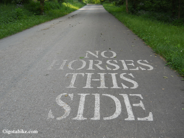
One side is for bikes and the other is for horses and buggies
on The Holmes County Trail.
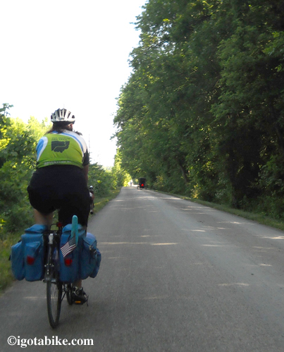
Understand that I am no authority on horses (I wish I were) but felt inspired to write about our experiences sharing the way with horses. The Holmes County Trail is really unique as it sits in the heart of Amish country and the trail is shared with Amish buggies. One side is for bikes and the other is for horses and it flips back and forth in places. It is a little tricky and passing is different than other trails but just remember that bikes always yield to horses and any other trail users. When in doubt, just stop and step off.
The article at horseandman.com says to always dismount, but again I think they are talking about narrow back-country mountain bike trails and equestrians. Most of the horses we have encountered along the trails in Ohio are pulling a buggy of some sort and are accustomed to people and passing is routine.
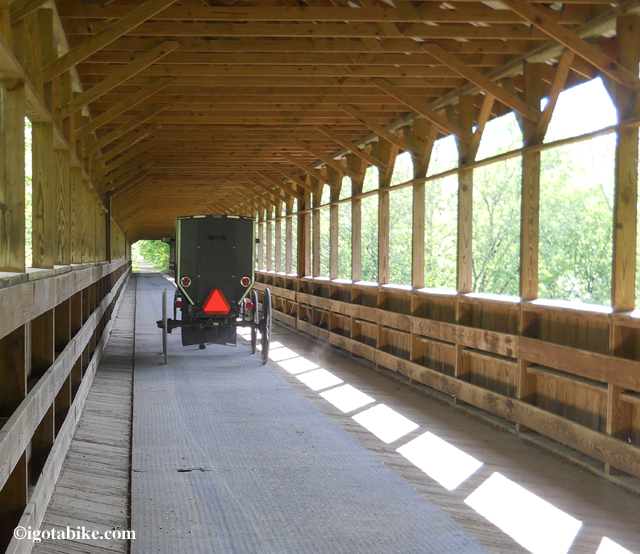
An Amish buggie crossing the shared
Bridge of Dreams on The Mohican Valley Trail.
On only a couple of occasions, while on Amish roads, not trails, have we had an encounter with a horse that was uncomfortable with us and our bicycles. Once we stopped moving things improved.
One day a man was walking ahead of us with a horse on a the country road and as we approached on our fully loaded touring bikes the horse was clearly displeased. He was rearing up and looking over his shoulder trying to figure out what we were and how to get away from us. We hopped off of our bikes and just walked slowly behind them. Soon they arrived at the next farm and they turned in and we waved and rode away.
Once we were approaching an Amish buggie on a small backroad lane and the horse was unsure of us and was rearing up. We stopped and and stood still, removing our helmets and sunglasses and spoke to horse. He then recognized us as humans and we all went on our way. That’s it. We have shared the trail with horses for many many miles those were the only memorable occasions of a glitch. We are always remember that another glitch is out there so we give a wide berth, slow down and pay attention.

You will always see Amish buggies on The Holmes County Trail in Millerburg but usually not this many. This photo was taken on Auction day, an annual event held in June that supports the trail.
Guy and I were delighted and honored to be interviewed by Diane Lees and featured on The Outspoken Cyclist Radio Program to discuss bicycle touring on the Ohio To Erie Trail.
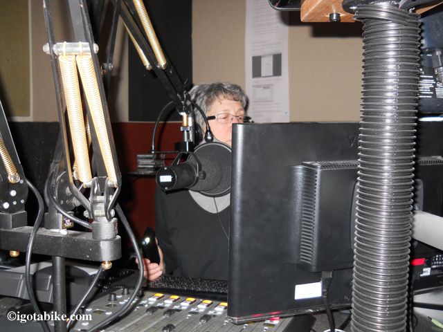
Diane’s radio program, The Outspoken Cyclist, is a 1-hour radio show with interviews, commentary, ideas, advocacy, and everything (anything) connected with bicycling. The program is a weekly feature on WJCU at John Carrroll University and airs live in northeast Ohio on Saturday evenings at 5:30 on 88.7 FM and is available to listen or download anytime via the internet.
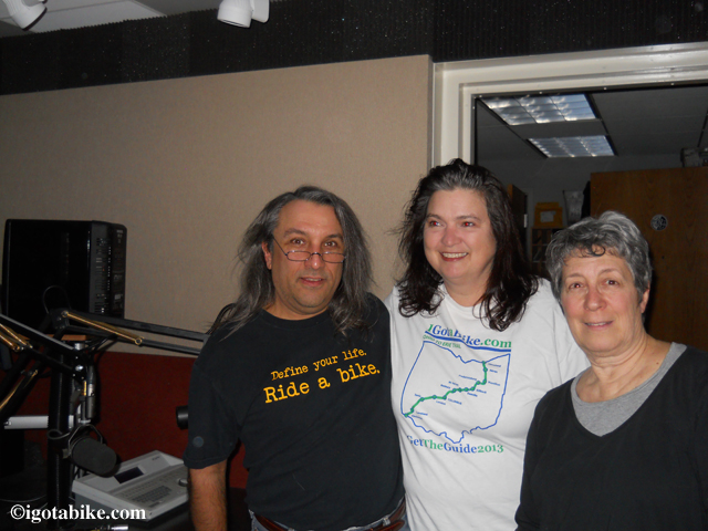
We were part of Show #182 that aired on February 15, 2014. The other guests were Michael Carroll of the New York Times Travel Show and Peter Vos of Tulip Cycling in the Netherlands. We were interviewed at the radio studio to discuss the new Ohio to Erie Trail Printed Maps and The IGotABike Ohio To Erie Trail Guide. It was a little tricky because there was a power failure and the recording equipment was improvised and we were sitting in the dark, using a flashlight to see! Regardless, Diane is a pro and she made us feel welcome and the conversation was easy going.
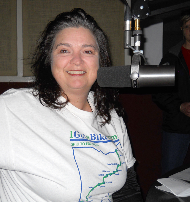
Diane asked many questions about how we went from riding our bikes around town to across the state, and back, and how that evolved into the IGotABike website, the Trail Guide, and the new Ohio To Erie Trail printed maps. We had a great time and are grateful for the opportunity to talk about bicycle touring. So many people have the dream of going on a bike tour and this program will help people have the courage to live the dream.
You can listen this show and hundreds of archived shows on The Outspoken Cyclist website and there is a lot to see on the Outspoken Cyclist Facebook page. Don’t forget to “like” the page.
WJCU is a noncommercial FM broadcast station owned and operated by John Carroll University. We were featured during their annual fundraising event. Diane’s program is interesting, informative and fun. How about sending them a buck or two so they know we like the program. Donate here.
Sincere thank you to Diane and all the crew at JCU who know how to get it done–with or without power!

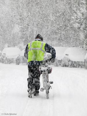
Ha ha! The only problem is we don’t have fat tire bikes so snow shoes is the next best equipment for navigating the Ohio and Erie Canal Towpath.

Unless you prefer cross country skis!

The towpath is jammed with snow but the Cuyahoga River was still flowin.

Ohio and Erie Canal Towpath buried under a foot of snow but the Cuyahoga Valley is as pretty as ever.
When navigating with The Ohio To Erie Trail Printed Maps take note of the bridges and use them as landmarks. Understanding when the route goes over or under a bridge, or over a road at surface level can help you easily find the way.

There is a key on every map to explain how significant bridges are
illustrated by a double black line.

The mileage marks on the Ohio To Erie Trail Printed Maps can help you to calculate the distance between trail towns and other locations on the route. Mileage marks are indicated by red arrows. The distance, in miles, between two arrows is indicated by a red numeral. The placement of the mileage arrows and the mileage distances are approximate. The mileage is rounded. The purpose here is to give you an approximate idea of distances and an indication of how far it is to the next turn or interchange. Just like any bicycle computer, it is not a perfect calculation. Your mileage will vary.

Mileage is indicated by red arrows and red numerals.
The mileage in each panel is determined by common sense based navigation needs rather than being equally divided. One panel may represent only two miles while the next panel may be twenty miles. For example there is a panel for downtown Akron that illustrates just 1 and 1/4 miles while the adjacent panel illustrates 8 miles. Always refer to the red numerals for distance.

Distance, in miles, is indicated by red numerals.
For more detailed mileage information consider purchasing The IGotABike Ohio To Erie Trail Guide. Designed to be used with smartphones and tablets, the guide gives cumulative mileage data between trail towns and reads both north to south and south to north. There is a second mileage chart that gives the cumulative mileage for the various trails that make up the Ohio To Erie Trail. This chart also reads in both directions.
I prefer a map, a compass, common sense, and the kindly advise from locals but for those of you addicted to GPS I have been told you will discover variances in mileage and locations. The modern technology of satellites is too accurate for the nearly 200 hundred-year-old Ohio and Erie Canal Towpath and other rural roads and trails. However, if you are a Garmin junkie you can document your ride and upload the data to Google Earth to re-live your adventure.
So, now you have the maps for easy on-bike reference, and the trail guide to help you plan where to eat, sleep and more. All you need is a bike, the time, and the desire. Ride the Ohio to Erie Trail and live the dream!
 The maps are available from the Ohio to Erie Trail Fund.
The Ohio To Erie Trail Printed Maps were designed to be easy to use if you are traveling north to south or south to north. The map panels and the accompanying text was created to be useful regardless of your direction of travel wherever possible. In the places where this is not possible the material is presented in a north to south order. The numbering of the maps and map panels is also oriented north to south. (Cleveland to Cincinnati).
The maps are printed on four sheets of paper with an overview map and section information on one side and detail map panels on the other side. The sheets are numbered and color coded. North is always up, at the top of each sheet and panel.
1 North Ohio Millersburg – Cleveland to Killbuck
2 North Central Ohio – Killbuck to Columbus
3 South Central Ohio – Columbus to Xenia
4 Southern Ohio – Xenia to Cincinnati
Each detail map panel is numbered. If you are traveling north to south read the panels top to bottom. If you are traveling south to north read the panel bottom to top.

The Ohio To Erie Trail Printed Maps read north to south and south to north
On each map panel there is one element, usually a road, that is repeated from the previous panel so you can remain orientated.

The Ohio To Erie Trail printed map panels have repeated elements.
The maps are available from the Ohio to Erie Trail Fund with a donation of $5 per map kit.