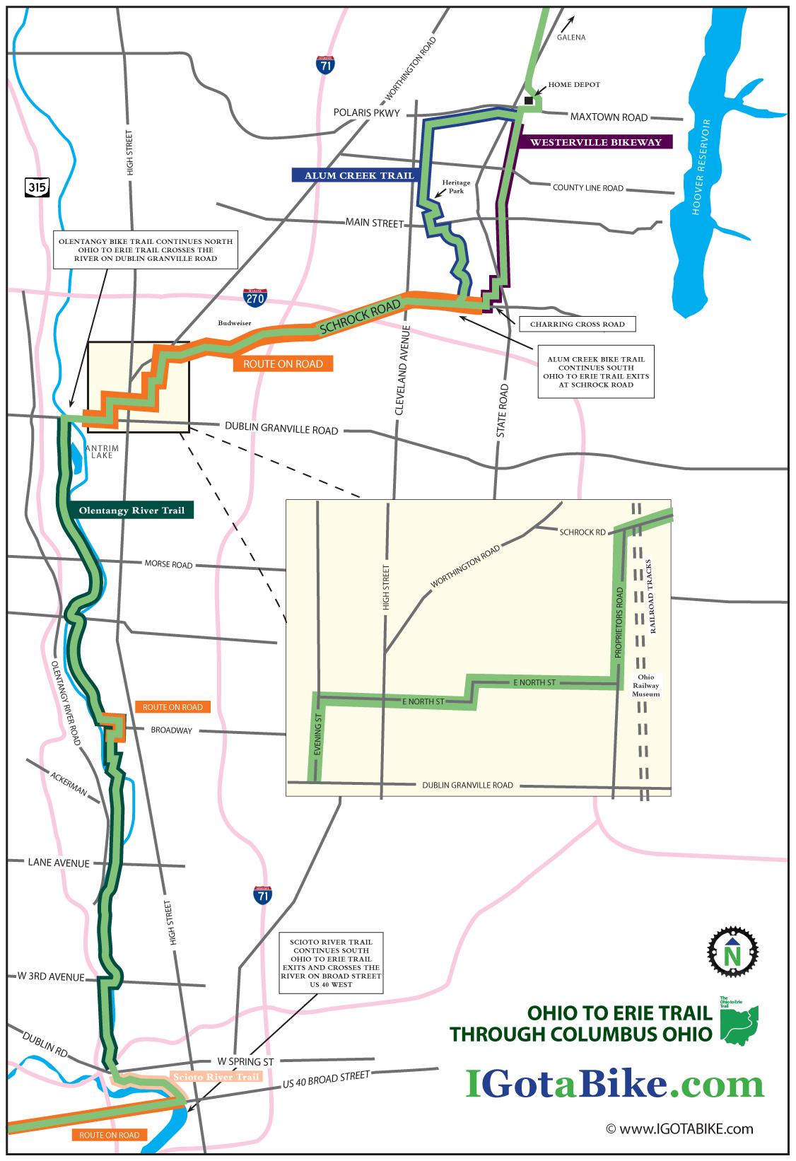
On the north end of Columbus it is riders choice to use the bike trail that goes through Alum Creek Park or the bike trail that goes through Westerville. Schrock Road is used to connect these trails to the Olentangy River Trail and the Scioto River Trail to US Route 40 / Broad Street. The road riding is a bit difficult in spots and finding the next turn can be tricky but it is overall a very nice route considering the challenges of urban riding. It is approximately 25 miles.
UPDATE February 2014: New section south of Columbus via the Scioto Trail
Until late 2013 the Ohio To Erie Trail used the Broad Street Bridge at Marconi. The new route follows the Scioto Trail west of Columbus. This new section is made possible by the bridges that cross the Scioto River 3 times. This new route eliminates several miles of road riding on US 40 Broad Street between Marconi and Westgate. The recommended road route is illustrated on Map 3, Panels 3, 4 & 5 of the Ohio To Erie Trail Printed Maps. You still need to use US 40 Broad Street to get under Interstate 270.
UPDATE April 2013: The Olentangy Trail detour between Lane Avenue and Dodridge is over. The Olentangy Trail is now contiguous through the Ohio State University campus.
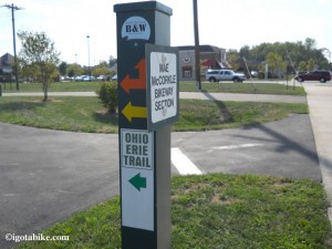
When we rode through Columbus in August 2012 we saw many new posts that “appear” to be marking the turns in the trail. They are green, metal, 4 x 4 posts, about chest high. This one included stickers for the Ohio to Erie trail but all others were blank.
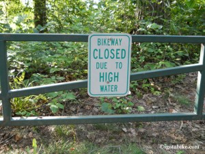
In several places there are gates and signs indicating that the Alum Creek Trail is subject to flooding. Remember you have the Westerville Bike Trail as an alternate route in case of poor conditions.
NORTH TO SOUTH:
When approaching Columbus from the north you will be riding on the bike trails that parallel N State Street and the Hoover Reservoir. As you exit the woods there is UDF (convenience store with ice cream and restrooms) that is the landmark for the beginning of the Columbus route. The bike trail turns south (left) and travels behind a giant retail complex that contains a Home Depot and Krogers (grocery / liquor mega store). You will pass behind the Trek store and they provide free air and water to cyclist at their back door.
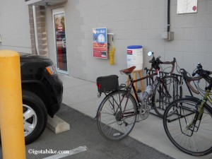
The bicycle trail travels behind a giant retail complex where there is a Trek store and they provide free air and water to cyclist at their back door.
At the south end of this section, near the Home Depot entrance, you will cross Maxtown Road which is also known as Polaris Parkway. There are restaurants here so if you need to refuel this is a good place to do it.
This is where you choose to use the bike trail that goes through Alum Creek Park or the bike trail that goes through Westerville. Using the Alum Creek trail is slightly longer because it travels at an angle, maybe 2 miles. We rode both and both are pleasant. Flip a coin if necessary.
WESTERVILLE BIKE TRAIL SOUTH:
To use the Westerville route the bike trail makes a left after crossing Maxtown Road to turn south and go behind another mega retail complex. The trail surface is perfectly smooth and seal coated and much of it is lined with shade trees. There are lots of road crossings–we counted seven. Many of them are small residential streets but all require a full stop as traffic is heavy in this suburban retail area. The tricky spot is where the bike trail appears to end at South State Street. On the north side is the dedication marker for the Ohio to Erie Trail which is a brass plaque mounted on a knee high boulder. From this spot it is difficult to see that trail continues south. Use the crosswalk to get across State Street and then turn left to continue south. The trail picks up again in about 300 feet and there are bike route signs.
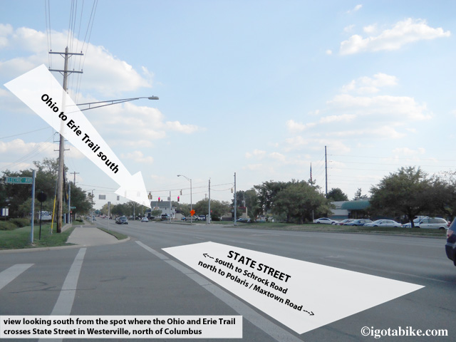
The Westerville bike trail bike trail appears to end at South State Street. From this spot it is difficult to see that trail continues south on the other side of S State Street.
This is a short connector that will take you behind more retail stores and dump you onto Charring Cross road which will take you to Schrock Road where you will turn right to continue south. (note that on the other side of Schrock Road Charring Cross Road is called Brooksedge Blvd.
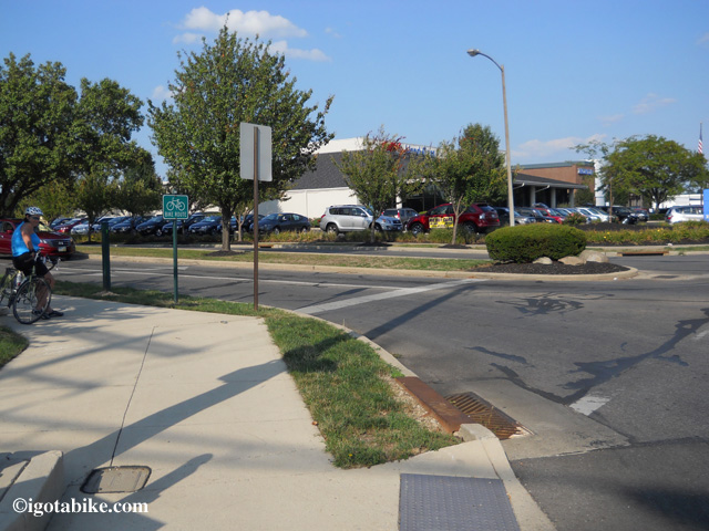
Intersection of Charring Cross Road and Schrock Road where you will find the Westerville bike trail terminus.
ALUM CREEK BIKE TRAIL SOUTH:
To use the Alum Creek trail do not turn left after crossing Maxtown Road near the Home Depot entrance. Continue west on the bike trail that is on the south side of Maxtown Road. It is newly paved and perfectly smooth and seal coated.
Follow this for approximately 3 miles and turn left at Cleveland Avenue where the bike trail is nice and wide and concrete (basically an oversized sidewalk) and follows along the east side of Cleveland Avenue. (note: if you miss the turn the bike trail dead ends)
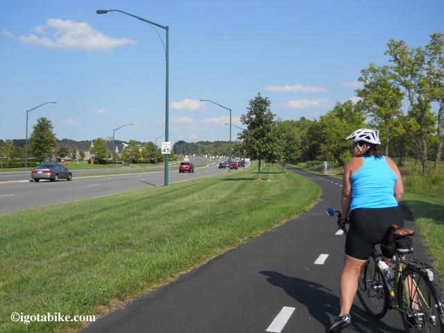
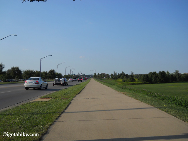
The bike trail on the south side of Maxtown Road / Polaris Parkway which connects to the Alum Creek Trail via Cleveland Avenue. In this photo Carol is facing east, following the northbound Ohio to Erie Trail.
(NOTE DANGER: do not attempt to get across Interstate 71 using Polaris Parkway as it is profoundly dangerous. It is the worst place I have ever been on a bike and I have been in some bad spots! There are many hotels and restaurants here, just choose one that is on the east side of 71 or use an alternate route.)
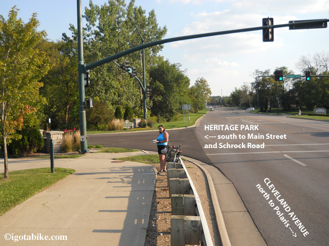
After traveling about 2 miles south on Cleveland Avenue you will notice a giant sports complex on the right and the super sized Westerville Recreation Center on the left and the trail will cross a bridge and turn left into Heritage Park. (there are bike trail connectors that go under the bridge and connects to the Sports Complex) After very a short distance turn right to follow the brick lined bike trail that takes you up to Main Street where you turn left to cross in front of the Westerville Fire Department and Senior Center. Use the cross walk to get across Main Street and pick up the bike trail with a right turn at the bridge.
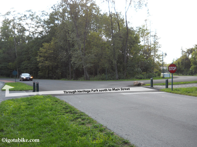
You are only in Heritage Park for a few hundred feet before you need to cross the park road and turn right and follow the brick lined bike trail, facing traffic, to get to the crossing at Main Street.
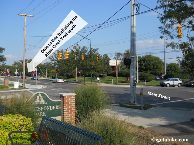
On the other side of Heritage Park the bike trail crosses Main Street after passing in front of the Westerville Fire Department, First Responders Park and the Senior Center. The trail picks up on the other side of Main Street before crossing the bridge.
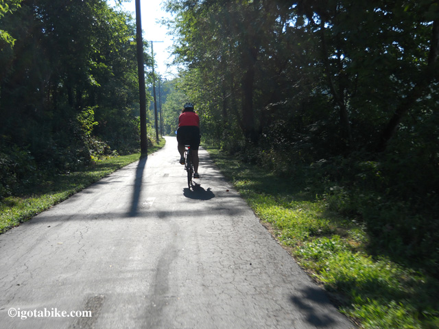
The Alum Creek Trail is nice and scenic. In this photo Carol is riding south in the early morning, late August 2012.
The trail continues past a lake and through the woods. You need to exit the trail with a left turn before the trail goes under Schrock Road and continues south. (on the other side of the bridge there are exit ramps so you are able to access the trail from both sides of Schrock Road) There are no signs to tell you it is Schrock Road, the trail going under the bridge is your landmark.
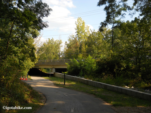
There was no sign to mark the exit from the Alum Creek Trail to Schrock Road when we were there in August 2012. The trail going under the bridge is your landmark. There is a new green metal 4 x 4 post on the right marking the the exit to the left, past the orange construction cones. Continuing forward under the bridge takes you under Schrock Road and further south on the Alum Creek Trail. Currently, The Ohio to Erie Trail exits here, to the left, to get up to the road, and turns right to cross the bridge and follow Schrock Road to connect to the Olentangy Trail.
SCHROCK ROAD TO THE OLENTANGY TRAIL (approximately 7 miles)
There are bike lanes along both sides of Schrock Road but we found them littered with debris; take the lane. This is a giant thoroughfare with heavy traffic. You will go over Interstate 270 and over Interstate 71 and past the Budweiser plant then across the railroad tracks where you immediately turn left onto Proprietors Road.
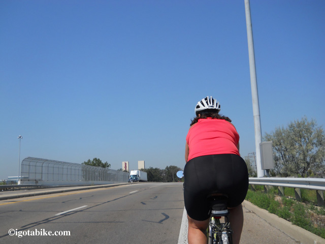
Schrock Road, southbound, over Interstate 71 with the Budweiser plant in sight. Carol says, “In this photo I should have taken the big lane. The marked and signed bike lane was full of debris.”
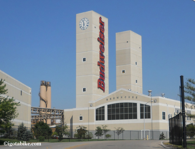
The Budweiser plant can be seen for miles and makes a good landmark along the east end of Schrock Road, no comment on the beer.
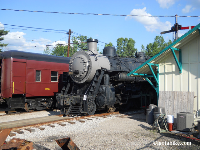
There is a lot to see at the Ohio Railway Museum and it makes an un-missable landmark to turn right onto E North Street from Proprietors Road. (unless you are so busy looking at the the trains that you fail to notice that E North is directly across the street from the trains!)
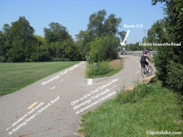
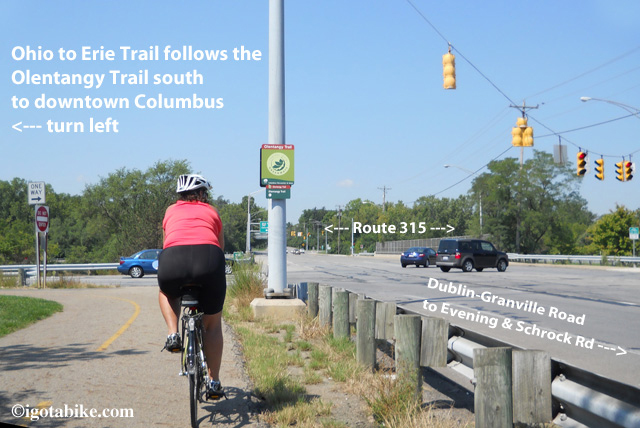
When you see the Ohio Railway Museum on your left turn right onto E North Street and continue across High Street until E North dead ends into Evening where you turn left. The best way to stay out of traffic is to follow Evening to cross Dublin Granville Road and immediately turn right onto the residential street that runs along Dublin Granville Road facing traffic. The marginal residential road becomes a bike trail that will fork at a soccer field. Bear right to go up a ramp and get onto the bridge that crosses the Olentangy River, (on the sidewalk / bike trail, facing traffic) on Dublin Granville Road and turn left onto The Olentangy Trail at the intersection of Dublin Granville Road and Route 315.
OLENTANGY TRAIL TO US 40 / BROAD STREET (APPROX 11 MILES)
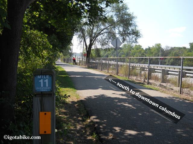
The Olentangy Trail travels south along a chain link fence with Route 315 on your right. (NOTE: there are other bike trails that go north on both sides of the river and there are “gopher holes” that take you under the intersection of 315 and Dublin Granville Road. Be very careful here as cyclists and motorists are everywhere).
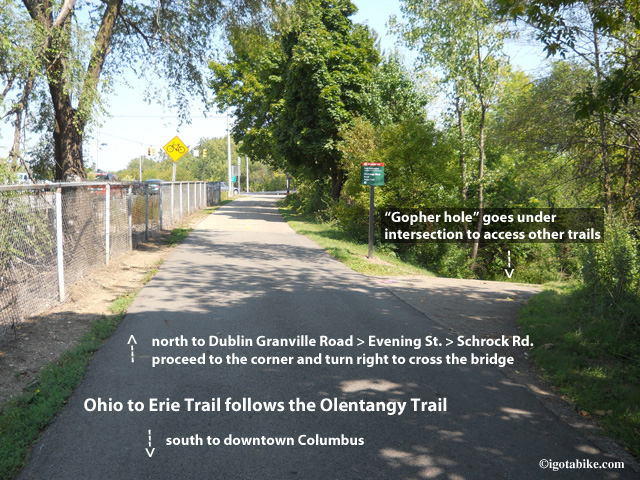
Ignore the “gopher holes” that go downhill and under the intersection of Route 315 and Dublin Granville Road. This photo is looking north approaching Dublin Granville Road.
Soon the trail leaves the roadside and ducks into the woods. There are many side spurs and connectors along the way but you can follow the yellow lines that are painted down the center of the main path. There is a drinking fountain in Antrim Park.
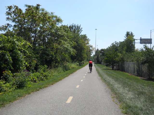
The Olentangy Trail is a nice ride and is marked with a center line. There are many side spur bicycle path connectors and the center line can help to keep you on the main trail.
The trail comes up to the road to use the bridge to cross the river at W Henderson Road and continues south with the river on your right. This is typical for the Olentangy Trail. Several times the trail comes up to the road only to cross a bridge and then heads off into the treeline on the other side.
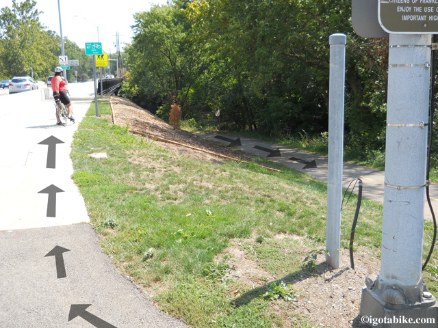
The trail comes up to the road to cross the river at W Henderson Road. This is typical for the Olentangy Trail. Several times the trail comes up to the road only to cross a bridge and then heads off into the treeline on the other side.
There is short section of the trail that goes on the road through a neighborhood in Clintonville. (It is a nice area with beautiful homes and gardens.) It is well signed, easy to navigate, and is approximately 1 mile. (the trail dead ends onto Northmoor – turn right on Olentangy Blvd which turns into W Kenworth – turn right on Milton – turn right on Delhi – turn left on Riverside Drive and the route becomes trail again at the intersection of Riverside and W Como Avenue.)
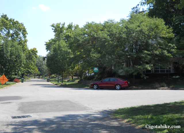
No worries as the trail goes on the road in Clintonville. It is well signed as it continues south through the neighborhood full of beautiful homes and gardens. Your only worry will be trying to figure out why you don’t live here, right on the trail!
UPDATE APRIL 2013: The detour described below has ended. The Olentangy Trail is now contiguous through the Ohio State University campus. Use the detour route if you want to experience Buckeye country.
There is a marked detour where the trail follows W Dodrige Street behind a temporary concrete barrier for 500 feet and then crosses Olentangy River Road at Ackerman Road. The trail appears and re-appears and as it utilizes sidewalks along Olentangy River Road and goes along the sidewalk in front of the Jack Nicklaus Museum and the Schottenstein Center and turns left to cross the Suspension Bridge at Lane Avenue.
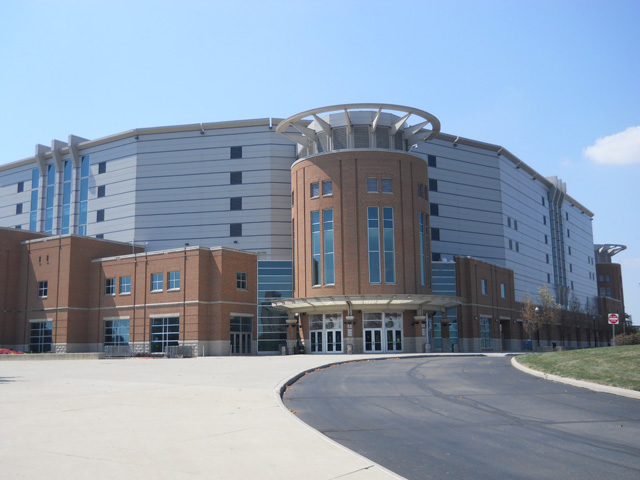
The Schottenstein Center is the landmark for navigating the Olentangy Trail detour through the Ohio State University campus. The detour follows Olentangy River Road on the west side of the street between Ackerman Road and Lane Avenue.
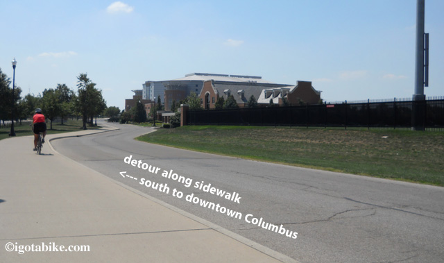
The marked detour on the Olentangy Trail utilizes sidewalks in front of the Jack Nicklaus Museum and the Schottenstein Center which can be seen just ahead on the right of this photo.
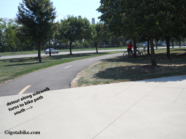
In front of the Schottenstein Center the on-sidewalk detour of the Olentangy Trail turns back into a recognizable bike trail.
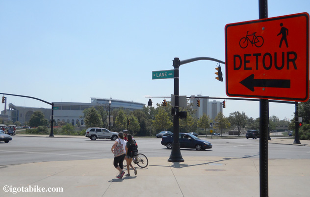
In front of The Schottenstein Center the Olentangy Trail detour through the Ohio State University campus turns left at Lane Avenue to cross the suspension bridge.
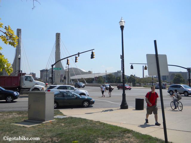
At Lane Avenue the Olentangy Trail detour through the Ohio State University campus turns left to cross Olentangy River Road and the suspension bridge.
Immediately after crossing the bridge turn left on the bike trail to go under the bridge and continue south with the river on your right.
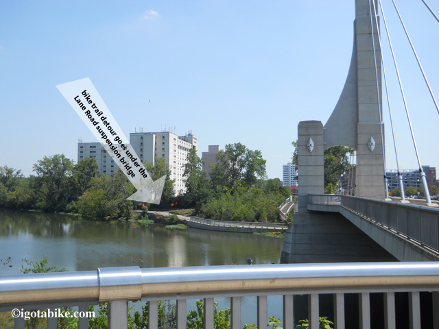
On the north east side of the Lane Avenue suspension bridge the Olentangy Trail picks up below the bridge. To continue south the river will be on your right. The trail heading north is closed, thus the detour.
(This section was closed for construction earlier in the year and was detoured by sending cyclist up into the city streets and sidewalks away from the river just below The Shoe [football stadium]. We saw one detour sign that they forgot to take down. The correct route is to stay along the river.)
You will cross the river again and go under 315 at West Third Avenue and there are gopher holes under the bridge to access the trail from either side of the road. Continue south with the river on your left.
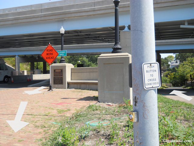
The trail comes up to the road to cross the river and go under Route 315 at West Third Avenue. This is typical for the Olentangy Trail. Several times the trail comes up to the road only to cross a bridge and then heads off into the treeline on the other side. There are gopher holes under the bridge to access the trail from either side of the road.
Immediately after crossing Dublin Road / W Spring Street The Olentangy trail continues south but you need to turn left to continue toward downtown Columbus on the Scioto River Trail.
UPDATE February 2014: New section south of Columbus via the Scioto Trail
Until late 2013 the Ohio To Erie Trail used the Broad Street Bridge at Marconi. The new route follows the Scioto Trail west of Columbus. This new section is made possible by the bridges that cross the Scioto River 3 times. This new route eliminates several miles of road riding on US 40 Broad Street between Marconi and Westgate. The recommended road route is illustrated on Map 3, Panels 3, 4 & 5 of the Ohio To Erie Trail Printed Maps. You still need to use US 40 Broad Street to get under Interstate 270.
IGotABike.com is proud to be the official online distributor of the new and free
Ohio to Erie Trail Map Kit! Click here to order.
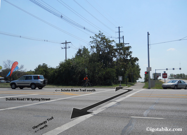
Immediately after crossing Dublin Road / W Spring Street The Olentangy Trail continues south. To continue toward downtown Columbus turn left on the Scioto River Trail.
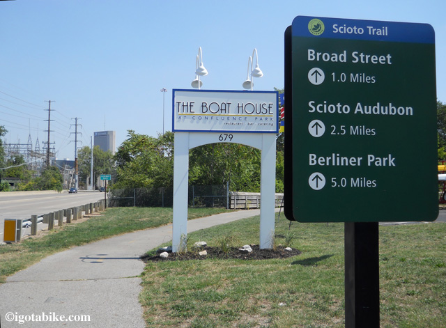
Cool! A sign! Scioto River Trail terminus at Dublin Road / W Spring Street where it intersects with the Olentangy Trail.
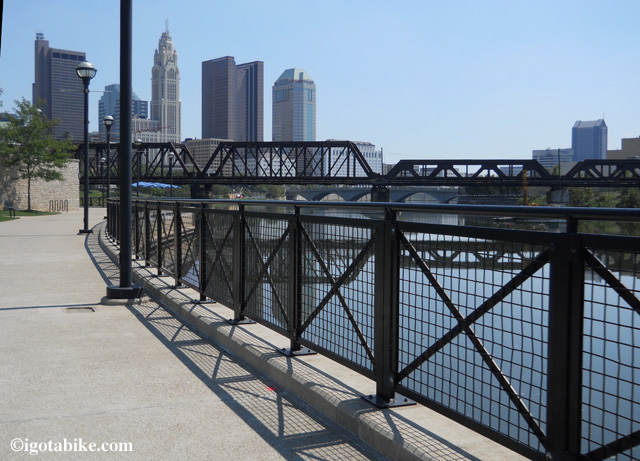
When you see a replica of the ship Santa Maria at the elaborately carved bridge you have arrived at US 40 / Broad Street. Exit the trail and turn right to follow US 40 / Broad Street west to proceed south to Cincinnati.
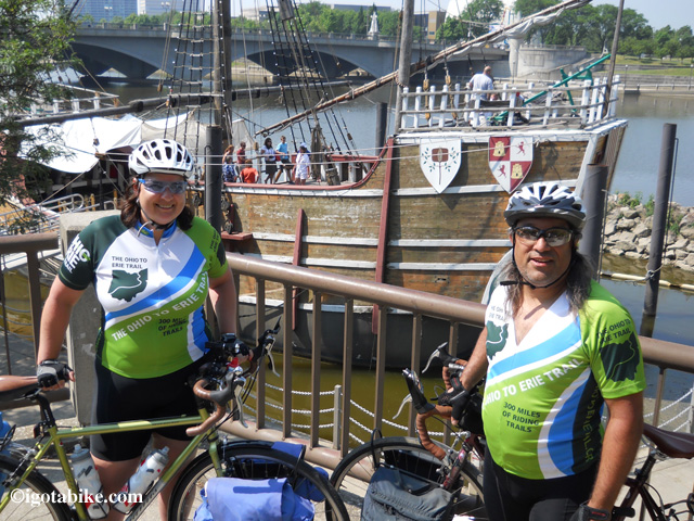
The replica of the ship Santa Maria is your landmark for the spot where you exit the Scioto River Trail and turn right to cross the river and continue on US 40 / Broad Street. The bridge in the background of this photo is US 40 / Broad Street.
There is not much to say about US 40 / Broad Street. It is big, mean, urban and not very bicycle friendly. The Ohio to Erie Trail is over 300 miles of fantastically beautiful scenery and easy-going routes with a few rough spots. US 40 / Broad Street is one of the not so pretty places. However it is only 8 miles so hammer down and get it over with. Use caution at the highway crossings.
UPDATE February 2014: New section of the Camp Chase Trail
There is a newly paved section of the Camp Chase Trail between Galloway and Georgesville. (south of Columbus, north of London). There is also a newly recommended route that uses Norton Road and Hall Road to eliminate a section of Galloway Road. The new trail section eliminates riding on Alkire Road and utilizes the Battelle Darby Creek Metropark Road from Kropp Road. The route still uses the Alkire Road bridge to cross the Darby Creek at Georgesville. The recommended road route is illustrated on the Ohio To Erie Trail Printed Maps. IGotABike.com is proud to be the official online distributor of the new and free Ohio to Erie Trail Map Kit! Click here to order.
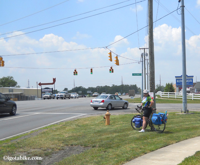
Intersection of US 40 / Broad Street and Galloway Road is where you turn left to make your way to the trailhead at The Battelle Darby Creek Metropark.
Note: You will no longer see the intersection pictured above when following the new road route Norton Road and Hall Road. Note the Krogers grocery store. Except for one gas station / mini mart along Galloway Road this is your last chance to stock up on food and water before arriving in London.
Congratulations you made it through Columbus–on a bike! For more information and additional photos you can check out the entry for this route going south to north.
Thanks for all your hard work on this. This is tremendously helpful. It brings back a flood of memories from my solo ride just under 2 months ago. Where does the time fly?
Plans are well underway for the organized group ride I intend to undertake late summer of 2013. I am so grateful for all the help you have given me in this undertaking.
–Jim
Good news – the detour for the Olentangy Trail as part of the Ohio to Erie Trail around the Dodridge bridge in Columbus is no longer applicable. The rebuilt bridge along with underpass is now open. Let me know if you revise your above nice map https://igotabike.com/wp-content/uploads/2012/10/igotabike_COLUMBUSMap.jpg to reflect this update. Many Ohio to Trail sections are in process of being built – west of Columbus & I-270) and two Scioto Trail bridges (near post office & Grandview Ave/670). Other gaps are in final stages of design planning stages – within west side of Columbus (Sullivant Ave/Camp Chase rail to trail) and on northeast for 2 pieces of 1.6 mile final Alum Creek Greenway Trail (near Ohio Dominican University). Reference: http://parks.columbus.gov/content.aspx?id= 26989 When these future OET routes are completed, hopefully in ~2015 , it’ll be much easier to pedal through metro Columbus on 100% multi-use trail system. Happy Trails!
Thanks for the info! We put it in a recent blog entry.
https://igotabike.com/2013/04/01/april-fools-day-lets-ride/
Maybe we’ll see you on the trail…..
This post is fabulous, great documentation on the current configuration.
One note, it is “Olentangy” e not a, I hope this gets fixed before the data goes on the printed map.
Thank you Jody. I fixed the error.
Guy and I are always interested in local information, updates, tips, corrections, suggestions.